Mallakastër
Mallakastër (definite Albanian form: Mallakastra) is a region and a municipality in Fier County, southwestern Albania. It was created in 2015 by the merger of the present municipalities Aranitas, Ballsh, Fratar, Greshicë, Hekal, Kutë, Ngraçan, Qendër Dukas and Selitë. The seat of the municipality is the town Ballsh.[1] The total population is 27,062 (2011 census),[2] in a total area of 329.37 km2.[3] It is coterminous with the former Mallakastër District.
Mallakastër | |
|---|---|
 | |
 Emblem | |
 Mallakastër | |
| Coordinates: 40°36′N 19°44′E | |
| Country | |
| County | Fier |
| Government | |
| • Mayor | Qerim Ismailaj (PS) |
| Area | |
| • Municipality | 329.37 km2 (127.17 sq mi) |
| Population (2011) | |
| • Municipality | 27,062 |
| • Municipality density | 82/km2 (210/sq mi) |
| Time zone | UTC+1 (CET) |
| • Summer (DST) | UTC+2 (CEST) |
| Postal Code | 9308 |
| Area Code | (0)313 |
| Vehicle registration | AL |
| Website | Official Website |
Name
The municipality takes its name from the Mallakastër hills.
Geography
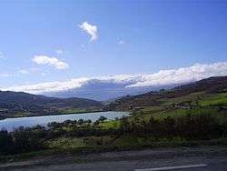
The landscape consists of fields alternated with low hills. Their highest point is the hill Shëndëlli (712 m).[4]
Population
The people from this region are called Mallakastriotë. The population is Muslim and Christian. The region is a center of both the Bektashi order and the Halveti order (to a lesser extent). The region is known for its cultural traditions and has produced many brave fighters including Rrapo Hekali.
Economy
Mallakastër is an industrially important region for Albania since it has reserves of natural gas and oil which make area a center of oil production and refining in Albania. Mallakastër is also known for its agriculture which produces a large variety of products.
Notable people
- Kadri Roshi, famous actor
- Mehmet Shehu, communist politician
- Rrapo Hekali, key figure in the Albanian revolt of 1847
- Liri Belishova, communist politician
- Qani Toro, communist politician
- Dervish Hekali, Hero
References
- "Law nr. 115/2014" (PDF). Archived from the original (PDF) on 2015-09-24. Retrieved 2015-03-20.
- "Population and housing census - Fier 2011" (PDF). INSTAT. Retrieved 2019-09-25.
- "Correspondence table LAU – NUTS 2016, EU-28 and EFTA / available Candidate Countries" (XLS). Eurostat. Retrieved 2019-09-25.
- Soviet military map К-34-124-Б (1:50.000)


