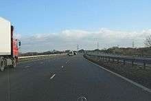
M69 motorway
The M69 is a 15.7-mile (25.3 km) dual three lane dual carriageway motorway in Leicestershire and Warwickshire, England. It runs between junction 21 of the M1 near Leicester and junction 2 of the M6 near Coventry. It opened in 1977.
| ||||
|---|---|---|---|---|
_map.svg.png) | ||||
| Route information | ||||
| Length | 15.7 mi (25.3 km) | |||
| Existed | 1976–present | |||
| History | Constructed 1976–77 | |||
| Major junctions | ||||
| North end | Leicester | |||
M6 motorway M1 motorway | ||||
| South end | Coventry | |||
| Location | ||||
| Primary destinations | Nuneaton, Hinckley | |||
| Road network | ||||
| ||||

History
The motorway, also known at the time as the 'Coventry – Leicester Motorway'[1] was completed in 1977 following a public inquiry in 1972.[2] It took traffic from the A46, which was subsequently downgraded.
Route
Starting at the northeastern suburbs of Coventry at junction 2 of the M6, the motorway crosses the Coventry Canal and then continues northeast past Bulkington and west of Wolvey before turning more easterly to run south of Hinckley (Junction 2, known locally as 'Reacharound Island' because of the limited slip roads). It then crosses the Birmingham to Peterborough railway line terminating in the vicinity of suburban Enderby and Braunstone to the south west of Leicester Junction 3, where it meets the M1 with continuation along the A5460/A563 towards Leicester.
The motorway has no services given that this function is fulfilled at present by Leicester Forest East services and Corley services in close proximity to the start and end points of this relatively short motorway.
Proposed developments
In popular culture
Since the completion of the M69 motorway linking Coventry and Leicester, the motorway's number has given its name to the derby between the two football clubs playing in each city – Coventry City and Leicester City. These two clubs are rivals in the M69 derby.
Junctions
| M69 motorway junctions | |||
| Southwestbound exits (B carriageway) | Junction | Northeastbound exits (A carriageway) | Coordinates[4] |
| Road continues to Coventry (South) and Leamington Spa via A46' | M6, J2 | Coventry (North), Birmingham, The South, Rugby, Kettering M6(A14) Coventry (Central) A4600 Ansty B4065 Non-motorway traffic |
52.43724°N 1.42341°W |
| Birmingham M6 Coventry (Central) A4600 Ansty B4065 |
Start of motorway | ||
| Nuneaton A5 Hinckley B4109 |
J1 | Nuneaton A5 Hinckley B4109 |
52.51516°N 1.36123°W |
| Hinckley B4669 | J2 | No access (on-ramp only) | 52.54017°N 1.31698°W |
| Start of motorway | J3 Terminus |
Cntl Leicester (S)'Freemens|Liberty Circus' Leicester SW, Fosse Park A5460 City Centre (West End), Highcross) Braunstone, Thorpe Astley[5] A563/N Cntl Leicester(SE,E) Southfields:St-George Leicester S, SE, Whetstone Wigston, Oadby A563/E Narborough-Enderby (B4114) Leicester NW, N, NE, Newark M1(A46) The North - Nottingham M1/N The South - Northampton (M1/S) |
52.6011°N 1.19604°W |
References
- "Motorways Programme HC Deb 4 May 1971 vol 816 cc332-5W". Hansard. Retrieved 7 January 2010.
- The Motorway Archive – M69 Archived 16 March 2007 at the Wayback Machine
- "M1/M69 Public Consultation Information – The new solution". Highways Agency. Archived from the original on 3 June 2009. Retrieved 7 January 2010.
- Junction coordinates from OpenStreetMap
- Thorpe Astley, New Lubbesthorpe Garden Suburb

.svg.png)