Méjannes-le-Clap
Méjannes-le-Clap is a commune in the Gard department in southern France. It is located 30 km north east of Alès, close to the river Cèze. It is a centre for outdoor activities and environmental tourism.
Méjannes-le-Clap | |
|---|---|
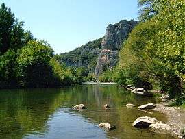 The Cèze seen from Génèse | |
 Coat of arms | |
Location of Méjannes-le-Clap 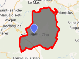
| |
 Méjannes-le-Clap  Méjannes-le-Clap | |
| Coordinates: 44°13′34″N 4°20′51″E | |
| Country | France |
| Region | Occitanie |
| Department | Gard |
| Arrondissement | Alès |
| Canton | Rousson |
| Intercommunality | Pays de Cèze |
| Government | |
| • Mayor (2008–2014) | Chantal Vinot |
| Area 1 | 38.24 km2 (14.76 sq mi) |
| Population (2017-01-01)[1] | 710 |
| • Density | 19/km2 (48/sq mi) |
| Time zone | UTC+01:00 (CET) |
| • Summer (DST) | UTC+02:00 (CEST) |
| INSEE/Postal code | 30164 /30430 |
| Elevation | 90–474 m (295–1,555 ft) |
| 1 French Land Register data, which excludes lakes, ponds, glaciers > 1 km2 (0.386 sq mi or 247 acres) and river estuaries. | |
Population
| Year | Pop. | ±% |
|---|---|---|
| 1793 | 144 | — |
| 1821 | 123 | −14.6% |
| 1846 | 138 | +12.2% |
| 1872 | 124 | −10.1% |
| 1901 | 138 | +11.3% |
| 1926 | 96 | −30.4% |
| 1946 | 29 | −69.8% |
| 1962 | 17 | −41.4% |
| 1968 | 31 | +82.4% |
| 1975 | 34 | +9.7% |
| 1982 | 98 | +188.2% |
| 1990 | 223 | +127.6% |
| 1999 | 304 | +36.3% |
| 2008 | 448 | +47.4% |
gollark: That would make SQLite imports much easier.
gollark: Yes, I'm aware.
gollark: Maybe I should write a script of some kind to convert my uncool weirdly formatted nginx logs into shiny SQLite3 databases.
gollark: I should make a backdoored manipulateable random command for ABR.
gollark: nonsense ! ! you are ultrag enius.
See also
References
- "Populations légales 2017". INSEE. Retrieved 6 January 2020.
| Wikimedia Commons has media related to Méjannes-le-Clap. |
| Authority control |
|
|---|
This article is issued from Wikipedia. The text is licensed under Creative Commons - Attribution - Sharealike. Additional terms may apply for the media files.