Lyndale, Minneapolis
Lyndale is a neighborhood within the Powderhorn community in south Minneapolis, Minnesota, United States. Its boundaries are Lake Street to the north, Interstate 35W to the east, 36th Street to the south and Lyndale Avenue South to the west.
Lyndale | |
|---|---|
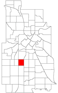 Location of Lyndale within the U.S. city of Minneapolis | |
| Country | United States |
| State | Minnesota |
| County | Hennepin |
| City | Minneapolis |
| Community | Powderhorn |
| Founded | 1849 |
| Area | |
| • Total | 0.483 sq mi (1.25 km2) |
| Population (2010)[2] | |
| • Total | 7,419 |
| • Density | 15,000/sq mi (5,900/km2) |
| Time zone | UTC-6 (CST) |
| • Summer (DST) | UTC-5 (CDT) |
| ZIP code | 55408 |
| Area code(s) | 612 |
| Historical population | |||
|---|---|---|---|
| Census | Pop. | %± | |
| 1980 | 7,167 | — | |
| 1990 | 7,239 | 1.0% | |
| 2000 | 7,690 | 6.2% | |
| 2010 | 7,419 | −3.5% | |
The neighborhood is separated from most of the rest of the Powderhorn community by Interstate 35W.
Schools
- Lyndale Community School (K-5), 312 West 34th Street, Minneapolis, MN 55408.[3]
gollark: It was very cheap, though installing an SSD and more RAM was *annoying*.
gollark: I have an outdated business one, so I still have 4 plus a USB-C port, which is nice.
gollark: I've got a really small TPLink one somewhere. It's basically just a USB-A connector with a small bit on the end. Probably terrible speed, but meh.
gollark: There are tiny USB WiFi things, just not Intel ones.
gollark: The weird part is that you can now commonly get devices with a theoretical wireless bandwidth faster than their wired bandwidth, since most stuff is still stuck on GbE.
References
- "Lyndale neighborhood in Minneapolis, Minnesota (MN), 55408 detailed profile". City-Data. 2011. Retrieved 2013-11-12.
- "Minneapolis Neighborhood Profile: Lyndale" (PDF). Minnesota Compass. October 2011. Retrieved 2013-11-12.
- "Lyndale Community School". Minneapolis Public Schools. Retrieved 28 December 2017.
External links
- Minneapolis Neighborhood Profile - Lyndale
- Lyndale Neighborhood Association
- Lyndale Community School
- Families Building Community
- Southwest Minneapolis Business Directory (NEHBA sponsored)
Places adjacent to Lyndale, Minneapolis | ||||||||||
|---|---|---|---|---|---|---|---|---|---|---|
| ||||||||||
This article is issued from Wikipedia. The text is licensed under Creative Commons - Attribution - Sharealike. Additional terms may apply for the media files.