Lynchat
Lynchat (Scottish Gaelic: Lainn a' Chait) is a small village, situated 2 miles northeast of Kingussie in Inverness-shire, Scottish Highlands[1] and is in the Scottish council area of Highland.[2]
Lynchat
| |
|---|---|
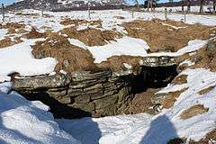
 Raitts Cave A souterrain near Lynchat which dates to the later Iron Age (around AD 100-400). A stone built underground chamber, in a horseshoe shape, believed by archaeologists to have been used as a secure and cool storage chamber for food supplies. It was first excavated in 1835. | |
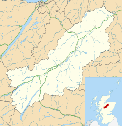
 Lynchat Location within the Badenoch and Strathspey area | |
| OS grid reference | NH784018 |
| Council area | |
| Country | Scotland |
| Sovereign state | United Kingdom |
| Post town | Kingussie |
| Postcode district | PH21 1 |
| Police | Scotland |
| Fire | Scottish |
| Ambulance | Scottish |
The River Spey which rises in Loch Insh and the Insh Marshes located 1–2 miles south and east of the village, passes the villages to the south. The main A9 road passes to the north of Lynchat.
References
This article is issued from Wikipedia. The text is licensed under Creative Commons - Attribution - Sharealike. Additional terms may apply for the media files.