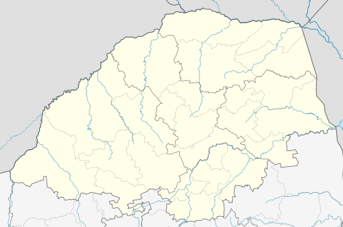
Lulekani
Lulekani (nicknamed Lukcity) is a township 13 km outside Phalaborwa in Mopani District Municipality in the Limpopo province of South Africa. During the Census of 2011, the population of Lulekani and its neighbouring township Humulani counted 40 225. [2]
Lulekani | |
|---|---|
 Lulekani  Lulekani | |
| Coordinates: 23.835°S 30.978°E | |
| Country | South Africa |
| Province | Limpopo |
| District | Mopani |
| Municipality | Ba-Phalaborwa |
| Established | 1979 |
| Area | |
| • Total | 6.61 km2 (2.55 sq mi) |
| Population (2011)[1] | |
| • Total | 14,464 |
| • Density | 2,200/km2 (5,700/sq mi) |
| Racial makeup (2011) | |
| • Black African | 99.4% |
| • Coloured | 0.1% |
| • Indian/Asian | 0.2% |
| • White | 0.2% |
| • Other | 0.1% |
| First languages (2011) | |
| • Tsonga | 89.0% |
| • Northern Sotho | 2.8% |
| • Sotho | 2.5% |
| • Swazi | 1.4% |
| • Other | 4.3% |
| Time zone | UTC+2 (SAST) |
| Postal code (street) | 1392 |
| PO box | 1392 |
| Area code | 015 |
The neighbouring townships of Lulekani is Namakgale, Majeje (Benfarm), Makhushwane and Mashishimale on the R71 road to Gravelotte.
References
- "Sub Place Lulekani". Census 2011.
- Sum of Sub Place Lulekani and Sub Place Humulani Census 2011.
This article is issued from Wikipedia. The text is licensed under Creative Commons - Attribution - Sharealike. Additional terms may apply for the media files.
.svg.png)