Lower Peace Region
The Lower Peace Region is a land-use framework region in northern Alberta, Canada. One of seven in the province, each is intended to develop and implement a regional plan, complementing the planning efforts of member municipalities in order to coordinate future growth. Corresponding roughly to major watersheds while following municipal boundaries, these regions are managed by Alberta Environment and Parks.[1]
With only 37,759 inhabitants spread over 29% of Alberta's landmass, it is the largest, least populated, and least densely populated region of the province.[2]
Lower Peace Region | |
|---|---|
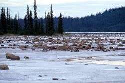 Salt Plains, Wood Buffalo National Park | |
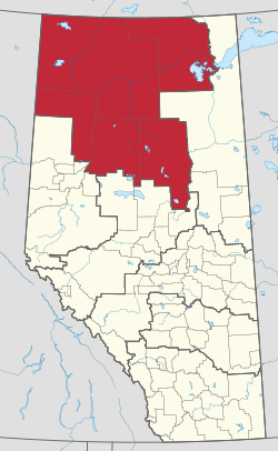 Location in Alberta | |
| Largest population centres | High Level La Crete Wabasca |
| Government | |
| • Parent authority | Alberta Environment and Parks |
| Area | |
| • Total | 192,198 km2 (74,208 sq mi) |
| Population (2016)[3] | |
| • Total | 37,759 |
| • Density | 0.20/km2 (0.51/sq mi) |
Communities
The following municipalities are contained in the Lower Peace Region.
|
|
gollark: Consider: in our modern economy, there are probably around (order of magnitude) a hundred million different sorts of thing people or organizations might need.
gollark: So you have to *vote* on who gets everything?
gollark: If you have some random authority decide who needs them, then... well, that won't really work very well - it doesn't scale to more complex things than allocating one resource, and that is obviously uncool central power.
gollark: If you just *ask*, everyone will go "yes, I really need a bee".
gollark: There is a difference between "want" and "need", and making it actually cost something to get something makes that more meaningful.
References
- "Land-use Framework". Alberta Environment and Parks. Retrieved 2019-07-07.
- "Land-use Planning Regions". Alberta Biosphere Monitoring Initiative. Retrieved 2019-07-07.
- "Population and dwelling counts, for Canada, provinces and territories, and census subdivisions (municipalities), 2016 and 2011 censuses – 100% data (Alberta)". Statistics Canada. February 8, 2017. Retrieved 2019-07-07.
| Towns | |
|---|---|
| Hamlets |
|
| Métis settlements | |
| Municipal districts | |
| Specialized municipalities |
|
| Improvement districts |
|
| Indian reserves |
|
| National parks | |
| Provincial parks | |
| Other topics |
|
This article is issued from Wikipedia. The text is licensed under Creative Commons - Attribution - Sharealike. Additional terms may apply for the media files.