Lodi Township, Athens County, Ohio
Lodi Township is one of the fourteen townships of Athens County, Ohio, United States. The 2010 census found 1,425 people in the township.[3]
Lodi Township, Athens County, Ohio | |
|---|---|
 | |
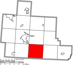 Location of Lodi Township in Athens County | |
| Coordinates: 39°13′52″N 82°1′7″W | |
| Country | United States |
| State | Ohio |
| County | Athens |
| Area | |
| • Total | 39.0 sq mi (101.0 km2) |
| • Land | 38.9 sq mi (100.7 km2) |
| • Water | 0.08 sq mi (0.2 km2) |
| Elevation | 692 ft (211 m) |
| Population (2010) | |
| • Total | 1,425 |
| • Density | 37/sq mi (14.1/km2) |
| Time zone | UTC-5 (Eastern (EST)) |
| • Summer (DST) | UTC-4 (EDT) |
| FIPS code | 39-44590[2] |
| GNIS feature ID | 1085756[1] |
| Website | www |
Geography
Located in the southern part of the county, it borders the following townships:
- Canaan Township - north
- Rome Township - northeast corner
- Carthage Township - east
- Orange Township, Meigs County - southeast corner
- Bedford Township, Meigs County - south
- Scipio Township, Meigs County - southwest corner
- Alexander Township - west
- Athens Township - northwest corner
No municipalities are located in Lodi Township.
Government
The township is governed by a three-member board of trustees, who are elected in November of odd-numbered years to a four-year term beginning on the following January 1. Two are elected in the year after the presidential election and one is elected in the year before it. There is also an elected township clerk, who serves a four-year term beginning on April 1 of the year after the election, which is held in November of the year before the presidential election. Vacancies in the clerkship or on the board of trustees are filled by the remaining trustees.
References
- "US Board on Geographic Names". United States Geological Survey. 2007-10-25. Retrieved 2008-01-31.
- "U.S. Census website". United States Census Bureau. Retrieved 2008-01-31.
- "Geographic Identifiers: 2010 Demographic Profile Data (G001): Lodi township, Athens County, Ohio". U.S. Census Bureau, American Factfinder. Archived from the original on February 12, 2020. Retrieved July 10, 2013.
- Walker, Charles Manning (1869). History of Athens County, Ohio, And, Incidentally, of the Ohio Land Company and the First Settlement of the State at Marietta. Robert Clarke & Company. p. 481.
- "Detailed map of Ohio" (PDF). United States Census Bureau. 2000. Retrieved 2007-02-16.
External links
Municipalities and communities of Athens County, Ohio, United States | ||
|---|---|---|
| Cities | 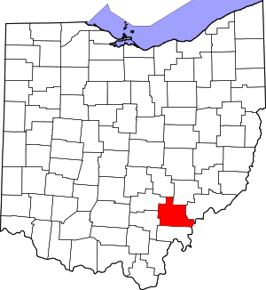 Map of Ohio highlighting Athens County | |
| Villages | ||
| Townships | ||
| CDPs | ||
| Unincorporated communities | ||
| Footnotes | ‡This populated place also has portions in an adjacent county or counties | |