Llobregat–Anoia Line
The Llobregat–Anoia Line (Catalan: Línia Llobregat-Anoia) is an unconnected metre gauge railway line linking Barcelona with the Baix Llobregat, Bages and Anoia regions, in Catalonia, Spain. Its name refers to the fact that it follows the course of the Llobregat and Anoia rivers for most of its length. Plaça d'Espanya station serves as the Barcelona terminus of the line, then continuing northwards to Martorell, where two main branches to Manresa and Igualada are formed. It also includes several freight branches, accounting for a total line length of 138 kilometres (86 mi) and 41 passenger stations.
| Llobregat–Anoia Line | |
|---|---|
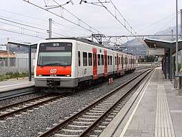 A 213 Series train at Olesa de Montserrat station. | |
| Overview | |
| Other name(s) | El Carrilet, Els Catalans |
| Native name | Línia Llobregat-Anoia |
| Type | Rapid transit, commuter rail, freight rail |
| Status | Operational |
| Locale | Barcelona metropolitan area and northern Bages |
| Termini | Pl. Espanya Igualada, Manresa Baixador |
| Stations | 41 |
| Ridership | 23,100,222 passenger journeys (2018)[1] |
| Line number | L8, S33, S4, S8, R5, R50, R6, R60 |
| Operation | |
| Opened |
|
| Owner | Government of Catalonia |
| Operator(s) | Ferrocarrils de la Generalitat de Catalunya (FGC) |
| Character | At-grade, underground (in Barcelona, L'Hospitalet de Llobregat and Cornellà de Llobregat) |
| Depot(s) | Martorell Enllaç |
| Rolling stock |
|
| Technical | |
| Line length | 138 km (86 mi) |
| Number of tracks |
|
| Track gauge | 1,000 mm (3 ft 3 3⁄8 in) metre gauge |
| Electrification | 1,500 V DC overhead lines (excepting the freight branches) |
| Llobregat–Anoia Line | |||||||||||||||||||||||||||||||||||||||||||||||||||||||||||||||||||||||||||||||||||||||||||||||||||||||||||||||||||||||||||||||||||||||||||||||||||||||||||||||||||||||||||||||||||||||||||||||||||||||||||||||||||||||||||||||||||||||||||||||||||||||||||||||||||||||||||||||||||||||||||||||||||||||||||||||||||||||||||||||||||||||||||||||||||||
|---|---|---|---|---|---|---|---|---|---|---|---|---|---|---|---|---|---|---|---|---|---|---|---|---|---|---|---|---|---|---|---|---|---|---|---|---|---|---|---|---|---|---|---|---|---|---|---|---|---|---|---|---|---|---|---|---|---|---|---|---|---|---|---|---|---|---|---|---|---|---|---|---|---|---|---|---|---|---|---|---|---|---|---|---|---|---|---|---|---|---|---|---|---|---|---|---|---|---|---|---|---|---|---|---|---|---|---|---|---|---|---|---|---|---|---|---|---|---|---|---|---|---|---|---|---|---|---|---|---|---|---|---|---|---|---|---|---|---|---|---|---|---|---|---|---|---|---|---|---|---|---|---|---|---|---|---|---|---|---|---|---|---|---|---|---|---|---|---|---|---|---|---|---|---|---|---|---|---|---|---|---|---|---|---|---|---|---|---|---|---|---|---|---|---|---|---|---|---|---|---|---|---|---|---|---|---|---|---|---|---|---|---|---|---|---|---|---|---|---|---|---|---|---|---|---|---|---|---|---|---|---|---|---|---|---|---|---|---|---|---|---|---|---|---|---|---|---|---|---|---|---|---|---|---|---|---|---|---|---|---|---|---|---|---|---|---|---|---|---|---|---|---|---|---|---|---|---|---|---|---|---|---|---|---|---|---|---|---|---|---|---|---|---|---|---|---|---|---|---|---|---|---|---|---|---|---|---|---|---|---|---|---|---|---|---|---|---|---|---|---|---|---|---|---|---|---|---|---|---|---|---|---|---|---|---|---|---|---|---|---|---|
| |||||||||||||||||||||||||||||||||||||||||||||||||||||||||||||||||||||||||||||||||||||||||||||||||||||||||||||||||||||||||||||||||||||||||||||||||||||||||||||||||||||||||||||||||||||||||||||||||||||||||||||||||||||||||||||||||||||||||||||||||||||||||||||||||||||||||||||||||||||||||||||||||||||||||||||||||||||||||||||||||||||||||||||||||||||
Barcelona Metro rapid transit line 8, together with a number of commuter and freight rail services, runs on the line's main route between Barcelona and Sant Boi de Llobregat. The section between Barcelona and Olesa de Montserrat is operated as a high-frequency commuter rail system known as Baix Llobregat Metro (Catalan: Metro del Baix Llobregat), with some services continuing northwards to Manresa and Igualada. This system further includes the temporarily closed Olesa de Montserrat–Esparreguera Cable Car, which is also operated by FGC. The Llobregat–Anoia Line is part of the Autoritat del Transport Metropolità (ATM) fare-integrated public transport system for the Barcelona metropolitan area.
Development plans
In January 2017, the Catalan government approved a plan to extend the Llobregat–Anoia line from Plaça d'Espanya through the city as far as Gràcia station, also stopping at Hospital Clínic and Francesc Macià station, thereby linking with the Barcelona–Vallès Line, at an estimated cost of over €300 million.[3] A second phase is also being considered to extend the line towards the Besòs station in the eastern part of the city.[4]
List of stations
The following table lists the name of each station on the Llobregat–Anoia Line in order from south to north; a photo of the current station; the rail services operating at the station—L8, S33, S4, S8, R5, R50, R6 and/or R60—; the date the current station was opened; the municipality or the city district (in the case of Barcelona) in which each station is located; the fare zone each station belongs to according to the Autoritat del Transport Metropolità (ATM) fare-integrated public transport system;[5] remarkable notes about the station, including clarifications, additional information and a location map; and usage figures.
| # | Terminal of a service |
| * | Transfer station |
| #* | Transfer station and terminal |
| ¤ | Station located in Barcelona; city district indicated instead of municipality |
| Station | Photo | Line(s) | Opened | Municipality | Fare zone |
Notes | Usage[lower-alpha 2] |
|---|---|---|---|---|---|---|---|
| Main route | |||||||
| Pl. Espanya#* |  | 1926 | Sants-Montjuïc¤ | 1 | Connects with Barcelona Metro lines 1 and 3.map 1 | 5.39 | |
| Magòria-La Campana |  | 1997 | Sants-Montjuïc¤ | 1 | Original at-grade station opened 1912.map 2 | 0.53 | |
| Ildefons Cerdà |  | 1987 | L'Hospitalet de Llobregat | 1 | This station will offer a transfer to Barcelona Metro line 10.map 3 | 1.20 | |
| Europa – Fira* |  | 13 May 2007 | L'Hospitalet de Llobregat | 1 | Connects with Barcelona Metro line 9 (L9 Sud).map 4 | 1.44 | |
| Gornal* |  | 2 Mar 1987 | L'Hospitalet de Llobregat | 1 | Connects with Rodalies de Catalunya commuter and regional rail services at Bellvitge station.map 5 | 0.69 | |
| Sant Josep |  | 8 Jul 1985 | L'Hospitalet de Llobregat | 1 | map 6 | 0.79 | |
| L'Hospitalet Av. Carrilet* | 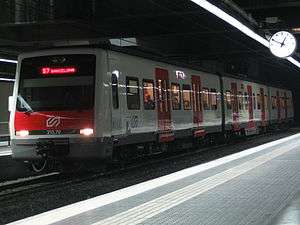 | 9 Jul 1985 | L'Hospitalet de Llobregat | 1 | Original at-grade station opened 1912. Connects with Barcelona Metro line 1.map 7 | 1.99 | |
| Almeda |  | 9 Jul 1985 | Cornellà de Llobregat | 1 | map 8 | 1.09 | |
| Cornellà Riera |  | 9 Jul 1985 | Cornellà de Llobregat | 1 | map 9 | 1.19 | |
| Sant Boi |  | 1912 | Sant Boi de Llobregat | 1 | map 10 | 1.83 | |
| Molí Nou-Ciutat Cooperativa# |  | 13 Feb 2000 | Sant Boi de Llobregat | 1 | map 11 | 0.68 | |
| Colònia Güell |  | 13 Feb 2000 | Santa Coloma de Cervelló | 2B | map 12 | 0.04 | |
| Santa Coloma de Cervelló | 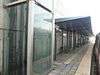 | 13 Feb 2000 | Santa Coloma de Cervelló | 2B | map 13 | 0.12 | |
| Sant Vicenç dels Horts |  | 1926 | Sant Vicenç dels Horts | 2B | map 14 | 0.47 | |
| Can Ros# | 1972 | Sant Vicenç dels Horts | 2B | map 15 | 0.37 | ||
| Quatre Camins | 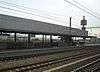 | 4 Jul 2003 | Sant Vicenç dels Horts | 2B | map 16 | 0.14 | |
| Pallejà | 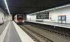 | Oct 2007 | Pallejà | 2B | Original at-grade station opened 1912.map 17 | 0.23 | |
| Sant Andreu de la Barca |  | 20 Nov 2001 | Sant Andreu de la Barca | 2B | Original at-grade station opened 1912.map 18 | 0.51 | |
| El Palau | 25 Apr 2002 | Sant Andreu de la Barca | 2B | map 19 | 0.20 | ||
| Martorell Vila – Castellbisbal | 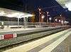 | 1912 | Castellbisbal | 2B | map 20 | 0.03 | |
| Martorell Central* | 21 May 2007 | Martorell | 3B | Original station opened 1893 as the southern terminus of the Catalan Central Railway. Connects with Rodalies de Catalunya commuter rail services.map 21 | 0.38 | ||
| Martorell Enllaç# | 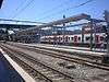 | 1912 | Martorell | 3B | map 22 | 0.15 | |
| Manresa branch | |||||||
| Abrera | 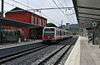 | 29 Mar 1922 | Abrera | 3B | map 23 | 0.12 | |
| Olesa de Montserrat#* | | 29 Mar 1922 | Olesa de Montserrat | 3B | Connects with the Olesa de Montserrat–Esparreguera Cable Car, which has been temporarily closed since August 2012.map 24 | 0.26 | |
| Aeri de Montserrat* | 1930 | Monistrol de Montserrat | 4Z | Connects with the Montserrat Cable Car.map 25 | 0.11 | ||
| Monistrol de Montserrat* |  | 29 Oct 1922 | Monistrol de Montserrat | 4Z | Connects with the Montserrat Rack Railway.map 26 | 0.22 | |
| Castellbell i el Vilar |  | 22 Aug 1924 | Castellbell i el Vilar | 5D | map 27 | 0.004 | |
| Sant Vicenç – Castellgalí | 22 Aug 1924 | Sant Vicenç de Castellet | 5D | map 28 | 0.11 | ||
| Manresa Viladordis | 16 Jul 1985 | Manresa | 6D | map 29 | 0.05 | ||
| Manresa Alta |  | 1924 | Manresa | 6D | Original station opened 1885 together with the Manresa–Puig-reig section of the Manresa to Berga and Guardiola de Berguedà Economical Railway.map 30 | 0.07 | |
| Manresa Baixador# | .JPG) | 1969 | Manresa | 6D | map 31 | 0.13 | |
| Igualada branch | |||||||
| Sant Esteve Sesrovires | 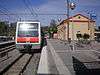 | 1893 | Sant Esteve Sesrovires | 3B | map 32 | 0.10 | |
| La Beguda |  | 1893 | Masquefa | 4C | map 33 | 0.01 | |
| Can Parellada | Masquefa | 4C | map 34 | 0.01 | |||
| Masquefa | 1893 | Masquefa | 4C | map 35 | 0.10 | ||
| Piera |  | 1893 | Piera | 4C | map 36 | 0.16 | |
| Vallbona d'Anoia |  | 1893 | Vallbona d'Anoia | 5C | map 37 | 0.03 | |
| Capellades | 1893 | Capellades | 5C | map 38 | 0.05 | ||
| La Pobla de Claramunt |  | 1893 | La Pobla de Claramunt | 5C | map 39 | 0.03 | |
| Vilanova del Camí | 1893 | Vilanova del Camí | 6B | map 40 | 0.03 | ||
| Igualada# |  | 1978 | Igualada | 6B | map 41 | 0.19 | |
See also
- Ferrocarrils de la Generalitat de Catalunya
- Barcelona Metro
- Olesa de Montserrat–Esparreguera Cable Car
- Montserrat Rack Railway
- Montserrat Cable Car
- Barcelona–Vallès Line
Maps
- ^map 1 Pl. Espanya – 41.374701°N 2.148494°E
- ^map 2 Magòria-La Campana– 41.3675°N 2.139444°E
- ^map 3 Ildefons Cerdà – 41.3608°N 2.13028°E
- ^map 4 Europa | Fira – 41.356978°N 2.124908°E
- ^map 5 Gornal – 41.354889°N 2.117417°E
- ^map 6 Sant Josep – 41.360556°N 2.110556°E
- ^map 7 L'Hospitalet Av. Carrilet – 41.357944°N 2.102722°E
- ^map 8 Almeda – 41.353056°N 2.085278°E
- ^map 9 Cornellà Riera – 41.351389°N 2.070833°E
- ^map 10 Sant Boi – 41.348056°N 2.043333°E
- ^map 11 Molí Nou-Ciutat Cooperativa – 41.357778°N 2.034444°E
- ^map 12 Colònia Güell – 41.364433°N 2.031303°E
- ^map 13 Santa Coloma de Cervelló – 41.370114°N 2.023803°E
- ^map 14 Sant Vicenç dels Horts – 41.388139°N 2.012464°E
- ^map 15 Can Ros – 41.399325°N 2.004964°E
- ^map 16 Quatre Camins– 41.406956°N 2.001636°E
- ^map 17 Pallejà – 41.420917°N 1.995528°E
- ^map 18 Sant Andreu de la Barca – 41.446742°N 1.973289°E
- ^map 19 El Palau – 41.455817°N 1.962231°E
- ^map 20 Martorell Vila | Castellbisbal – 41.475881°N 1.939033°E
- ^map 21 Martorell Central – 41.478944°N 1.925422°E
- ^map 22 Martorell Enllaç – 41.483833°N 1.918972°E
- ^map 23 Abrera – 41.522567°N 1.9067°E
- ^map 24 Olesa de Montserrat – 41.541142°N 1.888661°E
- ^map 25 Aeri de Montserrat – 41.590875°N 1.853181°E
- ^map 26 Monistrol de Montserrat – 41.610339°N 1.849122°E
- ^map 27 Castellbell i el Vilar – 41.640503°N 1.854814°E
- ^map 28 Sant Vicenç | Castellgalí – 41.667917°N 1.859753°E
- ^map 29 Manresa Viladordis – 41.7247°N 1.833986°E
- ^map 30 Manresa Alta – 41.732081°N 1.832972°E
- ^map 31 Manresa Baixador – 41.731414°N 1.827897°E
- ^map 32 Sant Esteve Sesrovires – 41.497597°N 1.872492°E
- ^map 33 La Beguda – 41.501744°N 1.838789°E
- ^map 34 Can Parellada – 41.502203°N 1.830808°E
- ^map 35 Masquefa – 41.502833°N 1.812558°E
- ^map 36 Piera – 41.525908°N 1.754383°E
- ^map 37 Vallbona d'Anoia – 41.520178°N 1.709006°E
- ^map 38 Capellades – 41.521506°N 1.695117°E
- ^map 39 La Pobla de Claramunt – 41.554567°N 1.677847°E
- ^map 40 Vilanova del Camí – 41.573194°N 1.642106°E
- ^map 41 Igualada – 41.578001°N 1.629981°E
Notes
References
- "Memòria de Ferrocarrils de la Generalitat de Catalunya" (PDF). Ferrocarrils de la Generalitat de Catalunya. 2018. Retrieved 5 September 2019.
- FGC (2014), p. 45
- "Adjudicat el projecte d'FGC a Barcelona entre plaça Espanya i Gràcia" (in Catalan). TV3 (Catalonia). 4 January 2017. Retrieved 4 January 2017.
- "FGC L8. Perllongament Plaça Espanya – Gràcia" (in Catalan). Àrea Metropolitana de Barcelona. Retrieved 4 January 2017.
- Integrated Railway Network (PDF) (Map). Autoritat del Transport Metropolità. June 2015. Retrieved 7 November 2015.
Bibliography
- Memòria de Ferrocarrils de la Generalitat de Catalunya 2014 [2014 Report of Ferrocarrils de la Generalitat de Catalunya] (PDF) (Report) (in Catalan). Ferrocarrils de la Generalitat de Catalunya. 2015. Retrieved 7 November 2015.
External links
| Wikimedia Commons has media related to Llobregat-Anoia Line. |
- Ferrocarrils de la Generalitat de Catalunya (FGC) official website
- Llobregat–Anoia Line at trenscat.cat (in Catalan)
| Stations |
| ||||||
|---|---|---|---|---|---|---|---|
| Rolling stock |
| ||||||
| History |
| ||||||
| Depots | Martorell Enllaç | ||||||
| Related articles |
| ||||||
| |||||||
| Road |
| ||||
|---|---|---|---|---|---|
| Public transport |
| ||||
| Stations |
| ||||
| Airport |
| ||||
| Seaport | |||||
| Leisure | |||||
| |||||