Litchfield, Michigan
Litchfield is a city in Hillsdale County in the U.S. state of Michigan. The population was 1,369 at the 2010 census.
Litchfield, Michigan | |
|---|---|
| City of Litchfield | |
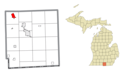 Location within Hillsdale County | |
 Litchfield Location within the state of Michigan | |
| Coordinates: 42°02′35″N 84°45′25″W | |
| Country | United States |
| State | Michigan |
| County | Hillsdale |
| Incorporated | 1877 (village) 1970 (city) |
| Government | |
| • Type | Council–manager |
| • Mayor | O.R. Smith |
| • Clerk | Susan Ballinger |
| • Manager | Douglas Terry |
| Area | |
| • Total | 2.56 sq mi (6.63 km2) |
| • Land | 2.52 sq mi (6.53 km2) |
| • Water | 0.04 sq mi (0.10 km2) |
| Elevation | 1,024 ft (312 m) |
| Population | |
| • Total | 1,369 |
| • Estimate (2019)[3] | 1,331 |
| • Density | 527.76/sq mi (203.75/km2) |
| Time zone | UTC-5 (Eastern (EST)) |
| • Summer (DST) | UTC-4 (EDT) |
| ZIP code(s) | 49252 |
| Area code(s) | 517 |
| FIPS code | 26-47980[4] |
| GNIS feature ID | 0630540[5] |
| Website | Official website |
Litchfield Township surrounds the city, but the two are autonomous municipalities.
Geography
According to the United States Census Bureau, the city has a total area of 2.54 square miles (6.58 km2), of which 2.50 square miles (6.47 km2) is land and 0.04 square miles (0.10 km2) is water.[6] Litchfield also has the St. Joseph River flowing close to the downtown area, within the city limits. Litchfield has a growing industrial base and is centrally located in southern Mid-Michigan. Litchfield is the only City in the County with a public pool.
Demographics
| Historical population | |||
|---|---|---|---|
| Census | Pop. | %± | |
| 1880 | 1,029 | — | |
| 1890 | 601 | −41.6% | |
| 1900 | 645 | 7.3% | |
| 1910 | 660 | 2.3% | |
| 1920 | 716 | 8.5% | |
| 1930 | 634 | −11.5% | |
| 1940 | 717 | 13.1% | |
| 1950 | 882 | 23.0% | |
| 1960 | 993 | 12.6% | |
| 1970 | 1,167 | 17.5% | |
| 1980 | 1,353 | 15.9% | |
| 1990 | 1,317 | −2.7% | |
| 2000 | 1,458 | 10.7% | |
| 2010 | 1,369 | −6.1% | |
| Est. 2019 | 1,331 | [3] | −2.8% |
| U.S. Decennial Census[7] | |||
Over 2000 people are employed within Litchfield's large industrial park.
2010 census
As of the census[2] of 2010, there were 1,369 people, 559 households, and 365 families living in the city. The population density was 547.6 inhabitants per square mile (211.4/km2). There were 616 housing units at an average density of 246.4 per square mile (95.1/km2). The racial makeup of the city was 96.9% White, 0.3% African American, 0.7% Native American, 0.1% Asian, 1.1% from other races, and 0.9% from two or more races. Hispanic or Latino of any race were 2.9% of the population.
There were 559 households, of which 32.7% had children under the age of 18 living with them, 45.6% were married couples living together, 12.2% had a female householder with no husband present, 7.5% had a male householder with no wife present, and 34.7% were non-families. 29.2% of all households were made up of individuals, and 12.3% had someone living alone who was 65 years of age or older. The average household size was 2.44 and the average family size was 2.99.
The median age in the city was 38.4 years. 25.6% of residents were under the age of 18; 9% were between the ages of 18 and 24; 23.4% were from 25 to 44; 27% were from 45 to 64; and 15% were 65 years of age or older. The gender makeup of the city was 49.8% male and 50.2% female.
2000 census
As of the census[4] of 2000, there were 1,458 people, 568 households, and 362 families living in the city. The population density was 608.9 per square mile (235.5/km2). There were 604 housing units at an average density of 252.2 per square mile (97.6/km2). The racial makeup of the city was 98.42% White, 0.21% African American, 0.07% Asian, 0.62% from other races, and 0.69% from two or more races. Hispanic or Latino of any race were 1.99% of the population.
There were 568 households, out of which 34.2% had children under the age of 18 living with them, 47.7% were married couples living together, 11.4% had a female householder with no husband present, and 36.1% were non-families. 31.9% of all households were made up of individuals, and 15.1% had someone living alone who was 65 years of age or older. The average household size was 2.40 and the average family size was 3.04.
In the city, the population was spread out, with 26.3% under the age of 18, 9.3% from 18 to 24, 26.2% from 25 to 44, 20.3% from 45 to 64, and 17.8% who were 65 years of age or older. The median age was 37 years. For every 100 females, there were 87.6 males. For every 100 females age 18 and over, there were 85.8 males.
The median income for a household in the city was $39,292, and the median income for a family was $47,500. Males had a median income of $34,464 versus $24,671 for females. The per capita income for the city was $17,362. About 5.6% of families and 10.3% of the population were below the poverty line, including 7.2% of those under age 18 and 17.9% of those age 65 or over.
Transportation
References
- "2019 U.S. Gazetteer Files". United States Census Bureau. Retrieved July 25, 2020.
- "U.S. Census website". United States Census Bureau. Retrieved 2012-11-25.
- "Population and Housing Unit Estimates". United States Census Bureau. May 24, 2020. Retrieved May 27, 2020.
- "U.S. Census website". United States Census Bureau. Retrieved 2008-01-31.
- "US Board on Geographic Names". United States Geological Survey. 2007-10-25. Retrieved 2008-01-31.
- "US Gazetteer files 2010". United States Census Bureau. Archived from the original on 2012-01-25. Retrieved 2012-11-25.
- "Census of Population and Housing". Census.gov. Retrieved June 4, 2015.
External links
Municipalities and communities of Hillsdale County, Michigan, United States | ||
|---|---|---|
| Cities | 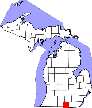 Map of Michigan highlighting Hillsdale County.svg | |
| Villages | ||
| Civil townships | ||
| Unincorporated communities | ||