List of valleys of Arizona
This is a list of valleys of Arizona. Valleys are ordered alphabetically, by county.
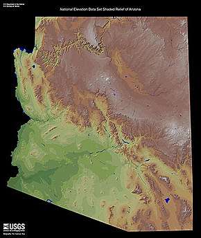
Shaded relief map, Arizona.
| Wikimedia Commons has media related to Valleys of Arizona. |
Graham County
A
- Aravaipa Valley, Aravaipa Creek
G
- Gila River Valley
- Gila Valley (Graham County)
W
- Whitlock Valley, Whitlock Mountains
La Paz County
|
B L
|
M
P
|
Maricopa County
|
A
B C
D
|
G H K
|
M
P
|
R
S T
|
Mohave County
|
A
B
C
|
D H L
|
M
S
|
U
V W
|
Pima County
|
A B
|
C G
|
L
O P
|
Q
V
|
Yavapai County
|
A
C
|
L
|
P
|
V W
|
Yuma County
|
D
G
|
K
|
L M
|
P
|
Valleys in the Gila River Valley corridor
(listed upriver-to-downriver)
- Gila Valley (Graham County)
- Pleasant Valley (Arizona)
- Rainbow Valley (Arizona)
- Citrus Valley
- Dendora Valley
- Hyder Valley
- Park Valley (Arizona)
- San Cristobal Valley
- Mohawk Valley (Arizona)
- Dome Valley
- Gila Valley (Yuma County)
Valleys in the Lower Colorado River Valley corridor, Arizona
(listed upriver-to-downriver)
- Sacramento Valley (Arizona)
- Mohave Valley
- Parker Valley
- Palo Verde Valley
- Gila Valley (Yuma County)
- Yuma Valley, (also in Baja California(state), Mexico?)
California
- Mohave Valley
- Chemehuevi Valley, Chemehuevi Wash
- Vidal Valley
- Parker Valley
- Palo Verde Valley
Alphabetic listing
gollark: !hwdyk msg
gollark: Pyrotelekinetic
gollark: !hwdyk msg
gollark: LyricLy
gollark: !hwdyk msg
See also
The Gila River, a tributary of the Colorado along the width of southern Arizona, and its valley can be traced on a map of Arizona. The Gila forms the boundary between various counties in Eastern Arizona.
This article is issued from Wikipedia. The text is licensed under Creative Commons - Attribution - Sharealike. Additional terms may apply for the media files.