List of listed buildings in Hamilton, South Lanarkshire
List
| Name | Location | Date Listed | Grid Ref. [note 1] | Geo-coordinates | Notes | LB Number [note 2] | Image |
|---|---|---|---|---|---|---|---|
| 2, 4, 6 Cadzow Street And 3, 5 Castle Street | 55°46′35″N 4°02′01″W | Category B | 34551 |  | |||
| 40, 42 Castle Street | 55°46′37″N 4°02′00″W | Category B | 34554 | | |||
| 371 Glasgow Road, Limetree, Including Boundary Wall | 55°47′07″N 4°04′38″W | Category C(S) | 34557 | | |||
| 4 And 6 Keith Street | 55°46′33″N 4°01′59″W | Category C(S) | 34560 | | |||
| 85-89 (Odd Nos) Quarry Street | 55°46′29″N 4°02′08″W | Category C(S) | 34572 | | |||
| 117-121 (Odd Nos) Quarry Street And 2-8 (Even Nos) Duke Street, Royal Hotel | 55°46′26″N 4°02′12″W | Category B | 34574 | | |||
| 123-127 (Odd Nos) Quarry Street | 55°46′26″N 4°02′13″W | Category C(S) | 34575 | | |||
| 185 Quarry Street | 55°46′19″N 4°02′18″W | Category C(S) | 34583 | | |||
| 74-78 (Even Nos) Quarry Street | 55°46′31″N 4°02′07″W | Category C(S) | 34589 | | |||
| 102-106 (Even Nos) Quarry Street | 55°46′29″N 4°02′10″W | Category C(S) | 34592 | | |||
| 29-41 (Odd Nos) Townhead Street, Hamilton Town Hotel | 55°46′32″N 4°01′58″W | Category C(S) | 34603 | | |||
| Churchyard Ann Street | 55°46′35″N 4°02′12″W | Category A | 34474 | 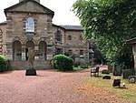 | |||
| 4-24 (Even Nos) Gateside Street And 175-177 (Odd Nos) Quarry Street | 55°46′20″N 4°02′17″W | Category B | 34517 | | |||
| Union Street, Auchingramont Church | 55°46′32″N 4°02′45″W | Category B | 34529 | | |||
| 4 Auchingramont Road, Strathclyde Regional Council Education Resource Centre, Including Gatepiers | 55°46′39″N 4°02′24″W | Category B | 34537 | | |||
| Chatelherault Hunting Lodge, Ornamental Gardens Boundary And Courtyard Walls And Leopard House | 55°45′44″N 4°00′55″W | Category A | 12485 | 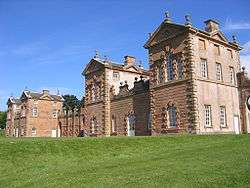 | |||
| Toll House (No. 50 Carlisle Road) | 55°46′09″N 4°01′03″W | Category B | 12517 | | |||
| Hamilton Monument | 55°45′58″N 4°01′39″W | Category A | 12520 | 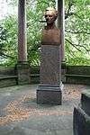 | |||
| 21-31 (Odd Nos) Quarry Street, Victoria Buildings | 55°46′32″N 4°02′02″W | Category B | 44550 | | |||
| 14-18 (Inclusive Nos) Kemp Street | 55°46′22″N 4°02′23″W | Category C(S) | 34565 | | |||
| 41-49 (Odd Nos) Quarry Street | 55°46′31″N 4°02′05″W | Category C(S) | 34569 | | |||
| 67-75 (Odd Nos) Quarry Street | 55°46′29″N 4°02′07″W | Category C(S) | 34571 | | |||
| 167 And 169 Quarry Street And 3 Avon Street | 55°46′21″N 4°02′14″W | Category C(S) | 34580 | | |||
| 183 Quarry Street | 55°46′20″N 4°02′17″W | Category C(S) | 34582 | | |||
| 38-46 (Even Nos) Quarry Street | 55°46′32″N 4°02′05″W | Category B | 34585 | | |||
| 58-64 (Even Nos) Quarry Street | 55°46′31″N 4°02′06″W | Category C(S) | 34587 | | |||
| 172-176 (Even Nos) Quarry Street | 55°46′21″N 4°02′16″W | Category B | 34596 | | |||
| 29 Wellhall Road, Flakedale, Including Boundary Wall | 55°46′32″N 4°03′34″W | Category C(S) | 34608 | | |||
| Auchencampbell Road, Hamilton Grammar School | 55°46′27″N 4°02′47″W | Category B | 34475 | | |||
| Auchingramont Road, St. Mary's Episcopal Church | 55°46′38″N 4°02′27″W | Category B | 34482 | | |||
| Bothwell Road, 65 Lodge And Gatepiers At Hamilton Public Park | 55°47′09″N 4°03′01″W | Category C(S) | 34485 | | |||
| Bothwell Road, Railings At Hamilton College Of Education | 55°46′58″N 4°02′48″W | Category B | 34488 | | |||
| Cadzow Street, 78, 80, 82, 84 And Corner Of Church Street | 55°46′37″N 4°02′12″W | Category B | 34501 | | |||
| Cadzow Street, 114 | 55°46′41″N 4°02′24″W | Category B | 34508 | | |||
| Cadzow Street, St Mary's Roman Catholic Church | 55°46′42″N 4°02′27″W | Category B | 34511 | | |||
| 4, 6, 8, 10, 14, 16 Muir Street | 55°46′45″N 4°02′38″W | Category B | 34524 | | |||
| 26, 28, 30, 32 Muir Street | 55°46′44″N 4°02′36″W | Category B | 34525 | | |||
| Windmill Road, 12 | 55°46′41″N 4°02′39″W | Category C(S) | 34535 | | |||
| 66 Brandon Street, Hamilton District Council Offices And Boundary Walls | 55°46′27″N 4°02′23″W | Category B | 34536 | | |||
| 14-18 (Even Nos) Brandon Street, Brandon Chambers | 55°46′27″N 4°02′14″W | Category B | 34541 | | |||
| Old Avon Bridge | 55°46′06″N 4°01′15″W | Category A | 12518 | 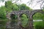 | |||
| Barncluith House | 55°46′02″N 4°01′34″W | Category B | 12481 | | |||
| Keith Street, Salvation Army Citadel, Including Boundary Wall And Railings | 55°46′34″N 4°01′56″W | Category C(S) | 34558 | | |||
| Kemp Street, Former Caledonian Railway Booking Office | 55°46′23″N 4°02′19″W | Category C(S) | 34563 | | |||
| Mill Road, Hamilton South Church, Including Boundary Railings | 55°45′37″N 4°02′48″W | Category C(S) | 34566 | | |||
| 48-56 (Even Nos) Quarry Street | 55°46′32″N 4°02′05″W | Category B | 34586 | | |||
| 57 Union Street, Including Coach House/Stable, Boundary And Terrace Walls | 55°46′34″N 4°03′02″W | Category B | 34606 | | |||
| Almada Street 63 Currie House | 55°46′44″N 4°02′51″W | Category B | 34471 | | |||
| Parish Church Ann Street | 55°46′34″N 4°02′13″W | Category A | 34473 | 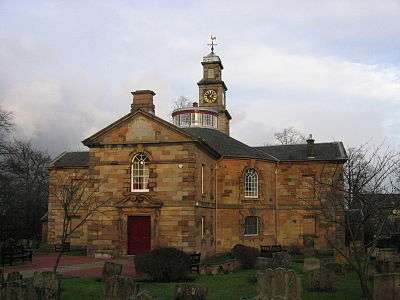 | |||
| Auchingramont Road, 31 | 55°46′32″N 4°02′47″W | Category C(S) | 34481 | | |||
| Burnbank Road, 57 | 55°46′43″N 4°03′31″W | Category C(S) | 34492 | | |||
| Cadzow Street, 111,113 And 1 Auchingramont Road, Bank Of Scotland | 55°46′39″N 4°02′21″W | Category B | 34498 | | |||
| Cadzow Street 26-42 (Even Nos) And Corner Of Campbell Street | 55°46′36″N 4°02′05″W | Category B | 34500 | | |||
| Cadzow Bridge Cadzow Street | 55°46′37″N 4°02′15″W | Category A | 34504 | 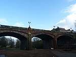 | |||
| Cadzow Street, 98-102 Municipal Buildings | 55°46′40″N 4°02′19″W | Category B | 34505 | | |||
| Carlisle Road, 9 Angus Hotel | 55°46′21″N 4°01′38″W | Category C(S) | 34513 | | |||
| Church Street, 5 | 55°46′37″N 4°02′11″W | Category B | 34515 | | |||
| 56 Muir Street | 55°46′43″N 4°02′23″W | Category B | 34526 | | |||
| Union Street, Waugh's Premises, Corner Of Auchinampbell Road | 55°46′27″N 4°02′40″W | Category B | 34531 | | |||
| 76 Burnbank Centre, Burnbank Library, Including Rear Enclosing Wall | 55°46′54″N 4°04′04″W | Category B | 34545 | | |||
| Cadzow Castle | 55°45′38″N 4°01′04″W | Category B | 12483 | | |||
| 51 Neilsland Road, Burnhouse, With Boundary Wall | 55°45′54″N 4°03′29″W | Category C(S) | 50117 | | |||
| 56 Woodfoot Road, Earnock Cottage | 55°46′06″N 4°04′06″W | Category B | 50118 | | |||
| Ferniegair, Carlisle Road, Ferniegair Mission Church (Church Of Scotland) | 55°45′57″N 4°00′28″W | Category C(S) | 50166 | | |||
| 33 Quarry Street And 2 Regent Way | 55°46′31″N 4°02′04″W | Category C(S) | 44551 | | |||
| 1, 3, 5 Gateside Street And 2, 4 Avon Street | 55°46′20″N 4°02′14″W | Category C(S) | 34555 | | |||
| Kemp Street And Graham Street, Hamilton Baptist Church, Including Adjoining Church Hall And Offices, Boundary Wall, Gatepiers And Railings | 55°46′20″N 4°02′25″W | Category C(S) | 34562 | | |||
| 3-10 (Inclusive Nos) Kemp Street | 55°46′22″N 4°02′17″W | Category B | 34564 | | |||
| Quarry Street, Former Entrance To Railway Station, Including Adjoining Wall | 55°46′23″N 4°02′15″W | Category C(S) | 34567 | | |||
| 35-39 (Odd Nos) Quarry Street | 55°46′31″N 4°02′04″W | Category C(S) | 34568 | | |||
| 57-65 (Odd Nos) Quarry Street | 55°46′30″N 4°02′06″W | Category C(S) | 34570 | | |||
| 129-135 (Odd Nos) Quarry Street | 55°46′25″N 4°02′13″W | Category C(S) | 34576 | | |||
| 30-36 (Even Nos) Quarry Street | 55°46′32″N 4°02′04″W | Category B | 34584 | | |||
| 186 And 188 Quarry Street | 55°46′21″N 4°02′18″W | Category C(S) | 34598 | | |||
| Auchingramont Road, 19, The Orchard | 55°46′34″N 4°02′39″W | Category B | 34478 | | |||
| Auchingramont Road, 4A Hall To St Mary's Church | 55°46′39″N 4°02′28″W | Category C(S) | 34483 | | |||
| Bothwell Road, Bandstand At Hamilton Public Park | 55°47′07″N 4°03′09″W | Category C(S) | 34486 | | |||
| Cadzow Street, 105 Royal Bank Of Scotland | 55°46′38″N 4°02′19″W | Category B | 34497 | | |||
| Cadzow Street, 86, 88 | 55°46′37″N 4°02′12″W | Category B | 34502 | | |||
| Cadzow Street, 108, 110, 112 | 55°46′41″N 4°02′24″W | Category B | 34507 | | |||
| St John's Church. Duke Street | 55°46′25″N 4°02′10″W | Category B | 34516 | | |||
| Keith Street, Vogue Social Club | 55°46′35″N 4°01′58″W | Category B | 34520 | | |||
| Riding School Off Muir Street | 55°46′47″N 4°02′07″W | Category A | 34522 | | |||
| 72 Muir Street | 55°46′43″N 4°02′16″W | Category B | 34527 | | |||
| 24 Brandon Street, Post Office | 55°46′27″N 4°02′16″W | Category B | 34543 | | |||
| Burnbank Centre, Gilmour Memorial Church, Including Gatepiers | 55°46′55″N 4°04′07″W | Category C(S) | 34544 | | |||
| 17 Burnbank Road, Ulva Cottage | 55°46′41″N 4°03′19″W | Category C(S) | 34548 | | |||
| Quarter Church | 55°44′13″N 4°02′13″W | Category B | 13821 | | |||
| Ross House | 55°46′44″N 4°00′41″W | Category B | 12486 | | |||
| Fairholm | 55°44′27″N 3°59′10″W | Category B | 12487 | | |||
| Barncluith | 55°46′02″N 4°01′32″W | Category B | 12521 | | |||
| Bothwell Road, Gatepiers To Sewage Works | 55°47′42″N 4°03′23″W | Category B | 50181 | .jpg) | |||
| 120 Cadzow Street, St Mary's Presbytery And Hall | 55°46′43″N 4°02′27″W | Category C(S) | 34553 | | |||
| 1-9 (Odd Nos) Keith Street, Douglas Chambers | 55°46′35″N 4°01′59″W | Category B | 34559 | | |||
| 179 And 181 Quarry Street | 55°46′20″N 4°02′17″W | Category C(S) | 34581 | | |||
| 66-72 (Even Nos) Quarry Street | 55°46′31″N 4°02′07″W | Category C(S) | 34588 | | |||
| 118-122 (Even Nos) Quarry Street | 55°46′28″N 4°02′11″W | Category B | 34593 | | |||
| 15-27 (Odd Nos) Townhead Street | 55°46′33″N 4°01′59″W | Category B | 34602 | | |||
| 51 Union Street, Linnburn, Including Gatepiers And Boundary Wall | 55°46′32″N 4°02′53″W | Category B | 34605 | | |||
| Woodside Walk, Cadzow Parish Church, Including Gatepiers, Gates, Boundary Walls And Railings | 55°46′18″N 4°02′13″W | Category B | 34610 | | |||
| Auchingramont Road 29 | 55°46′33″N 4°02′46″W | Category B | 34480 | | |||
| Bothwell Road, Lodge To Hamilton College Of Education | 55°46′48″N 4°02′39″W | Category B | 34487 | | |||
| Burnbank Road, 53 | 55°46′43″N 4°03′29″W | Category B | 34490 | | |||
| Cadzow Street, 118A Old Chapel House | 55°46′42″N 4°02′26″W | Category C(S) | 34510 | | |||
| Townhead Street, 89 Staneacre House | 55°46′28″N 4°01′52″W | Category B | 34528 | | |||
| Chatelherault Country Park, Laigh Quarter, Laigh Quarter Bridge Over Burn | 55°44′40″N 4°00′15″W | Category C(S) | 13623 | | |||
| Quarter Manse | 55°44′12″N 4°02′16″W | Category B | 12489 | | |||
| 115 Cadzow Street, Hamilton District Council Computer Department (Formerly British Linen Bank) | 55°46′39″N 4°02′23″W | Category C(S) | 34549 | | |||
| 129 Cadzow Street | 55°46′41″N 4°02′30″W | Category C(S) | 34550 | | |||
| 7-17 (Odd Nos) Gateside Street | 55°46′20″N 4°02′14″W | Category C(S) | 34556 | | |||
| 91-99 (Odd Nos) Quarry Street | 55°46′28″N 4°02′09″W | Category C(S) | 34573 | | |||
| 88-94 (Even Nos) Quarry Street | 55°46′30″N 4°02′09″W | Category C(S) | 34590 | | |||
| 96-100 (Even Nos) Quarry Street | 55°46′29″N 4°02′10″W | Category C(S) | 34591 | | |||
| 178-184 (Even Nos) Quarry Street | 55°46′21″N 4°02′17″W | Category C(S) | 34597 | | |||
| Saffronhall Lane, Hamilton North Church, Including Gatepiers, Boundary Wall And Railings | 55°46′42″N 4°02′37″W | Category C(S) | 34600 | | |||
| Udston Road, Burnbank Parish Church And Hall | 55°46′52″N 4°04′28″W | Category C(S) | 34604 | | |||
| 68 Wellhall Road, Cemetery Lodge, Including Gatepiers, Gates, Adjoining Walls And Waiting Room | 55°46′19″N 4°03′12″W | Category C(S) | 34609 | | |||
| Sheriff Court Buildings, Almada Street | 55°46′46″N 4°02′56″W | Category A | 34470 | 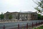 | |||
| Auchingramont Road, 7 And Glen Cottage Adjoining | 55°46′36″N 4°02′28″W | Category C(S) | 34477 | | |||
| Avon Street, St Andrews Parish Church | 55°46′20″N 4°02′10″W | Category B | 34484 | | |||
| Burnbank Road, 59, Herbertfield | 55°46′43″N 4°03′33″W | Category C(S) | 34493 | | |||
| Burnbank Road 61 | 55°46′44″N 4°03′34″W | Category C(S) | 34494 | | |||
| Burnbank Road, West Church Of Scotland, Including Church House, 40 Burnbank Road | 55°46′43″N 4°03′20″W | Category B | 34496 | | |||
| Cadzow Street, 104, 106 Masonic Buildings, And Corner Of Lower Auchingramont Road | 55°46′41″N 4°02′23″W | Category B | 34506 | | |||
| Cadzow Street, 116 | 55°46′41″N 4°02′25″W | Category B | 34509 | | |||
| Hamilton Mausoleum | 55°47′00″N 4°01′54″W | Category A | 34518 | | |||
| 14 Beckford Street, Lanarkshire Health Board Offices, Including Gatepiers And Lampstandards | 55°46′48″N 4°02′58″W | Category B | 34538 | | |||
| Bent Road, Bent Cemetery, Monument To Dukes Of Hamilton | 55°46′22″N 4°03′14″W | Category C(S) | 34539 | | |||
| 1, 3 Burnbank Road And 2, 4 Wellhall Road, Harveys Bar | 55°46′40″N 4°03′14″W | Category C(S) | 34546 | | |||
| 5, 7 Burnbank Road | 55°46′40″N 4°03′16″W | Category C(S) | 34547 | | |||
| Chatelherault Country Park, Bridge Over Burn, Darling Bridge | 55°45′43″N 4°01′30″W | Category B | 13622 | | |||
| Fairholm Bridge | 55°44′41″N 3°59′22″W | Category B | 12488 | | |||
| Avon Bridge | 55°46′11″N 4°01′04″W | Category A | 12516 | .jpg) | |||
| 5 Blackswell Lane | 55°46′30″N 4°01′53″W | Category B | 47366 | | |||
| 8 Keith Street And 1 Bourne Street | 55°46′34″N 4°01′58″W | Category C(S) | 34561 | | |||
| 143 And 145 Quarry Street And 2-6 (Even Nos) John Street | 55°46′23″N 4°02′14″W | Category C(S) | 34577 | | |||
| 147-155 (Odd Nos) Quarry Street | 55°46′22″N 4°02′14″W | Category C(S) | 34578 | | |||
| 157-165 (Odd Nos) Quarry Street | 55°46′22″N 4°02′14″W | Category C(S) | 34579 | | |||
| Almada Street, Lanark County Buildings | 55°46′45″N 4°03′03″W | Category A | 34472 |  | |||
| Auchingramont Road, 21 | 55°46′34″N 4°02′41″W | Category C(S) | 34479 | | |||
| Burnbank Road, 63 Dunrod | 55°46′44″N 4°03′37″W | Category B | 34495 | | |||
| Cadzow Street, 8, 10, 12, 14, 16, 18, 20, 22, 24 | 55°46′35″N 4°02′02″W | Category B | 34499 | | |||
| Cadzow Street, 92, 94 | 55°46′38″N 4°02′13″W | Category A | 34503 |  | |||
| Carlisle Road, 4 The Priory | 55°46′19″N 4°01′40″W | Category C(S) | 34514 | | |||
| Hamilton Mausoleum, Keeper's House/Lodge | 55°47′03″N 4°01′55″W | Category B | 34519 | | |||
| Hamilton Burgh Museum Muir Street | 55°46′46″N 4°02′07″W | Category A | 34521 |  | |||
| Premises Of L.S. Smellie & Sons, Auction Mart. Muir Street | 55°46′42″N 4°02′22″W | Category B | 34523 | | |||
| Union Street, Auchingramont Church Manse | 55°46′31″N 4°02′43″W | Category B | 34530 | | |||
| Windmill Road, 19, 21 | 55°46′40″N 4°02′38″W | Category C(S) | 34533 | | |||
| Windmill Road, 10 | 55°46′41″N 4°02′38″W | Category C(S) | 34534 | | |||
| 20-22 (Even Nos) Brandon Street, Post Office | 55°46′27″N 4°02′15″W | Category B | 34542 | | |||
| Cadzow Chapel | 55°45′38″N 4°01′06″W | Category B | 12484 | | |||
| Terraces And Summerhouse, Barncluith | 55°46′01″N 4°01′33″W | Category A | 12522 | | |||
| 118 Cadzow Street, Muirbrow Chambers | 55°46′41″N 4°02′26″W | Category C(S) | 34552 | | |||
| 164 Quarry Street And 1 And 2 Kemp Street | 55°46′22″N 4°02′16″W | Category B | 34594 | | |||
| 166-170 (Even Nos) Quarry Street | 55°46′22″N 4°02′16″W | Category B | 34595 | | |||
| 6 And 8 Saffronhall Crescent, Public Baths | 55°46′43″N 4°02′48″W | Category B | 34599 | | |||
| 20 Strathmore Road, Old Parish Church Halls, Including Gatepiers, Gates And Railings | 55°46′33″N 4°02′16″W | Category B | 34601 | | |||
| 59 Union Street, Cadzowburn, Including Boundary Wall | 55°46′34″N 4°03′04″W | Category C(S) | 34607 | | |||
| Auchencampbell Road, House At Hamilton Grammar School (45 Union Street) | 55°46′27″N 4°02′42″W | Category C(S) | 34476 | | |||
| Brandon Street, Brandon Tower | 55°46′27″N 4°02′13″W | Category B | 34489 | | |||
| Burnbank Road, 55 | 55°46′43″N 4°03′30″W | Category C(S) | 34491 | | |||
| Cadzow Street/Muir Street Watson Fountain | 55°46′44″N 4°02′32″W | Category C(S) | 34512 | | |||
| Bent Road, Bent Cemetery, Monument To Robert Brown | 55°46′22″N 4°03′14″W | Category B | 34540 |  | |||
| Bridge, Chatelherault | 55°45′40″N 4°01′01″W | Category B | 12482 | | |||
| Avon Railway Viaduct And Tunnel Approach | 55°46′03″N 4°01′25″W | Category B | 12519 | |
Key
The scheme for classifying buildings in Scotland is:
- Category A: "buildings of national or international importance, either architectural or historic; or fine, little-altered examples of some particular period, style or building type."[1]
- Category B: "buildings of regional or more than local importance; or major examples of some particular period, style or building type, which may have been altered."[1]
- Category C: "buildings of local importance; lesser examples of any period, style, or building type, as originally constructed or moderately altered; and simple traditional buildings which group well with other listed buildings."[1]
In March 2016 there were 47,288 listed buildings in Scotland. Of these, 8% were Category A, and 50% were Category B, with the remaining 42% being Category C.[2]
Notes
- Sometimes known as OSGB36, the grid reference (where provided) is based on the British national grid reference system used by the Ordnance Survey.
• "Guide to National Grid". Ordnance Survey. Retrieved 2007-12-12.
• "Get-a-map". Ordnance Survey. Retrieved 2007-12-17. - Historic Environment Scotland assign a unique alphanumeric identifier to each designated site in Scotland, for listed buildings this always begins with "LB", for example "LB12345".
gollark: They would be pseudobees, not real bees.
gollark: Hmm, yes, a fair concern. Maybe you would have to use built-in bees to perform some operations, to encourage inter-bee interaction?
gollark: Basically.
gollark: It might be good to try and build this on top of an existing language so it's actually mildly usable and serious.
gollark: You could also serialize a bee's execution state and code and transfer it to a different computer for execution.
References
- All entries, addresses and coordinates are based on data from Historic Scotland. This data falls under the Open Government Licence
- "What is Listing?". Historic Environment Scotland. Retrieved 29 May 2018.
- Scotland's Historic Environment Audit 2016 (PDF). Historic Environment Scotland and the Built Environment Forum Scotland. pp. 15–16. Retrieved 29 May 2018.
This article is issued from Wikipedia. The text is licensed under Creative Commons - Attribution - Sharealike. Additional terms may apply for the media files.