List of listed buildings in East Kilbride, South Lanarkshire
List
| Name | Location | Date Listed | Grid Ref. [note 1] | Geo-coordinates | Notes | LB Number [note 2] | Image |
|---|---|---|---|---|---|---|---|
| Montgomery Street, Montgomerie Arms Hotel, Loupin-On-Stane | 55°45′54″N 4°10′33″W | Category B | 26611 |  | |||
| Stuart Street, Wellbeck House, Including Boundary Walls And Mews Cottages Numbered 1-4 (Inclusive) | 55°45′53″N 4°10′25″W | Category B | 26616 | | |||
| 15-17 (Odd Nos) Montgomery Street | 55°45′55″N 4°10′35″W | Category C(S) | 26617 | | |||
| Kittochside, Carmunnock Road, Dykehead Farm, Kittochside, Including Outbuildings Gatepiers With Boundary Wall | 55°46′40″N 4°12′33″W | Category B | 26623 | | |||
| 1A, 1B, 1C Maxwelton Road | 55°46′36″N 4°08′56″W | Category B | 26608 | | |||
| Newhouse | 55°44′42″N 4°14′17″W | Category B | 1009 | | |||
| Lawside | 55°44′39″N 4°14′41″W | Category B | 1016 | | |||
| Flatt Bridge | 55°44′18″N 4°09′15″W | Category C(S) | 100 | | |||
| Calderglen Country Park (Formerly Torrance House Estate), Bridge | 55°45′00″N 4°09′06″W | Category C(S) | 48651 | | |||
| Calderglen Country Park, (Formerly Torrance House Estate), Gatelodge, Gatepiers And Boundary Wall | 55°45′01″N 4°09′08″W | Category C(S) | 48652 | | |||
| 8-12 (Even Nos) Hunter Street | 55°45′55″N 4°10′31″W | Category C(S) | 48655 | | |||
| 96 And 98 Mains Street, Former Parish Council Chambers With Gatepiers And Boundary Wall | 55°46′05″N 4°10′34″W | Category C(S) | 48656 | | |||
| 114-118 (Even Nos) Maxwelton Avenue | 55°46′07″N 4°09′46″W | Category C(S) | 48666 | | |||
| 16-22 (Even Nos) Montgomery Street, William Hill (16) And Montgomery House (18-22) | 55°45′55″N 4°10′34″W | Category C(S) | 48674 | | |||
| 8-12 (Even Nos) Langland Place, Auldhouse Arms | 55°43′34″N 4°11′31″W | Category C(S) | 51123 | | |||
| 101 Maxwelton Avenue | 55°46′08″N 4°09′42″W | Category C(S) | 26609 | | |||
| Montgomery Street, Montgomerie Arms Hotel | 55°45′54″N 4°10′33″W | Category B | 26610 | 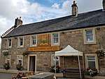 | |||
| 3-5 (Odd Nos) Montgomery Street | 55°45′54″N 4°10′34″W | Category B | 26612 | | |||
| 10 -14 (Even Nos) Montgomery Street | 55°45′55″N 4°10′34″W | Category B | 26614 | | |||
| Calderglen Country Park (Formerly Torrance House Estate), Statue Of Sir John Falstaff | 55°44′56″N 4°08′48″W | Category C(S) | 26625 | | |||
| Mains Road, Mains Castle | 55°46′41″N 4°11′21″W | Category A | 26626 | .jpg) | |||
| 8 Glebe Street | 55°45′53″N 4°10′32″W | Category B | 26628 | | |||
| Crossbasket | 55°47′00″N 4°07′40″W | Category A | 1004 | 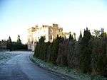 | |||
| Dripps Mill House | 55°46′08″N 4°16′55″W | Category C(S) | 1012 | | |||
| Dripps Mill | 55°46′10″N 4°16′55″W | Category B | 1013 | | |||
| Bystone Mews | 55°46′36″N 4°14′57″W | Category C(S) | 1022 | | |||
| Newhousemill Road, Newhousemill Cottages | 55°45′21″N 4°08′50″W | Category C(S) | 48677 | | |||
| Kittochside Road, Castlehill (Including Walled Garden, Gatepiers And Boundary Walls) And Castlehill Steading | 55°46′41″N 4°13′02″W | Category B | 26621 | | |||
| Kittochside, Carmunnock Road, Kittochside Cottages | 55°46′42″N 4°12′51″W | Category B | 26622 | | |||
| 181 Maxwelton Avenue, Alma , Including Gatepiers And Boundary Walls | 55°46′02″N 4°09′49″W | Category B | 1025 | | |||
| Craig Mill, Packhorse Bridge, And Mill Dam | 55°43′46″N 4°13′38″W | Category B | 1015 | | |||
| North Craighall Farm | 55°44′31″N 4°14′28″W | Category B | 1018 | | |||
| 103-105 (Odd Nos) Maxwelton Avenue | 55°46′08″N 4°09′42″W | Category C(S) | 48658 | | |||
| 115-121 (Odd Nos) Maxwelton Avenue | 55°46′07″N 4°09′44″W | Category C(S) | 48661 | | |||
| 136-140 (Even Nos) Maxwelton Avenue | 55°46′06″N 4°09′47″W | Category C(S) | 48667 | | |||
| Montgomery Street, Old Parish Church | 55°45′53″N 4°10′35″W | Category B | 26615 | | |||
| Calderglen Country Park, Rangers Office (Formerly Torrance House Stables) | 55°44′54″N 4°08′43″W | Category B | 26624 | | |||
| Philipshill Hospital Chapel | 55°46′17″N 4°13′48″W | Category B | 1026 | | |||
| The Peel, Lodge | 55°46′38″N 4°14′35″W | Category B | 1007 | | |||
| Cleughearn Lodge | 55°42′31″N 4°11′05″W | Category B | 1011 | | |||
| 1 And 1A Hunter Street And 2 Stuart Street | 55°45′55″N 4°10′29″W | Category C(S) | 47265 | | |||
| Calderglen Country Park (Formerly Torrance House Estate), Gatepiers | 55°44′57″N 4°08′46″W | Category C(S) | 48653 | | |||
| Calderglen Country Park, (Formerly Torrance House Estate), Torrance House And Courtyard | 55°44′55″N 4°08′41″W | Category A | 48654 | 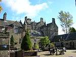 | |||
| 107-111 (0Dd Nos) Maxwelton Avenue | 55°46′07″N 4°09′43″W | Category C(S) | 48659 | | |||
| 142 Maxwelton Avenue | 55°46′06″N 4°09′47″W | Category C(S) | 48668 | | |||
| 146 Maxwelton Avenue | 55°46′05″N 4°09′48″W | Category C(S) | 48670 | | |||
| 9 Montgomery Street And Boundary Wall | 55°45′54″N 4°10′35″W | Category B | 26613 | 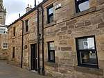 | |||
| 12 Graham Avenue, Former Toll House | 55°46′02″N 4°10′53″W | Category C(S) | 26629 | | |||
| Maxwelton Road, The Hunter Museum (Formerly Hunter House), Including Gatepiers And Boundary Wall | 55°46′36″N 4°09′01″W | Category A | 26607 | 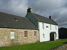 | |||
| The Peel | 55°46′40″N 4°14′41″W | Category A | 1005 | .jpg) | |||
| The Peel, Stable Or Barn | 55°46′39″N 4°14′38″W | Category A | 1006 | | |||
| 123-127 (Odd Nos) Maxwelton Avenue | 55°46′07″N 4°09′44″W | Category C(S) | 48662 | | |||
| Montgomery Street, Old Parish Church, Kirkyard, Gateway, Boundary Wall, Railings, Session House And Stuarts Of Torrance Mausoleum | 55°45′52″N 4°10′35″W | Category B | 48672 | | |||
| 24 Montgomery Street | 55°45′56″N 4°10′34″W | Category C(S) | 48676 | | |||
| Calderstone House | 55°44′08″N 4°09′23″W | Category B | 50796 | | |||
| Markethill Road, Laigh Markethill Cottage | 55°46′08″N 4°10′40″W | Category B | 26620 | | |||
| Waterside House, Including Gates, Gatepiers And Boundary Wall | 55°46′47″N 4°14′15″W | Category C(S) | 6614 | | |||
| Gill | 55°45′13″N 4°14′59″W | Category C(S) | 4875 | | |||
| Kirkland Bridge | 55°44′49″N 4°15′19″W | Category C(S) | 1010 | | |||
| Millbrae (Now Renamed Bryans) | 55°45′39″N 4°13′59″W | Category B | 1017 | | |||
| Blackburn Mill | 55°42′00″N 4°05′31″W | Category B | 1019 | | |||
| Bystone Lodge | 55°46′36″N 4°14′55″W | Category B | 1021 | | |||
| 19 Montgomery Street | 55°45′55″N 4°10′35″W | Category C(S) | 48673 | | |||
| Old Coach Road, Old Toll House | 55°46′08″N 4°10′37″W | Category C(S) | 48680 | | |||
| Brousterhill, Brousterlands | 55°45′49″N 4°10′40″W | Category A | 26619 | 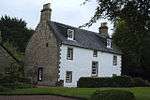 | |||
| Newhousemill Road, Newhouse House And Outbuildings | 55°45′23″N 4°08′46″W | Category B | 26627 | | |||
| Stoneymeadow Road, General's Bridge | 55°46′57″N 4°07′43″W | Category B | 26606 | | |||
| Wester Kittochside, Including Farmhouse, Steading, Dutch Barns, Boundary Walls And Gatepiers | 55°46′49″N 4°13′14″W | Category A | 1008 | | |||
| Bystone House | 55°46′33″N 4°14′55″W | Category B | 1020 | | |||
| Markethill Road, Statue Of Sir Walter Scott | 55°46′08″N 4°10′40″W | Category C(S) | 48657 | | |||
| 106 Maxwelton Avenue | 55°46′08″N 4°09′44″W | Category C(S) | 48664 | | |||
| 144 Maxwelton Avenue | 55°46′06″N 4°09′48″W | Category C(S) | 48669 | | |||
| Newhousemill Road, Newhouse Bridge | 55°45′18″N 4°08′43″W | Category B | 48678 | | |||
| 4 Newlands Place | 55°45′43″N 4°10′45″W | Category C(S) | 48679 | | |||
| Priestknowe Roundabout, Hunter Memorial | 55°45′51″N 4°10′24″W | Category B | 48681 | | |||
| Kittoch Street, West Kirk | 55°45′57″N 4°10′41″W | Category B | 26618 | 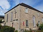 | |||
| Whitemoss Avenue, St Bride's Roman Catholic Church, Including Presbytery And Ancillary Buildings | 55°45′47″N 4°10′06″W | Category A | 26630 | | |||
| Braehead Farm, Braehead Road | 55°46′18″N 4°14′13″W | Category B | 6686 | | |||
| Crag Tower, 1 Wellknowe Road, Thorntonhall | 55°46′13″N 4°14′48″W | Category B | 6404 | | |||
| Waterfoot Bridge | 55°46′10″N 4°16′54″W | Category B | 1014 | | |||
| 129 Maxwelton Avenue | 55°46′06″N 4°09′45″W | Category C(S) | 48663 | | |||
| 110 Maxwelton Avenue | 55°46′07″N 4°09′45″W | Category C(S) | 48665 | | |||
| Town Centre Park, Dollan Aqua Centre | 55°45′43″N 4°10′57″W | Category A | 48682 | .jpg) |
Key
The scheme for classifying buildings in Scotland is:
- Category A: "buildings of national or international importance, either architectural or historic; or fine, little-altered examples of some particular period, style or building type."[1]
- Category B: "buildings of regional or more than local importance; or major examples of some particular period, style or building type, which may have been altered."[1]
- Category C: "buildings of local importance; lesser examples of any period, style, or building type, as originally constructed or moderately altered; and simple traditional buildings which group well with other listed buildings."[1]
In March 2016 there were 47,288 listed buildings in Scotland. Of these, 8% were Category A, and 50% were Category B, with the remaining 42% being Category C.[2]
Notes
- Sometimes known as OSGB36, the grid reference (where provided) is based on the British national grid reference system used by the Ordnance Survey.
• "Guide to National Grid". Ordnance Survey. Retrieved 2007-12-12.
• "Get-a-map". Ordnance Survey. Retrieved 2007-12-17. - Historic Environment Scotland assign a unique alphanumeric identifier to each designated site in Scotland, for listed buildings this always begins with "LB", for example "LB12345".
gollark: An astrapi xenowyrm?
gollark: Eh, maybe, don't like them much though.
gollark: They should be removed on the now-2-minutely update cycle, though.
gollark: Er, sure.
gollark: Hmm, they can't do much wrapping, can they...
References
- All entries, addresses and coordinates are based on data from Historic Scotland. This data falls under the Open Government Licence
- "What is Listing?". Historic Environment Scotland. Retrieved 29 May 2018.
- Scotland's Historic Environment Audit 2016 (PDF). Historic Environment Scotland and the Built Environment Forum Scotland. pp. 15–16. Retrieved 29 May 2018.
This article is issued from Wikipedia. The text is licensed under Creative Commons - Attribution - Sharealike. Additional terms may apply for the media files.