List of highways in Pecos County, Texas
The following is a list of all state highways in Pecos County, Texas maintained by the Texas Department of Transportation. All state highways in Texas are paved.
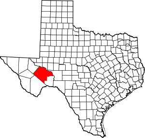
Location of Pecos County
Interstates
| Route Name | Direction | Termini | Junctions | Length[1] | Remarks |
|---|---|---|---|---|---|
| W/E | Reeves County to Crockett County | 100.5 miles (161.7 km)[1] | Bypasses Fort Stockton, Bakersfield |
Interstate business routes
| Route Name | Direction | Termini | Junctions | Length | Remarks |
|---|---|---|---|---|---|
| W/E | 1.4 miles (2.3 km)[3] | Fort Stockton business loop |
U.S. highways
| Route Name | Direction | Termini | Junctions | Length | Remarks |
|---|---|---|---|---|---|
| S/N | Brewster County to Crockett County | 74.6 miles (120.1 km)[5] | Passes through Fort Stockton, Girvin | ||
| W/E | Brewster County to Terrell County | 10.7 miles (17.2 km)[7] | Passes through Longfellow | ||
| W/E | 15.2 miles (24.5 km)[9] | Passes through Iraan | |||
| S/N | Terrell County to Reeves County | 80.8 miles (130.0 km)[11] | Passes through Fort Stockton | ||
| S/N | Brewster County to Crockett County | 75.8 miles (122.0 km)[13] | Passes through Fort Stockton, Girvin |
State highways
| Route Name | Direction | Termini | Junctions | Length | Remarks |
|---|---|---|---|---|---|
| S/N | 28.7 miles (46.2 km)[15] | Ends at Fort Stockton | |||
| W/E | 8.7 miles (14.0 km)[17] | Passes through Sheffield | |||
| S/N | Terrell County to Crockett County | 31.8 miles (51.2 km)[19] | Passes through Sheffield, Iraan |
State highway loops and spurs
| Route Name | Direction | Termini | Junctions | Length | Remarks |
|---|---|---|---|---|---|
| S/N | Old Alpine Road to |
1.4 miles (2.3 km)[20] | |||
| S/N | I-10 frontage road to I-10 frontage road | 3.2 miles (5.1 km)[21] | Passes through Bakersfield |
Farm and ranch to market roads
Historic Roads
| Route Name | Direction | Termini | Remarks |
|---|---|---|---|
| W/E | Reeves County to Crockett County | Replaced by I-10, Bus. I-10-G, and SH 290 in 1992 | |
| W/E | Brewster County to Terrell County | Replaced by US 90 in 1939 | |
| S/N | Brewster County to Crockett County | Replaced by US 67 in 1939 | |
| W/E | Reeves County to Crockett County | Replaced by US 290 and US 285 in 1939 | |
| W/E | Brewster County to Crockett County | Replaced by SH 349 in 1957Redesignation replaced by US 385 in 1959 | |
| S/N | Terrell County to Ward County | Replaced by US 285 south of Fort Stockton in 1939Replaced by TX 18 north of Fort Stockton in 1958 | |
| S/N | Brewster County to Crockett County | Replaced by SH 10 by 1935 | |
| S/N | Replaced by SH 27 by 1935 | ||
| S/N | Replaced by US 290 in 1939 | ||
| S/N | Replaced by FM 11 in 1951 | ||
| S/N | Brewster County to |
Replaced by SH 51 in 1956 | |
| S/N | Terrell County to |
Replaced by SH 349 in 1990 |
Adjacent counties
- Ward County (north)
- Crane County (northeast)
- Crockett County (east)
- Terrell County (southeast)
- Brewster County (southwest)
- Jeff Davis County (west)
- Reeves County (northwest)
gollark: --apiotel status
gollark: CEASE hangups.
gollark: --apiotel info
gollark: --apiotel status
gollark: Again.
References
- Texas Department of Transportation, Statewide Planning Map using map's measurement utility.
- Transportation Planning and Programming Division (n.d.). "Interstate Highway No. 10". Highway Designation Files. Texas Department of Transportation. Retrieved 2009-09-27.
- Texas Department of Transportation, "Highway Designation File - Business Interstate Highway No. 10-G Archived 2012-10-10 at the Wayback Machine". Retrieved 2009-09-27.
- Transportation Planning and Programming Division (n.d.). "U.S. Highway No. 67". Highway Designation Files. Texas Department of Transportation. Retrieved 2009-09-27.
- Route of US 67 through Pecos County (Map). Google Maps. Retrieved 2009-09-30.
- Transportation Planning and Programming Division (n.d.). "U.S. Highway No. 90". Highway Designation Files. Texas Department of Transportation. Retrieved 2009-09-27.
- Route of US 67 through Pecos County (Map). Google Maps. Retrieved 2009-09-30.
- Transportation Planning and Programming Division (n.d.). "U.S. Highway No. 190". Highway Designation Files. Texas Department of Transportation. Retrieved 2009-09-27.
- Route of US 190 through Pecos County (Map). Google Maps. Retrieved 2009-09-30.
- Transportation Planning and Programming Division (n.d.). "U.S. Highway No. 285". Highway Designation Files. Texas Department of Transportation. Retrieved 2009-09-27.
- Route of US 285 through Pecos County (Map). Google Maps. Retrieved 2009-09-30.
- Transportation Planning and Programming Division (n.d.). "U.S. Highway No. 385". Highway Designation Files. Texas Department of Transportation. Retrieved 2009-09-27.
- Route of US 385 through Pecos County (Map). Google Maps. Retrieved 2009-09-30.
- Transportation Planning and Programming Division (n.d.). "State Highway No. 18". Highway Designation Files. Texas Department of Transportation. Retrieved 2009-09-27.
- Route of US 385 through Pecos County (Map). Google Maps. Retrieved 2009-10-01.
- Transportation Planning and Programming Division (n.d.). "State Highway No. 290". Highway Designation Files. Texas Department of Transportation. Retrieved 2009-09-27.
- Route of US 385 through Pecos County (Map). Google Maps. Retrieved 2009-10-01.
- Transportation Planning and Programming Division (n.d.). "State Highway No. 349". Highway Designation Files. Texas Department of Transportation. Retrieved 2009-09-27.
- Route of US 385 through Pecos County (Map). Google Maps. Retrieved 2009-10-01.
- Transportation Planning and Programming Division (n.d.). "State Highway Spur No. 194". Highway Designation Files. Texas Department of Transportation. Retrieved 2009-09-27.
- Transportation Planning and Programming Division (n.d.). "State Highway Loop No. 293". Highway Designation Files. Texas Department of Transportation. Retrieved 2009-09-27.
- Transportation Planning and Programming Division (n.d.). "Farm to Market Road No. 11". Highway Designation Files. Texas Department of Transportation. Retrieved 2009-09-27.
- Route of US 385 through Pecos County (Map). Google Maps. Retrieved 2009-10-01.
- Transportation Planning and Programming Division (n.d.). "Farm to Market Road No. 305". Highway Designation Files. Texas Department of Transportation. Retrieved 2009-09-27.
- Route of US 385 through Pecos County (Map). Google Maps. Retrieved 2009-10-01.
- Transportation Planning and Programming Division (n.d.). "Farm to Market Road No. 1053". Highway Designation Files. Texas Department of Transportation. Retrieved 2009-09-27.
- Route of US 385 through Pecos County (Map). Google Maps. Retrieved 2009-10-01.
- Transportation Planning and Programming Division (n.d.). "Farm to Market Road No. 1450". Highway Designation Files. Texas Department of Transportation. Retrieved 2009-09-27.
- Route of US 385 through Pecos County (Map). Google Maps. Retrieved 2009-10-01.
- Transportation Planning and Programming Division (n.d.). "Farm to Market Road No. 1776". Highway Designation Files. Texas Department of Transportation. Retrieved 2009-09-27.
- Route of US 385 through Pecos County (Map). Google Maps. Retrieved 2009-10-01.
- Transportation Planning and Programming Division (n.d.). "Farm to Market Road No. 1901". Highway Designation Files. Texas Department of Transportation. Retrieved 2009-09-27.
- Route of US 385 through Pecos County (Map). Google Maps. Retrieved 2009-10-01.
- Transportation Planning and Programming Division (n.d.). "Ranch to Market Road No. 2023". Highway Designation Files. Texas Department of Transportation. Retrieved 2009-09-27.
- Transportation Planning and Programming Division (n.d.). "Farm to Market Road No. 2037". Highway Designation Files. Texas Department of Transportation. Retrieved 2009-09-27.
- Transportation Planning and Programming Division (n.d.). "Ranch to Market Road No. 2400". Highway Designation Files. Texas Department of Transportation. Retrieved 2009-09-27.
- Route of US 385 through Pecos County (Map). Google Maps. Retrieved 2009-10-01.
- Transportation Planning and Programming Division (n.d.). "Ranch to Market Road No. 2593". Highway Designation Files. Texas Department of Transportation. Retrieved 2009-09-27.
- Transportation Planning and Programming Division (n.d.). "Ranch to Market Road No. 2886". Highway Designation Files. Texas Department of Transportation. Retrieved 2009-09-27.
- Route of US 385 through Pecos County (Map). Google Maps. Retrieved 2009-10-01.
- Transportation Planning and Programming Division (n.d.). "U.S. Highway No. 290". Highway Designation Files. Texas Department of Transportation. Retrieved 2009-10-01.
- Transportation Planning and Programming Division (n.d.). "State Highway No. 3". Highway Designation Files. Texas Department of Transportation. Retrieved 2009-10-01.
- Transportation Planning and Programming Division (n.d.). "State Highway No. 10". Highway Designation Files. Texas Department of Transportation. Retrieved 2009-10-01.
- Transportation Planning and Programming Division (n.d.). "State Highway No. 27". Highway Designation Files. Texas Department of Transportation. Retrieved 2009-10-01.
- Transportation Planning and Programming Division (n.d.). "State Highway No. 62". Highway Designation Files. Texas Department of Transportation. Retrieved 2009-10-01.
- Transportation Planning and Programming Division (n.d.). "State Highway No. 82". Highway Designation Files. Texas Department of Transportation. Retrieved 2009-10-01.
- Transportation Planning and Programming Division (n.d.). "State Highway No. 99". Highway Designation Files. Texas Department of Transportation. Retrieved 2009-10-01.
- Transportation Planning and Programming Division (n.d.). "State Highway No. 192". Highway Designation Files. Texas Department of Transportation. Retrieved 2009-10-01.
- Transportation Planning and Programming Division (n.d.). "State Highway No. 196". Highway Designation Files. Texas Department of Transportation. Retrieved 2009-10-01.
- Transportation Planning and Programming Division (n.d.). "Farm to Market Road No. 847". Highway Designation Files. Texas Department of Transportation.
- Transportation Planning and Programming Division (n.d.). "Farm to Market Road No. 1214". Highway Designation Files. Texas Department of Transportation.
- Transportation Planning and Programming Division (n.d.). "Farm to Market Road No. 1217". Highway Designation Files. Texas Department of Transportation.
This article is issued from Wikipedia. The text is licensed under Creative Commons - Attribution - Sharealike. Additional terms may apply for the media files.