List of U.S. Highways in Arkansas
The U.S. Highways in Arkansas are the U.S. Routes maintained by the U.S. state of Arkansas. There are 20 such highways.

1926 map of the U.S. routes in Arkansas.
| United States Numbered Highways of the Arkansas Highway System | |
|---|---|
.svg.png) .svg.png)  Highway markers for US 71, US 371 and US 49B | |
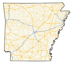 A map of highways in the state of Arkansas | |
| System information | |
| Formed | 1926 |
| Highway names | |
| US Highways | US Highway nn, US Route nn (US nn) |
| System links | |
Mainline highways
| Number | Length (mi) | Length (km) | Southern or western terminus | Northern or eastern terminus | Formed | Removed | Notes |
|---|---|---|---|---|---|---|---|
| 182.33 | 293.43 | US 49 at Mississippi state line near Helena | US 62/ AR 1 at Piggott | 1963[1] | current | ||
| 112 | 180 | I-30 at Texarkana | US 59 at Oklahoma state line west of Acorn | 1934 | current | ||
| 75.3 | 121.2 | US 61 at Tennessee state line near West Memphis | US 61 at Missouri state line near Blytheville | 1926 | current | ||
| 329.9 | 530.9 | US 62 at Oklahoma state line | US 62 at Missouri state line near St. Francis | 1930 | current | ||
| 388 | 624 | US 167 at Junction City | US 63 at Missouri state line near Mammoth Spring | 1926 | current | ||
| 246.35 | 396.46 | US 64 at Oklahoma state line near Fort Smith | US 64 at Tennessee state line near Memphis, TN | 1926 | current | ||
| 309 | 497 | US 65 at Louisiana state line south of Eudora | US 65 at Missouri state line north of Burlington | 1926 | current | ||
| 325 | 523 | US 67 at Texas state line at Texarkana | US 67 at Missouri state line | 1926 | current | ||
| 290 | 467 | US 70 at Oklahoma state line | US 70 at Tennessee state line near West Memphis | 1926 | current | ||
| 300 | 480 | US 71 at Louisiana state line | US 71 at Missouri state line north of Bella Vista | 1926 | current | ||
| 272 | 438 | US 79 at Louisiana state line | US 79 at Tennessee state line near West Memphis | 1935 | current | ||
| 190.71 | 306.92 | US 82 at Texas state line at Texarkana | US 82 at Mississippi state line near Greenville, MS | 1931[2] | current | ||
| 183 | 295 | US 165 at Louisiana state line | US 70 at North Little Rock | 1926 | current | ||
| — | — | US 167 at Louisiana state line | US 62/US 412 in Ash Flat | 1926 | current | ||
| — | — | US 270 at Oklahoma state line | I-530/US 65 at White Hall | 1930 | current | ||
| 3 | 5 | US 271 at Oklahoma state line near Fort Smith | US 71B, Ft. Smith | 1926 | current | ||
| — | — | US 59/US 71 at Wickes | US 278 at Mississippi state line | 1998 | current | ||
| — | — | US 371 at Louisiana state line | US 59/US 70/US 71/ AR 41 at De Queen | 1994 | current | ||
| — | — | US 412 at Oklahoma state line near Siloam Springs | US 412 at Missouri state line | 1982 | current | ||
| 91 | 146 | US 425 at Louisiana state line | I-530/US 63/US 65/US 79 at Pine Bluff | 1989 | current |
Suffixed and special routes
U.S. Highways in Arkansas sometimes have spur or business routes. The signs feature a "B" if designating a business route.
| Number | Length (mi)[3] | Length (km) | Southern or western terminus | Northern or eastern terminus | Formed | Removed | Notes | |
|---|---|---|---|---|---|---|---|---|
| 3.66 | 5.89 | US 49 in Brookland | US 49 in Brookland | 2000[4] | current | |||
| 6.92 | 11.14 | US 49 in Helena-West Helena | US 49 in Helena-West Helena | 1970[5] | current | |||
| 5.2[6] | 8.4 | US 49/US 63 in Jonesboro | US 49/AR 1 in Jonesboro | 1979[7] | 1996[8] | |||
| 2.36 | 3.80 | US 49/AR 1 in Paragould | US 49/AR 1/US 412/Crowley's Ridge Parkway in Paragould | 1979[9] | current | |||
| — | — | — | — | — | — | |||
| — | — | — | — | — | — | |||
| — | — | — | — | — | — | |||
| — | — | — | — | — | — | |||
| — | — | — | — | — | — | |||
| — | — | — | — | — | — | |||
| — | — | — | — | — | — | |||
| — | — | — | — | — | — | |||
| — | — | — | — | — | — | |||
| — | — | — | — | — | — | |||
| — | — | — | — | — | — | |||
| — | — | — | — | — | — | |||
| — | — | — | — | — | — | |||
| — | — | — | — | — | — | |||
| — | — | — | — | — | — | |||
| — | — | — | — | — | — | |||
| — | — | — | — | — | — | |||
| — | — | — | — | — | — | |||
| — | — | — | — | — | — | |||
| — | — | — | — | — | — | |||
| — | — | — | — | — | — | |||
| — | — | — | — | — | — | |||
| — | — | — | — | — | — | |||
| — | — | — | — | — | — | |||
| — | — | — | — | — | — | |||
| — | — | — | — | — | — | |||
| — | — | — | — | — | — | |||
| — | — | — | — | — | — | |||
| — | — | — | — | — | — | |||
| — | — | — | — | — | — | |||
| — | — | — | — | — | — | |||
| — | — | — | — | — | — | |||
| — | — | — | — | — | — | |||
| — | — | — | — | — | — | |||
| — | — | — | — | — | — | |||
| — | — | — | — | — | — | |||
| — | — | — | — | — | — | |||
| — | — | — | — | — | — | |||
| — | — | — | — | — | — | |||
| — | — | — | — | — | — | |||
| — | — | — | — | — | — | |||
| — | — | — | — | — | — | |||
| 1.65[3] | 2.66 | US 82/US 371 in Magnolia | US 79/US 82 in Magnolia | 1970[10] | current | |||
| 5.44[3] | 8.75 | — | — | 1982[11] | current | |||
| 0.14[3] | 0.23 | US 82 | Port of Crossett | — | — | |||
| 1.3 | 2.1 | US 82 in Stamps | US 82/AR 53 in Stamps | — | 2006[12] | |||
| 1.28[3] | 2.06 | US 165/AR 1 in Gillett | US 165/AR 1 in Gillett | 1982 | current | |||
| — | — | — | — | 1971[13] | current | |||
| 1.67 | 2.69 | — | — | 1968[14] | current | |||
| — | — | — | — | 2013[15] | current | |||
| — | — | — | — | — | — | |||
| — | — | — | — | — | — | |||
| 2.65[3] | 4.26 | US 412 | US 412/AR 45 | 2009 | current | |||
| 5.48[3] | 8.82 | US 412 | US 412 in Huntsville | 1999 | current | |||
| ||||||||
gollark: <@160279332454006795> `loadfile` it and then pass it imports as the first argument.
gollark: Oh right, loadfile.
gollark: I don't think that works. I can probably make it take the env.
gollark: Quite possibly.
gollark: Truly, safety of all tends ever lower.
See also


References
- "Minutes of the Meeting of the Arkansas State Highway Commission" (PDF). Little Rock: Arkansas State Highway Commission. 1953–1969. pp. 903–904. OCLC 21798861. Retrieved June 13, 2019.
- Weingroff, Richard (November 18, 2015). "US 82". Highway History. Federal Highway Administration. Retrieved December 11, 2016.
- System Information and Research Division (2014). "Arkansas Road Log Database" (MDB). Arkansas State Highway and Transportation Department. Retrieved March 27, 2016.
- "Minutes" (2000–09), pp. 88-89.
- "Minutes" (1970–79), p. 1636.
- General Highway Map Craighead County, Arkansas (PDF) (Map). 1:63500. Cartography by Planning and Research Division. Little Rock: Arkansas State Highway and Transportation Department. March 1990. Retrieved April 6, 2011.
- Special Committee on U.S. Route Numbering (June 25, 1979). "Route Numbering Committee Agenda Showing Action Taken by the Executive Committee" (PDF) (Report). Washington, DC: American Association of State Highway and Transportation Officials. p. 1. Retrieved December 14, 2017 – via Wikimedia Commons.
- "Minutes" (1990–99), pp. 852-853.
- "Minutes" (1970–79), p. 153.
- "Minutes" (1970–79), p. 1619.
- "Minutes" (1980–89), p. 284.
- "Minutes of the Meeting" (PDF). Arkansas State Highway Commission. September 2000. pp. 922–923. Retrieved December 4, 2016.
- "Minutes" (1970–79), p. 1521.
- "Minutes" (1953–69), p. 202.
- "Minutes" (2010–19), p. 432.
This article is issued from Wikipedia. The text is licensed under Creative Commons - Attribution - Sharealike. Additional terms may apply for the media files.