List of Indiana state historical markers in Fulton County
This is a list of the Indiana state historical markers in Fulton County.
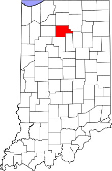
Location of Fulton County in Indiana
This is intended to be a detailed table of the official state historical marker placed in Fulton County, Indiana, United States by the Indiana Historical Bureau. The location of the historical marker and its latitude and longitude coordinates are included below when available, along with its name, year of placement, and topics as recorded by the Historical Bureau. There is 1 historical marker located in Fulton County.[1]
Historical marker
| Marker title | Image | Year placed | Location | Topics |
|---|---|---|---|---|
| Michigan Road[2] | 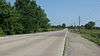 |
1949 | Southeastern corner of the bridge that carries Old U.S. Route 31 over the Tippecanoe River, 3 miles north of Rochester 41°6′20″N 86°13′13″W |
Transportation, American Indian/Native American |
gollark: The obvious solution is piracy™.
gollark: I can't actually be bothered, myself.
gollark: Only for the US though, and I think this is using an outdated architecture.
gollark: https://nirvan66.github.io/geoguessr.html
gollark: I checked and they have.
See also
References
- "Indiana Historical Markers by County". State of Indiana. Retrieved 2012-03-15.
- Michigan Road, Indiana Historical Bureau, n.d. Accessed 2012-03-14.
External links
Municipalities and communities of Fulton County, Indiana, United States | ||
|---|---|---|
| City | Map of Indiana highlighting Fulton County | |
| Towns | ||
| Townships | ||
| Unincorporated communities | ||
| Footnotes | ‡This populated place also has portions in an adjacent county or counties | |
This article is issued from Wikipedia. The text is licensed under Creative Commons - Attribution - Sharealike. Additional terms may apply for the media files.