Lipov Lad
Lipov Lad (Serbian: Липов Лад) is an urban neighborhood of Belgrade, the capital of Serbia. It is located in Belgrade's municipality of Zvezdara.
Lipov Lad Липов Лад | |
|---|---|
Lipov Lad kafana | |
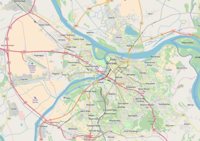
 Lipov Lad Location within Belgrade | |
| Coordinates: 44.797477°N 20.493553°E | |
| Country | |
| Region | Belgrade |
| Municipality | Zvezdara |
| Area | |
| • Total | 0.21 km2 (0.08 sq mi) |
| Population (2011) | |
| • Total | 4,759 |
| • Density | 23,000/km2 (59,000/sq mi) |
| Time zone | UTC+1 (CET) |
| • Summer (DST) | UTC+2 (CEST) |
| Area code | +381(0)11 |
| Car plates | BG |
Location
| Year | Pop. | ±% |
|---|---|---|
| 1981 | 6,989 | — |
| 1991 | 5,616 | −19.6% |
| 2002 | 5,162 | −8.1% |
| 2011 | 4,759 | −7.8% |
| Source: [1][2][3][4] | ||
Lipov Lad is located between the right side of the Bulevar kralja Aleksandra and the left side of the Vojislava Ilića Street, being on border of the Zvezdara and Vračar municipalities, 2.5 m (8 ft 2 in) kilometers southeast of downtown Belgrade (Terazije). It extends into the neighborhoods of Lion on the east and Đeram and Crveni Krst on the west.[5][6]
Characteristics
Prior to World War II, the neighborhood was called Borov Park.[7] The area is residential, with present objects mostly built in the 1970s, with lawns and children playgrounds between the buildings, and some commercial facilities.
The most distinctive feature in the neighborhood is the famous kafana Lipov lad (Serbian for 'lime tree shade') which gave its name to the entire neighborhood. The original kafana was open in 1928. It became trendy in the late 1950s as a meeting place of the artists, actors, poets and local bohemians, and later became a popular family venue. In 1972 the entire neighborhood was reconstructed and many old buildings were demolished, including the old kafana. Only the lime trees were preserved and the new kafana building was constructed.[8]
Lipov Lad constitutes a local community (mesna zajednica), sub-municipal administrative unit of the same name within the municipality of Zvezdara, with a population of 4,759 in 2011.
Peti Park
Peti Park (Serbian for "fifth park") is a small green area in the north-eastern corner of the neighborhood, on the corner of the Stanislava Sremčevića and Despota Olivera (formerly Toneta Tomšiča, name still largely used by the reporters) streets. In the mid-2005, city government cut trees in this area for the purpose of building a commercial complex. Local population protested, trying to keep the green area while city government claimed that the area was designed for construction in 1980s and that mini-park was just a temporary solution. However, local population gained a popular support among Belgraders and celebrities for their cause, as at one point even police was involved to make the construction possible. In January 2008 municipality of Zvezdara re-planted 31 firs in circular pattern in an effort to keep the park.
References
- Osnovni skupovi stanovništva u zemlji – SFRJ, SR i SAP, opštine i mesne zajednice 31.03.1981, tabela 191. Savezni zavod za statistiku (txt file). 1983.
- Stanovništvo prema migracionim obeležjima – SFRJ, SR i SAP, opštine i mesne zajednice 31.03.1991, tabela 018. Savezni zavod za statistiku (txt file).
- Popis stanovništva po mesnim zajednicama, Saopštenje 40/2002, page 4. Zavod za informatiku i statistiku grada Beograda. 26 July 2002.
- Stanovništvo po opštinama i mesnim zajednicama, Popis 2011. Grad Beograd – Sektor statistike (xls file). 23 April 2015.
- Tamara Marinković-Radošević (2007). Beograd - plan i vodič. Belgrade: Geokarta. ISBN 86-459-0006-8.
- Beograd - plan grada. Smedrevska Palanka: M@gic M@p. 2006. ISBN 86-83501-53-1.
- M.D.Kandić (1941). Vođ – Zemun, Beograd, Pančevo [Guide – Zemun, Belgrade, Pančevo]. Štamparija “Dom”, Belgrade.
- Dr. Miroslav Todorović (24 January 2016). "Sećanje na stari "Lipov lad"" [Memory of old "Lipov Lad"]. Politika (in Serbian).