Linta River
Linta is a river in the region of Atsimo-Andrefana in southern Madagascar. It crosses the Route nationale 10 near Ejeda and flows into the Indian Ocean in the Bay of Langarano, east of Androka.
| Linta River | |
|---|---|
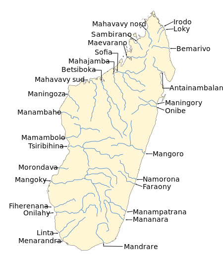 | |
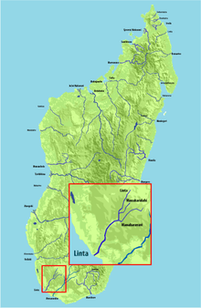 Map of Malagasy rivers (Linta flows into the Indian Ocean). | |
| Location | |
| Country | Madagascar |
| Region | Atsimo-Andrefana |
| City | Ejeda |
| Physical characteristics | |
| Source | |
| • elevation | 520 m (1,710 ft) |
| Source confluence | Fotadrevo |
| Mouth | Indian Ocean |
• location | Androka, Atsimo-Andrefana |
• coordinates | 25°02′00″S 44°01′00″E |
• elevation | 0 m (0 ft) |
| Length | 173 km (107 mi) |
| Basin size | 5,800 km2 (2,200 sq mi) |
| Basin features | |
| Tributaries | |
| • left | Manakaralahy, Manakaravavy |
Its main affluents are the Manakaralahy and Manakaravavy which are dry during the dry season from July to November. Its annual discharge is low, approx. 1-2 l/s/km².
References
This article is issued from Wikipedia. The text is licensed under Creative Commons - Attribution - Sharealike. Additional terms may apply for the media files.