Atsimo-Andrefana
Atsimo-Andrefana is a region of Madagascar. It borders Menabe in north, Amoron'i Mania and Haute Matsiatra in northeast, Ihorombe and Anosy in east and Androy in southeast. The capital is Toliara and the population was 1,799,088 in 2018.[1] Atsimo Andrefana is geographically the largest of all Malagasy regions with an area of 66,236 km2 (25,574 sq mi).[3]
Atsimo Andrefana Region Région Atsimo Andrefana | |
|---|---|
Region | |
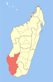 Location in Madagascar | |
| Country | |
| Capital | Toliara |
| Government | |
| • Chief of the Region | David Ranaivoson |
| Area | |
| • Total | 66,236 km2 (25,574 sq mi) |
| Population (2018)[1] | |
| • Total | 1,799,088 |
| • Density | 27/km2 (70/sq mi) |
| Time zone | UTC3 (EAT) |
| HDI (2018) | 0.418[2] low · 21st of 22 |
Administrative divisions
Atsimo-Andrefana region is divided into nine districts, which are sub-divided into 105 communes.
Transport
Airports
- Ampanihy Airport
- Andavadoaka Airport
- Ankazoabo Airport
- Beroroha Airport
- Betioky Airport
- Morombe Airport
- Tanandava Airport
- Toliara Airport
Protected areas
In Atsimo-Andrefana are found the following protected areas:
- Part of Mangoky Ihotry Wetland Complex
- Velondriake New Protected Area
- Tsinjoriake New Protected Area
- Analandraza Analavelo New Protected Area
- Ranobe Bay New Protected Area
- Ranobe PK32 New Protected Area
- Atsimo Andrefan'Ifotaky New Protected Area
- Vohidefo New Protected Area
- Beza Mahafaly Reserve
- Mikea National Park
- Nosy Ve-Androka National Park
- Zombitse-Vohibasia National Park
- Tsimanampetsotsa National Park
- Soariake New Protected Area
- Amoron'i Onilahy New Protected Area
gollark: Infinite world height and infinite incompatibility.
gollark: Can I just mention that Cubic Chunks is cool?
gollark: PHP. Really. Why.
gollark: Yep! lunatic86.
gollark: It no longer does (I have to stick that manually in now...)
References
- "Troisieme Recensement General de la Population et de L'Habitation (RGPH-3) Resultats Provisoires" (PDF). Institut National de la Statistique Madagascar. Retrieved May 23, 2020.
- "Sub-national HDI - Area Database - Global Data Lab". hdi.globaldatalab.org. Retrieved 2018-09-13.
- Ralison, Eliane; Goossens, Frans. "Madagascar: Profil des marchés pour les évaluations d'urgence de la sécurité alimentaire" (PDF) (in French). Programme Alimentaire Mondial, Service de l’Evaluation des besoins d’urgence (ODAN). Archived from the original (PDF) on 2007-09-26. Retrieved 2008-03-01.
This article is issued from Wikipedia. The text is licensed under Creative Commons - Attribution - Sharealike. Additional terms may apply for the media files.