Lincoln Park, Colorado
Lincoln Park is a census-designated place (CDP) in Fremont County, Colorado, United States. The population was 3,546 at the 2010 census,[2] down from 3,904 at the 2000 census.
Lincoln Park, Colorado | |
|---|---|
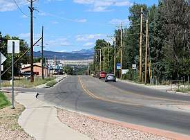 Looking north along S. 9th St. (State Highway 115). | |
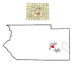 Location in Fremont County and the state of Colorado | |
| Coordinates: 38°25′36″N 105°12′56″W | |
| Country | |
| State | |
| County | Fremont[1] |
| Area | |
| • Total | 3.7 sq mi (9.7 km2) |
| • Land | 3.7 sq mi (9.7 km2) |
| • Water | 0 sq mi (0 km2) |
| Elevation | 5,384 ft (1,641 m) |
| Population (2010) | |
| • Total | 3,546 |
| • Density | 942/sq mi (363.7/km2) |
| Time zone | UTC-7 (Mountain (MST)) |
| • Summer (DST) | UTC-6 (MDT) |
| ZIP code | 81212 (Cañon City) |
| FIPS code | 08-45145 |
| GNIS feature ID | 0192007 |
Geography
Lincoln Park is located in eastern Fremont County at 38°25′36″N 105°12′56″W (38.426684, -105.215579).[3] It is bordered to the north and west by Cañon City, the county seat, and to the southeast by Brookside.
According to the United States Census Bureau, the Lincoln Park CDP has a total area of 3.7 square miles (9.7 km2), all of it land.[2]
The former incorporated town of Prospect Heights[4] now lies within the Lincoln Park CDP.[5]
Demographics
| Historical population | |||
|---|---|---|---|
| Census | Pop. | %± | |
| U.S. Decennial Census[6] | |||
As of the census[7] of 2000, there were 3,904 people, 1,650 households, and 1,138 families residing in the CDP. The population density was 1,037.6 people per square mile (400.9/km2). There were 1,772 housing units at an average density of 471.0 per square mile (182.0/km2). The racial makeup of the CDP was 95.34% White, 0.20% African American, 0.95% Native American, 0.23% Asian, 0.23% Pacific Islander, 1.10% from other races, and 1.95% from two or more races. Hispanic or Latino of any race were 5.48% of the population.
There were 1,650 households, out of which 26.2% had children under the age of 18 living with them, 57.3% were married couples living together, 8.2% had a female householder with no husband present, and 31.0% were non-families. 27.3% of all households were made up of individuals, and 14.4% had someone living alone who was 65 years of age or older. The average household size was 2.36 and the average family size was 2.84.
In the CDP, the population was spread out, with 23.1% under the age of 18, 5.3% from 18 to 24, 22.4% from 25 to 44, 26.9% from 45 to 64, and 22.3% who were 65 years of age or older. The median age was 44 years. For every 100 females, there were 93.1 males. For every 100 females age 18 and over, there were 89.8 males.
The median income for a household in the CDP was $35,313, and the median income for a family was $45,353. Males had a median income of $34,909 versus $24,156 for females. The per capita income for the CDP was $18,636. About 7.3% of families and 10.2% of the population were below the poverty line, including 15.4% of those under age 18 and 2.5% of those age 65 or over.
Environmental issues
In 1958, Cotter Corporation, a company owned by Commonwealth Edison of Chicago, began to process uranium ore in Cañon City. In the process of mining uranium ore, the company contaminated the surrounding land, and compromised the water supply of nearby Lincoln Park, 10 miles (16 km) from ADX Florence. In a class-action lawsuit filed by 340 people, the company was accused of lowering nearby land values due to radioactive contamination both at the site of the mill and along the Santa Fe Railway. In 1983, the state of Colorado sued over these damages to the environment; settling for $15 million, Cotter Corporation promised to clean up the mill site. The company resumed work in 1999, but laid off the majority of employees in 2005 after it was determined that shipping ore from Colorado's Western Slope was cost-prohibitive. The water contamination in Lincoln Park remains, and the area has been declared a Superfund site.
See also
- Outline of Colorado
- State of Colorado
- Colorado cities and towns
- Colorado census designated places
- Colorado counties
- Colorado metropolitan areas
- Colorado cities and towns
References
- "US Board on Geographic Names". United States Geological Survey. 2007-10-25. Retrieved 2008-01-31.
- "Geographic Identifiers: 2010 Census Summary File 1 (G001): Lincoln Park CDP, Colorado". American Factfinder. U.S. Census Bureau. Archived from the original on February 13, 2020. Retrieved April 24, 2016.
- "US Gazetteer files: 2010, 2000, and 1990". United States Census Bureau. 2011-02-12. Retrieved 2011-04-23.
- "Coal Camps of Fremont County Colorado". Retrieved 2018-08-20.
- "Prospect Heights (in Fremont County, CO) Populated Place Profile". CO HomeTownLocator. Retrieved 2018-08-21.
Prospect Heights (GNIS FID: 192009) is a populated place LOCATED WITHIN the Lincoln Park CDP. In turn, the Lincoln Park CDP is located within Fremont County.
- "Census of Population and Housing". Census.gov. Retrieved June 4, 2016.
- "U.S. Census website". United States Census Bureau. Retrieved 2008-01-31.
Municipalities and communities of Fremont County, Colorado, United States | ||
|---|---|---|
| Cities |  Map of Colorado highlighting Fremont County | |
| Towns | ||
| CDPs | ||
| Unincorporated communities | ||
| Ghost towns | ||