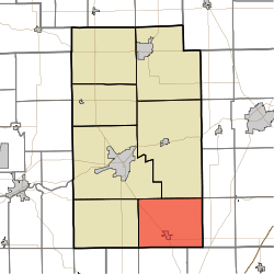
Liberty Township, Wabash County, Indiana
Liberty Township is one of seven townships in Wabash County, Indiana, United States. As of the 2010 census, its population was 2,365 and it contained 991 housing units.[1]
Liberty Township | |
|---|---|
 Location in Wabash County | |
| Coordinates: 40°41′44″N 85°43′03″W | |
| Country | United States |
| State | Indiana |
| County | Wabash |
| Government | |
| • Type | Indiana township |
| Area | |
| • Total | 47.21 sq mi (122.3 km2) |
| • Land | 46.53 sq mi (120.5 km2) |
| • Water | 0.68 sq mi (1.8 km2) 1.44% |
| Elevation | 869 ft (265 m) |
| Population (2010) | |
| • Total | 2,365 |
| • Density | 50.8/sq mi (19.6/km2) |
| ZIP codes | 46940, 46992 |
| GNIS feature ID | 453564 |
Geography
According to the 2010 census, the township has a total area of 47.21 square miles (122.3 km2), of which 46.53 square miles (120.5 km2) (or 98.56%) is land and 0.68 square miles (1.8 km2) (or 1.44%) is water.[1]
Cities, towns, villages
Unincorporated towns
(This list is based on USGS data and may include former settlements.)
Adjacent townships
- Lagro Township (north)
- Polk Township, Huntington County (northeast)
- Wayne Township, Huntington County (east)
- Washington Township, Grant County (southeast)
- Pleasant Township, Grant County (south)
- Richland Township, Grant County (southwest)
- Waltz Township (west)
- Noble Township (northwest)
Cemeteries
The township contains these seven cemeteries: America, Gardner, Hale, Harper, Rennaker, Stone and Waggoner.
Lakes
- Mississinewa Lake
School districts
- Metropolitan School District of Wabash County Schools
Political districts
- Indiana's 5th congressional district
- State House District 22
- State Senate District 17
gollark: I mostly read my news in the afternoon, to prolong the suffering.
gollark: WHY DO I LIVE HERE
gollark: ææææææææææææ boris johnson is also being stupid about brexit
gollark: æææææ quite a lot
gollark: ææææææææææa UK coronavirus cases are going back up again
References
- United States Census Bureau 2007 TIGER/Line Shapefiles
- United States Board on Geographic Names (GNIS)
- IndianaMap
- "Population, Housing Units, Area, and Density: 2010 - County -- County Subdivision and Place -- 2010 Census Summary File 1". United States Census. Archived from the original on 2020-02-12. Retrieved 2013-05-10.
This article is issued from Wikipedia. The text is licensed under Creative Commons - Attribution - Sharealike. Additional terms may apply for the media files.