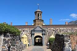
Letterklip
The Letterklip, Afrikaans for "lettered rock", is a provincial heritage site in Namaqualand in the Northern Cape province of South Africa. The unique rock formation was fortified by dry stone walling; it was occupied from 1901 to 1902 by British forces during the Anglo-Boer War. Various regimental badges and officers' names are engraved in the rockface.[1]
| Letterklip | |
|---|---|
"Lettered rock" | |
| Garies, South Africa | |
| Coordinates | 30°33′20″S 17°58′33″E |
| Type | Natural rock formation, Dry Wall construction. |
| Site information | |
| Controlled by | |
| Open to the public | Yes |
| Condition | Intact |
| Site history | |
| Built | 1901 |
| Materials | Local stone. |
| Events | Second Boer War |
| Garrison information | |
| Garrison | British Forces |
History
In 1980, it was described in the Government Gazette of South Africa:
This unique rock formation was fortified and occupied from 1901 to 1902 by the British forces during the Anglo-Boer War. Various regimental badges and officers' names are engraved in the rockface.
- Engravings on the rocks
gollark: I guess I could be checking heavserver.
gollark: I'm on my phone and I don't have revolution IRC open.
gollark: Gibson changed server domain, see.
gollark: Anyway, consider fixing APIONET?
gollark: I dislike that feature and don't like respinning arbitrary technical limitations as philosophical things.
See also
- List of Castles and Fortifications in South Africa
- Military history of South Africa
- List of castles in Africa
- History of South Africa
- List of castles
- List of forts
- Second Boer War
- List of heritage sites in Northern Cape
References
- "Archived copy". Archived from the original on 2008-12-31. Retrieved 2008-12-31.CS1 maint: archived copy as title (link) South African Heritage Resource Agency database
This article is issued from Wikipedia. The text is licensed under Creative Commons - Attribution - Sharealike. Additional terms may apply for the media files.
