Lemsterland
Lemsterland (![]()
Lemsterland Lemsterlân | |
|---|---|
Former municipality | |
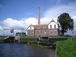 Pumping station in Echten | |
 Flag  Coat of arms | |
.svg.png) Location in Friesland | |
| Coordinates: 52°51′N 5°43′E | |
| Country | Netherlands |
| Province | Friesland |
| Dissolved | 1 January 2014[1] |
| Area | |
| • Total | 124.34 km2 (48.01 sq mi) |
| • Land | 75.93 km2 (29.32 sq mi) |
| • Water | 48.41 km2 (18.69 sq mi) |
| Elevation | 0 m (0 ft) |
| Population (November 2013)[4] | |
| • Total | 13,544 |
| • Density | 178/km2 (460/sq mi) |
| Time zone | UTC+1 (CET) |
| • Summer (DST) | UTC+2 (CEST) |
| Postcode | 8508, 8530–8539 |
| Area code | 0514 |
Population centres
gollark: I mean, I use Google Play for apps, but much of my stuff is from F-droid anyway.
gollark: Oh, I don't use Google services, but *lots of people* do.
gollark: > This problem is fine because I can use a partly working hacky workaround which creates other problems.
gollark: Also the fact that they have a bunch of services many have come to depend on tied to an account they can randomly cancel for no good reason with no customer support for recourse.
gollark: Yes, the data collection.
References
- "Gemeentelijke indeling op 1 januari 2014" [Municipal divisions on 1 January 2014]. cbs.nl (in Dutch). CBS. Retrieved 10 January 2014.
- "Kerncijfers wijken en buurten" [Key figures for neighbourhoods]. CBS Statline (in Dutch). CBS. 2 July 2013. Retrieved 11 July 2013.
- "Postcodetool for 8531ED". Actueel Hoogtebestand Nederland (in Dutch). Het Waterschapshuis. Archived from the original on 21 September 2013. Retrieved 21 September 2013.
- "Bevolkingsontwikkeling; regio per maand" [Population growth; regions per month]. CBS Statline (in Dutch). CBS. 23 December 2013. Retrieved 20 January 2014.
External links

Neighbouring municipalities at time of dissolution | ||||||||||
|---|---|---|---|---|---|---|---|---|---|---|
| ||||||||||
Municipalities of Friesland | ||
|---|---|---|
 | ||
| ||
This article is issued from Wikipedia. The text is licensed under Creative Commons - Attribution - Sharealike. Additional terms may apply for the media files.