Le Vert, Deux-Sèvres
Le Vert is a commune in the Deux-Sèvres department in western France. It is around 25 km south of Niort.
Le Vert | |
|---|---|
Location of Le Vert 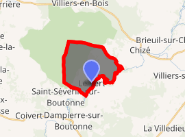
| |
 Le Vert  Le Vert | |
| Coordinates: 46°05′38″N 0°23′39″W | |
| Country | France |
| Region | Nouvelle-Aquitaine |
| Department | Deux-Sèvres |
| Arrondissement | Niort |
| Canton | Mignon-et-Boutonne |
| Intercommunality | Val de Boutonne |
| Government | |
| • Mayor (2008–2014) | Claude Beaudoux |
| Area 1 | 11.81 km2 (4.56 sq mi) |
| Population (2017-01-01)[1] | 128 |
| • Density | 11/km2 (28/sq mi) |
| Time zone | UTC+01:00 (CET) |
| • Summer (DST) | UTC+02:00 (CEST) |
| INSEE/Postal code | 79346 /79170 |
| Elevation | 35–97 m (115–318 ft) (avg. 50 m or 160 ft) |
| 1 French Land Register data, which excludes lakes, ponds, glaciers > 1 km2 (0.386 sq mi or 247 acres) and river estuaries. | |
There are no shops in the village. The nearest pâtisserie is in Chizé.
Geography
The commune is traversed by the river Boutonne. To the south of the village is the border between Deux-Sèvres and Charente-Maritime.
gollark: Or you WILL rotate at 2π radians per second or more or less.
gollark: Well, do that.
gollark: Perhaps your teaching is bad. Did you try arbitrary internet videos™?
gollark: https://www.maa.org/sites/default/files/pdf/devlin/LockhartsLament.pdf
gollark: School maths is ÆÆææææÆÆÆÆÆææææÆÆÆÆÆÆÆÆæææÆÆÆÆÆAaaææææaaaaAAAÆÆÆææaaæÆAAÆÆÆa for several reasons but maths *generally* is cool.
References
- "Populations légales 2017". INSEE. Retrieved 6 January 2020.
| Wikimedia Commons has media related to Le Vert. |
| Authority control |
|
|---|
This article is issued from Wikipedia. The text is licensed under Creative Commons - Attribution - Sharealike. Additional terms may apply for the media files.