Latimer, Leicester
Latimer was an electoral ward and administrative division of the city of Leicester, England, consisting of the residential suburb of St Marks.
| Latimer | |
|---|---|
 | |
| Population | 11,583 |
| Unitary authority | |
| Ceremonial county | |
| Region | |
| Country | England |
| Sovereign state | United Kingdom |
| Post town | LEICESTER |
| Postcode district | LE4 |
| Dialling code | 0116 |
| Police | Leicestershire |
| Fire | Leicestershire |
| Ambulance | East Midlands |
| UK Parliament | |
History
The St Marks estate was built in the wake of Leicester's slum clearance programmes in 1960.[1]
Geography
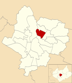
Latimer is bounded was the wards of Belgrave to the north, Spinney Hills to the south, Abbey to the west and North Evington to the east.[2]
Demographics
The Latimer ward had a population of 11,583, with an average age of 35, in line with the average for Leicester. It has the highest concentration of Indian residents in Leicester, at 74% of Latimer's population, compared to 25% across the city. Only 16% of Latimer residents are native British.[3]
gollark: So it could download a manifest file, see "hmm, this is version 1247.-006.3a and 1248.3033030.æææ is available, I must now update these files".
gollark: I would probably just go for automatically generated machine-readable changelogs of some form.
gollark: *Currently* I can't do half of those because there's no actual versioning mechanism, and no way to compile stuff because it is all run straight off pastebin.
gollark: Having version control would probably make some potatOS things I've wanted possible, such as verified boot where potatOS ensures that the currently installed stuff matches a checksum, compressed updates, and updates which work if I change a non-core file (the updater logic is very weird).
gollark: And I think cloud catcher.
References
- OneLeicester. "St Matthews and St Marks Neighborhood Delivery Plan". Retrieved 14 November 2011.
- Leicester City Council. "Ward Maps". Archived from the original on 13 June 2011. Retrieved 11 October 2011.
- Leicester City Council. "Ward Profiles - 2001 Census - Population". Archived from the original on 15 September 2012. Retrieved 14 November 2011.
This article is issued from Wikipedia. The text is licensed under Creative Commons - Attribution - Sharealike. Additional terms may apply for the media files.