Larrabee Township, Gove County, Kansas
Larrabee Township is a township in Gove County, Kansas, USA. As of the 2000 census, its population was 80.
Larrabee Township | |
|---|---|
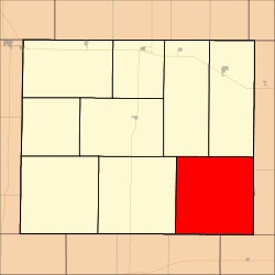 Location in Gove County | |
| Coordinates: 38°47′06″N 100°15′49″W | |
| Country | United States |
| State | Kansas |
| County | Gove |
| Area | |
| • Total | 143.39 sq mi (371.39 km2) |
| • Land | 143.37 sq mi (371.34 km2) |
| • Water | 0.02 sq mi (0.05 km2) 0.01% |
| Elevation | 2,362 ft (720 m) |
| Population (2000) | |
| • Total | 80 |
| • Density | 0.6/sq mi (0.2/km2) |
| GNIS feature ID | 0471401 |
Geography
Larrabee Township covers an area of 143.39 square miles (371.4 km2) and contains no incorporated settlements. According to the USGS, it contains two cemeteries: Alanthus and Morning Star.
The streams of Big Windy Creek, Indian Creek and Sand Creek run through this township.
Transportation
Larrabee Township contains one airport or landing strip, Castle Rock Ranch Airport.
gollark: This does not prevent you from trusting people if you want to for whatever reason.
gollark: The whole blockchain thing is a clever mechanism to low-trust-ly synchronize data, in this case a transaction log.
gollark: I don't want to *have* to arbitrarily trust people. This is why I do things like "TLS" and "not giving everyone my SSH keys".
gollark: ????
gollark: It would be possible, although stupid, to make a cryptocurrency where new blocks can only be issued by GTech™ bee cuboids using a private signing key, although this may break some of the security incentives.
External links
Municipalities and communities of Gove County, Kansas, United States | ||
|---|---|---|
| Cities | 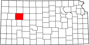 Map of Kansas highlighting Gove County | |
| Ghost towns | ||
| Townships | ||
| Footnotes | ‡This populated place also has portions in an adjacent county or counties | |
This article is issued from Wikipedia. The text is licensed under Creative Commons - Attribution - Sharealike. Additional terms may apply for the media files.