Langsur
Langsur is a municipality in the Trier-Saarburg district, in Rhineland-Palatinate, Germany.
Langsur | |
|---|---|
 | |
 Coat of arms | |
Location of Langsur within Trier-Saarburg district 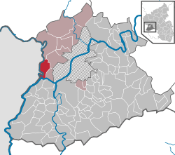 | |
 Langsur  Langsur | |
| Coordinates: 49°43′29″N 6°29′59″E | |
| Country | Germany |
| State | Rhineland-Palatinate |
| District | Trier-Saarburg |
| Municipal assoc. | Trier-Land |
| Government | |
| • Mayor | Karl Heinrich Orth (CDU) |
| Area | |
| • Total | 11.93 km2 (4.61 sq mi) |
| Elevation | 154 m (505 ft) |
| Population (2018-12-31)[1] | |
| • Total | 1,717 |
| • Density | 140/km2 (370/sq mi) |
| Time zone | CET/CEST (UTC+1/+2) |
| Postal codes | 54308 |
| Dialling codes | 06501 |
| Vehicle registration | TR |
| Website | www.langsur.info |
Wasserbilligerbrück
Wasserbilligerbrück is a small German village belonging to the Ortsgemeinde of Langsur.[2] It is located on the bridge across the Sauer connecting it to the Luxembourgish town of Wasserbillig.[3]
gollark: We, can cause terror and destruction with, this new technology, it should be a simple Python, script.
gollark: I think I use commas somewhat less than average, but I don't really know.
gollark: You put in a sentence and it removes the existing commas and randomly adds new ones.
gollark: Idea: autodecommaizer.
gollark: All, who disagree are wrong.
References
- "Bevölkerungsstand 2018 - Gemeindeebene". Statistisches Landesamt Rheinland-Pfalz (in German). 2019.
- Müllers Großes Deutsches Ortsbuch 2012: Vollständiges Ortslexikon (in German). Walter de Gruyter. 2012-08-31. p. 1469. ISBN 9783110278064.
- Kamphausen, Rudolf E.; Strewe, Hans J. (2013-03-08). Reiseverkehrsgeographie (in German). Springer-Verlag. p. 41. ISBN 9783322826497.
| Authority control |
|
|---|
This article is issued from Wikipedia. The text is licensed under Creative Commons - Attribution - Sharealike. Additional terms may apply for the media files.