Lamar Heights, Missouri
Lamar Heights is a village in Barton County, Missouri, United States. The population was 178 at the 2010 census.
Lamar Heights, Missouri | |
|---|---|
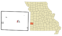 Location of Lamar Heights, Missouri | |
| Coordinates: 37°29′33″N 94°17′33″W | |
| Country | United States |
| State | Missouri |
| County | Barton |
| Area | |
| • Total | 0.80 sq mi (2.08 km2) |
| • Land | 0.78 sq mi (2.03 km2) |
| • Water | 0.02 sq mi (0.05 km2) |
| Elevation | 968 ft (295 m) |
| Population | |
| • Total | 178 |
| • Estimate (2019)[3] | 175 |
| • Density | 223.50/sq mi (86.26/km2) |
| Time zone | UTC-6 (Central (CST)) |
| • Summer (DST) | UTC-5 (CDT) |
| FIPS code | 29-40430[4] |
| GNIS feature ID | 0720771[5] |
Geography
Lamar Heights is located at 37°29′33″N 94°17′33″W (37.492411, -94.292570).[6]
According to the United States Census Bureau, the city has a total area of 0.80 square miles (2.07 km2), of which 0.78 square miles (2.02 km2) is land and 0.02 square miles (0.05 km2) is water.[7]
Demographics
| Historical population | |||
|---|---|---|---|
| Census | Pop. | %± | |
| 1960 | 113 | — | |
| 1970 | 96 | −15.0% | |
| 1980 | 171 | 78.1% | |
| 1990 | 176 | 2.9% | |
| 2000 | 216 | 22.7% | |
| 2010 | 178 | −17.6% | |
| Est. 2019 | 175 | [3] | −1.7% |
| U.S. Decennial Census[8] | |||
2010 census
As of the census[2] of 2010, there were 178 people, 79 households, and 47 families living in the city. The population density was 228.2 inhabitants per square mile (88.1/km2). There were 90 housing units at an average density of 115.4 per square mile (44.6/km2). The racial makeup of the city was 98.9% White and 1.1% from two or more races. Hispanic or Latino of any race were 1.1% of the population.
There were 79 households, of which 29.1% had children under the age of 18 living with them, 51.9% were married couples living together, 2.5% had a female householder with no husband present, 5.1% had a male householder with no wife present, and 40.5% were non-families. 38.0% of all households were made up of individuals, and 12.7% had someone living alone who was 65 years of age or older. The average household size was 2.25 and the average family size was 2.98.
The median age in the city was 45 years. 23% of residents were under the age of 18; 4.5% were between the ages of 18 and 24; 22.5% were from 25 to 44; 34.3% were from 45 to 64; and 15.7% were 65 years of age or older. The gender makeup of the city was 47.8% male and 52.2% female.
2000 census
As of the census[4] of 2000, there were 216 people, 89 households, and 59 families living in the village. The population density was 269.1 people per square mile (104.2/km2). There were 102 housing units at an average density of 127.1 per square mile (49.2/km2). The racial makeup of the village was 94.91% White, 0.46% Native American, 0.93% Asian, and 3.70% from two or more races. Hispanic or Latino of any race were 1.39% of the population.
There were 89 households, out of which 30.3% had children under the age of 18 living with them, 52.8% were married couples living together, 9.0% had a female householder with no husband present, and 32.6% were non-families. 29.2% of all households were made up of individuals, and 7.9% had someone living alone who was 65 years of age or older. The average household size was 2.43 and the average family size was 2.92.
In the village, the population was spread out, with 27.3% under the age of 18, 11.6% from 18 to 24, 25.0% from 25 to 44, 22.2% from 45 to 64, and 13.9% who were 65 years of age or older. The median age was 38 years. For every 100 females, there were 107.7 males. For every 100 females age 18 and over, there were 96.3 males.
The median income for a household in the village was $30,625, and the median income for a family was $36,389. Males had a median income of $25,000 versus $21,000 for females. The per capita income for the village was $16,018. About 18.6% of families and 18.3% of the population were below the poverty line, including 28.1% of those under the age of eighteen and none of those 65 or over.
References
- "2019 U.S. Gazetteer Files". United States Census Bureau. Retrieved July 26, 2020.
- "U.S. Census website". United States Census Bureau. Retrieved 2012-07-08.
- "Population and Housing Unit Estimates". United States Census Bureau. May 24, 2020. Retrieved May 27, 2020.
- "U.S. Census website". United States Census Bureau. Retrieved 2008-01-31.
- "US Board on Geographic Names". United States Geological Survey. 2007-10-25. Retrieved 2008-01-31.
- "US Gazetteer files: 2010, 2000, and 1990". United States Census Bureau. 2011-02-12. Retrieved 2011-04-23.
- "US Gazetteer files 2010". United States Census Bureau. Archived from the original on 2012-07-02. Retrieved 2012-07-08.
- "Census of Population and Housing". Census.gov. Retrieved June 4, 2015.
Municipalities and communities of Barton County, Missouri, United States | ||
|---|---|---|
| Cities | 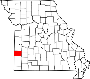 Map of Missouri highlighting Barton County | |
| Villages | ||
| Townships | ||
| CDP | ||
| Other unincorporated communities | ||
| Ghost towns | ||