Lake Edward
Lake Edward, Rutanzige or Edward Nyanza is the smallest of the African Great Lakes. It is located in the Albertine Rift, the western branch of the East African Rift, on the border between the Democratic Republic of the Congo (DRC) and Uganda, with its northern shore a few kilometres south of the equator.
| Lake Edward | |
|---|---|
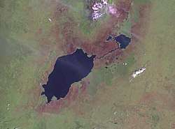 NASA Landsat photo of Lake Edward (left) and smaller Lake George with the Kazinga Channel between them | |
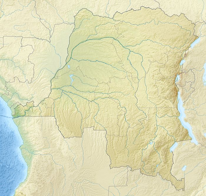 Lake Edward 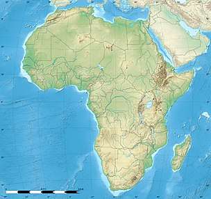 Lake Edward | |
| Coordinates | 0°20′S 29°36′E |
| Primary inflows | Nyamugasani Ishasha Rutshuru Rwindi Ntungwe Lubilia |
| Primary outflows | Semliki River |
| Catchment area | 12,096 km2 (4,670 sq mi) |
| Basin countries | Democratic Republic of Congo Uganda |
| Max. length | 77 km (48 mi) |
| Max. width | 40 km (25 mi) |
| Surface area | 2,325 km2 (898 sq mi) |
| Average depth | 17 m (56 ft) |
| Max. depth | 112 m (367 ft) |
| Water volume | 39.5 km3 (9.5 cu mi) |
| Surface elevation | 912 m (2,992 ft) |
History
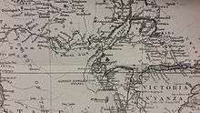
Henry Morton Stanley first saw the lake in 1888, during the Emin Pasha Relief Expedition. The lake was named in honour of Prince Albert Edward, The Prince of Wales, son of then British-monarch Queen Victoria, and later to become King Edward VII.
In 1973, Uganda and Zaire (DRC) renamed it Lake Idi Amin or Lake Idi Amin Dada after Ugandan dictator Idi Amin. After his overthrow in 1979, it recovered its former name.
In 2014, the lake was the center of an oil dispute. SOCO international entered the premises of the Virunga National Park wherethe lake is situated to prospect for oil. However villagers and workers who attempted to stop the oil company from entering the area were beaten up and even kidnapped and tortured. Plans to redraw the lines of Virunga’s boundaries and exclude the lake were taken into consideration. However, since the Park is a world heritage site and the lake is part of it such plans naturally go against the World Heritage Convention.[1]
Geography
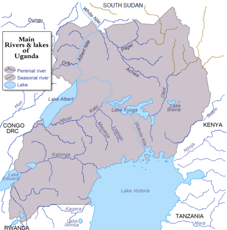
Click image to enlarge.
Topography and drainage
Lake Edward lies at an elevation of 920 metres (3,020 ft), is 77 kilometres (48 mi) long by 40 kilometres (25 mi) wide at its maximum points, and covers a total surface area of 2,325 square kilometres (898 sq mi), making it the 15th-largest on the continent. The lake is fed by the Nyamugasani River, the Ishasha River, the Rutshuru River, the Ntungwe River, and the Rwindi River. Lake George to the northeast empties into it via the Kazinga Channel. Lake Edward empties to the north via the Semliki River into Lake Albert.
The western escarpment of the Great Rift Valley towers up to 2,000 metres (6,600 ft) above the western shore of the lake. The southern and eastern shores are flat lava plains. The Ruwenzori Mountains are 20 kilometres (12 mi) north of the lake.[2]
Volcanism
The region shows much evidence of volcanic activity over the last 5000 years. The Katwe-Kikorongo and Bunyaruguru Volcanic Fields, with extensive cones and craters, lie either side of the Kazinga Channel on the northwest shore of the lake. It is thought that Lakes George and Edward used to be joined as one larger lake, but lava from these fields flowed in and divided it, leaving only the Kazinga Channel as the remnant of the past union. To the south lies the May-ya-Moto thermally active volcano 30 kilometres (19 mi) away, and the Nyamuragira volcano in the western Virunga Mountains lies 80 kilometres (50 mi) south, but its lava flows have reached the lake in the past.[2]
The Katwe-Kikorongo field features dozens of large craters and cones covering an area of 30 kilometres (19 mi) by 15 kilometres (9.3 mi) between lakes Edward and George, and includes seven crater lakes. The largest of these, the 2.5 kilometres (1.6 mi) long Lake Katwe, occupies a crater 4 kilometres (2.5 mi) across and is separated from Lake Edward by just 300 metres (980 ft) of land. The crater is about 100 metres (330 ft) deep, and Lake Katwe's surface is about 40 metres (130 ft) lower than Lake Edward's. It is remarkable that the volcanic origin of this area southeast of the Ruwenzoris was not known until it was reported by G. F. Scott Elliot in 1894. Stanley visited Lake Katwe in 1889 and noted the deep depression, the salinity of the lake, and a spring of sulphurous water nearby, but he failed to connect this to volcanism.[3]
High-resolution analyses of the elemental composition of calcite and biogenic silica (BSi) content in piston cores from Lake Edward, equatorial Africa, document complex interactions between climate variability and lacustrine geochemistry over the past 5400 years.[4]
The similarly-sized Bunyaruguru field on the other side of the Kazinga Channel contains about 30 crater lakes, some of which are larger than Katwe.
Settlements
Lake Edward lies completely within the Virunga National Park (Congo) and the Queen Elizabeth National Park (Uganda) and does not have extensive human habitation on its shores, except at Ishango (DRC) in the north, home to a park ranger training facility. About two-thirds of its waters are in the DRC and one third in Uganda. Apart from Ishango, the main Congolese settlement in the south is Vitshumbi, while the Ugandan settlements are Mweya and Katwe in the northeast, near the crater lake of that name, which is the chief producer of salt for Uganda. The nearest cities are Kasese in Uganda to the northeast and Butembo in the DRC to the northwest, which are respectively about 50 kilometres (31 mi) and 150 kilometres (93 mi) distant by road.[5]
Ecology
Lake Edward is home to many species of fish, including populations of Bagrus docmak, Oreochromis niloticus, Oreochromis leucostictus, and over 50 species of Haplochromis and other haplochromine species, of which only 25 are formally described. Fishing is an important activity among local residents. Fauna living on the banks of the lake – including chimpanzees, elephants, crocodiles, and lions – are protected by the national parks. The area is also home to many perennial and migratory bird species.
2018 Lake Edward Skirmish
On July 6, 2018 there was a naval skirmish between the two nations of Uganda and Democratic Republic of the Congo on Lake Edward. This skirmish began as a result of Congolese naval vessels being sent to investigate reports of the Ugandan navy apprehending several Congolese fishing vessels, and civilians. This clash resulted in the death of one person, and the wounding of three others.[6][7]
Early reports by local Congolese officials claim that seven were killed in the clash, however, this has not been backed up by either national government.[8] On July 9, North Kivu official Muhindo Kyakwa claimed twelve Congolese fishermen had been killed in the clashes.[9]
References
- Gettleman, Jeffrey (2014-11-15). "Oil Dispute Takes a Page From Congo's Bloody Past". The New York Times. ISSN 0362-4331. Retrieved 2017-12-21.
- Google Earth/Geographic Features/Volcanoes
- Holmes, A. and Harwood, H.F. (1932) "Petrology of the Volcanic Fields East and South-East of Ruwenzori, Uganda", Quarterly Journal of the Geological Society, 88 (1-4), p. 370–442, doi:10.1144/GSL.JGS.1932.088.01-04.16
- Russell, James M.; Johnson, Thomas C. (July 2005). "A high-resolution geochemical record from Lake Edward, Uganda Congo and the timing and causes of tropical African drought during the late Holocene". Quaternary Science Reviews. 24 (12–13): 1375–1389. doi:10.1016/j.quascirev.2004.10.003. ISSN 0277-3791.
- Carte Routière et Touristique Michelin (1996) Afrique Nord-Est et Arabie, map scale 1:4 000 000, Paris : Pneu Michelin
- "One killed, three wounded after clashes near Congo-Uganda border". Reutesrs. July 6, 2018.
- "One killed, three wounded after clashes near Congo-Uganda border". africanews.com. July 7, 2018.
- "Uganda and DR Congo clash on Lake Edward". Club of Mozambique. BBC. July 6, 2018.
- "Uganda and Congo forces clash in Lake Edward dispute". Deutsche Welle. July 10, 2018.
"The 12 bodies of our compatriots are still floating on Edward Lake," said Muhindo Kyakwa, a senior Congolese official of the province of North Kivu.