Lake Butte des Morts
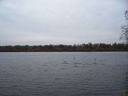
Big Lake Butte des Morts (/ˌbjuːdəˈmɔːr/[2]) is an 8,800-acre (36 km2) lake located in the U.S. state of Wisconsin and is part of the Winnebago Pool (also known as the Winnebago System). The lake is fed by the Fox River in the southwest and the Wolf River draining from Lake Winneconne in the northwest, and drains via the Fox River southeast into Lake Winnebago. The lake is also part of the Butte des Morts region in Winnebago County, Wisconsin.
| Lake Butte des Morts | |
|---|---|
 Lake Butte des Morts | |
 Lake Butte des Morts | |
| Location | Winnebago County, Wisconsin, United States |
| Coordinates | 44°04′23″N 088°38′31″W |
| Primary inflows | Fox River, Wolf River |
| Primary outflows | Fox River |
| Basin countries | United States |
| Surface area | 8,581 acres (35 km2)[1] |
| Average depth | 9 ft (3 m) |
| Surface elevation | 741 feet (226 m) |
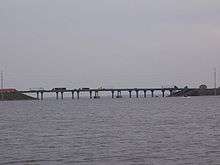
Much of the lake is flooded marshland, which was created by the damming of the Fox River downstream in Menasha in the 19th century. This has resulted in the lake's flat and shallow character (maximum depth is 15 ft [4.5 m]). U.S. Highway 41 (US 41) / Interstate 41 (I41) spans the east end of the lake via a bridge and causeway combination. The bridge includes the Tribal Heritage Crossing, a designated national trail, which is a portion of the Wiouwash State Trail.[3] The city of Oshkosh lies between Lake Butte des Morts and Lake Winnebago.
Big Lake Butte des Morts is popular among both fishermen and recreational boaters during the warm months, and with ice fishermen in the winter. A marked navigation channel guides passage across the lake from the inflow of the Wolf River in the west (connecting to Lake Poygan), to the outflow of the Fox River east to Lake Winnebago. This lake is not connected to Little Lake Butte des Morts. The smaller lake is located to the north downstream of the Winnebago Pool. Big Lake Butte des Morts served as part of the Fox-Wisconsin Waterway.
Fish species found in the lake include walleye, drum, white bass, largemouth bass, smallmouth bass, carp, flathead and channel catfish, northern pike, crappie, yellow perch, bluegill and sturgeon. Sunset Point, located near the Interstate 41 bridge, is one of the most popular walleye fishing spots on the Winnebago System.
The name "Butte des Morts" was given by French colonial settlers from the period when France controlled this area. It means "Mound of the Dead", in reference to a nearby prehistoric Native American burial mound. In the Menominee language this place is known as Paehkuahkīhsaeh which means "small mound".[4]
Gallery
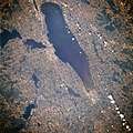
 Winnebago pool, July 1996. Lake Winnebago is in the center, with Lake Butte des Morts just to the left of the center of the lake.
 Interstate 41 bridge over Lake Butte des Morts
References
- "Results for Lake Butte des Morts". USGNIS. Retrieved May 24, 2018.
- Miss Pronouncer: Hear how to pronounce; The Wisconsin pronunciation guide for cities, counties, Indians & lawmakers
- Dickmann, Noell (June 13, 2015). "Tribal Heritage Crossing Designated as National Trail". The Post Crescent. Gannett Company. p. 3D.
- Hoffman, Mike. "Menominee Place Names in Wisconsin". The Menominee Clans Story. Retrieved 2018-10-06.
External links
- Lake Butte des Morts at Wisconsin Department of Natural Resources