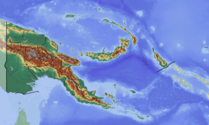
Lagaip Rural LLG
Lagaip Rural LLG is a local-level government (LLG) of Enga Province, Papua New Guinea.[1][2]
Lagaip Rural LLG | |
|---|---|
 Lagaip Rural LLG Location within Papua New Guinea | |
| Coordinates: 5.495148°S 143.48861°E | |
| Country | Papua New Guinea |
| Province | Enga Province |
| Time zone | UTC+10 (AEST) |
Wards
- 01. Malale
- 02. Wapele
- 03. Kembos
- 04. Komaip
- 05. Wanepos
- 06. Takuup
- 07. Kasap
- 08. Yangiyangi
- 09. Kindarep
- 10. Yakenda
- 11. Keriapaka
- 12. Aiyak (Aiyaka)
- 13. Ipai
- 14. Lyonge
- 15. Paip
- 16. Liop
- 17. Yaki Due
- 18. Sirunki
- 19. Yailingis
- 20. Kaipare
- 21. Pore
- 22. Tukusenda (Tukisenta)
- 23. Nagulama
- 24. Yomondi
- 25. Kusi
- 26. Paindako
- 27. Kulita
- 28. Watali
- 29. Pipingus
- 30. Kuimas
- 81. Laiagam Urban
gollark: Well, "work"space.
gollark: And I think my reboot-time metric is tracking "time from power on to working desktop", not "time to full workspace starting up", which is more like... 40 seconds?
gollark: Firefox doesn't actually pull down the latest tab contents on every startup though, that would be silly.
gollark: Yes, it's pretty fast.
gollark: I can't really get the time needed for a reboot below about 25 seconds, so I don't like to reboot often.]
References
- "Census Figures by Wards - Highlands Region". www.nso.gov.pg. 2011 National Population and Housing Census: Ward Population Profile. Port Moresby: National Statistical Office, Papua New Guinea. 2014.
- "Final Figures". www.nso.gov.pg. 2011 National Population and Housing Census: Ward Population Profile. Port Moresby: National Statistical Office, Papua New Guinea. 2014.
- OCHA FISS (2018). "Papua New Guinea administrative level 0, 1, 2, and 3 population statistics and gazetteer". Humanitarian Data Exchange. 1.31.9.
- United Nations in Papua New Guinea (2018). "Papua New Guinea Village Coordinates Lookup". Humanitarian Data Exchange. 1.31.9.
This article is issued from Wikipedia. The text is licensed under Creative Commons - Attribution - Sharealike. Additional terms may apply for the media files.