Lafayette, Ohio
Lafayette is a village in Allen County, Ohio, United States. The population was 445 at the 2010 census. It is included in the Lima, Ohio Metropolitan Statistical Area.
Lafayette, Ohio | |
|---|---|
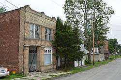
 Buildings on High Street | |
| Nickname(s): Patriot City USA | |
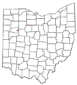
 Location of Lafayette, Ohio | |
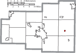
 Location of Lafayette in Allen County | |
| Coordinates: 40°45′31″N 83°56′58″W | |
| Country | United States |
| State | Ohio |
| County | Allen |
| Township | Jackson |
| Government | |
| • Mayor | Ronald Joe Moots |
| Area | |
| • Total | 0.23 sq mi (0.60 km2) |
| • Land | 0.23 sq mi (0.60 km2) |
| • Water | 0.00 sq mi (0.00 km2) |
| Elevation | 928 ft (283 m) |
| Population | |
| • Total | 445 |
| • Estimate (2019)[4] | 417 |
| • Density | 1,789.70/sq mi (692.32/km2) |
| Time zone | UTC-5 (Eastern (EST)) |
| • Summer (DST) | UTC-4 (EDT) |
| ZIP code | 45854 |
| Area code(s) | 419 |
| FIPS code | 39-41118[5] |
| GNIS feature ID | 1056388[2] |
| Website | http://www.lafayetteoh.com/ |
History
The village was incorporated in 1868.[6]
Geography
Lafayette is located at 40°45′31″N 83°56′58″W (40.758643, -83.949488).[7]
According to the United States Census Bureau, the village has a total area of 0.25 square miles (0.65 km2), all land.[8]
Demographics
| Historical population | |||
|---|---|---|---|
| Census | Pop. | %± | |
| 1870 | 337 | — | |
| 1880 | 333 | −1.2% | |
| 1900 | 316 | — | |
| 1910 | 418 | 32.3% | |
| 1920 | 383 | −8.4% | |
| 1930 | 382 | −0.3% | |
| 1940 | 411 | 7.6% | |
| 1950 | 444 | 8.0% | |
| 1960 | 476 | 7.2% | |
| 1970 | 486 | 2.1% | |
| 1980 | 488 | 0.4% | |
| 1990 | 449 | −8.0% | |
| 2000 | 304 | −32.3% | |
| 2010 | 445 | 46.4% | |
| Est. 2019 | 417 | [4] | −6.3% |
| U.S. Decennial Census[9] | |||
2010 census
As of the census[3] of 2010, there were 445 people, 161 households, and 120 families living in the village. The population density was 1,780.0 inhabitants per square mile (687.3/km2). There were 172 housing units at an average density of 688.0 per square mile (265.6/km2). The racial makeup of the village was 97.8% White, 0.2% Native American, 1.3% Asian, and 0.7% from two or more races. Hispanic or Latino of any race were 1.1% of the population.
There were 161 households, of which 46.0% had children under the age of 18 living with them, 54.7% were married couples living together, 10.6% had a female householder with no husband present, 9.3% had a male householder with no wife present, and 25.5% were non-families. 21.7% of all households were made up of individuals, and 11.2% had someone living alone who was 65 years of age or older. The average household size was 2.76 and the average family size was 3.21.
The median age in the village was 33.4 years. 32.1% of residents were under the age of 18; 6.7% were between the ages of 18 and 24; 29.9% were from 25 to 44; 20.9% were from 45 to 64; and 10.3% were 65 years of age or older. The gender makeup of the village was 47.9% male and 52.1% female.
2000 census
As of the census[5] of 2000, there were 304 people, 118 households, and 86 families living in the village. The population density was 1,483.3 people per square mile (586.9/km2). There were 126 housing units at an average density of 614.8 per square mile (243.2/km2). The racial makeup of the village was 99.34% White and 0.66% African American.
There were 118 households, out of which 38.1% had children under the age of 18 living with them, 58.5% were married couples living together, 9.3% had a female householder with no husband present, and 26.3% were non-families. 23.7% of all households were made up of individuals, and 14.4% had someone living alone who was 65 years of age or older. The average household size was 2.58 and the average family size was 3.06.
In the village, the population was spread out, with 26.6% under the age of 18, 8.9% from 18 to 24, 32.2% from 25 to 44, 17.8% from 45 to 64, and 14.5% who were 65 years of age or older. The median age was 35 years. For every 100 females there were 86.5 males. For every 100 females age 18 and over, there were 82.8 males.
The median income for a household in the village was $41,250, and the median income for a family was $47,969. Males had a median income of $44,821 versus $19,375 for females. The per capita income for the village was $17,822. About 3.7% of families and 3.5% of the population were below the poverty line, including 1.5% of those under the age of eighteen and 7.9% of those 65 or over.
Education
Allen East is the name of the high school formerly located in Lafayette. The school relocated in 2006 to a new campus two miles south of town, at Napoleon Rd. and State Route 309.
Lafayette high school sports participate in the Northwest Conference, an athletic body sanctioned by the Ohio High School Athletic Association (OHSAA) which includes the Ada Bulldogs, Allen East Mustangs, Bluffton Pirates, Columbus Grove Bulldogs, Convoy Crestview Knights, Delphos Jefferson Wildcats, Lincolnview Lancers, Paulding Panthers, and Spencerville Bearcats.
Lafayette has a public library, a branch of the Allen County Library.[10]
References
- "2019 U.S. Gazetteer Files". United States Census Bureau. Retrieved July 28, 2020.
- "US Board on Geographic Names". United States Geological Survey. 2007-10-25. Retrieved 2008-01-31.
- "U.S. Census website". United States Census Bureau. Retrieved 2013-01-06.
- "Population and Housing Unit Estimates". Retrieved May 21, 2020.
- "U.S. Census website". United States Census Bureau. Retrieved 2008-01-31.
- Rusler, William (1921). A Standard History of Allen County, Ohio: An Authentic Narrative of the Past, with Particular Attention to the Modern Era in the Commercial, Industrial, Educational, Civic and Social Development. American Historical Society. p. 194.
- "US Gazetteer files: 2010, 2000, and 1990". United States Census Bureau. 2011-02-12. Retrieved 2011-04-23.
- "US Gazetteer files 2010". United States Census Bureau. Archived from the original on 2012-07-02. Retrieved 2013-01-06.
- "Census of Population and Housing". Census.gov. Retrieved June 4, 2015.
- "Lafayette Branch". Lima Public Library. Retrieved 25 February 2018.
