Lac-Ernest, Quebec
Lac-Ernest is an unorganized territory in the Laurentides region of Quebec, Canada. It is almost entirely within the Papineau-Labelle Wildlife Reserve.
Lac-Ernest | |
|---|---|
Unorganized territory | |
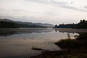 Ernest Lake at dawn | |
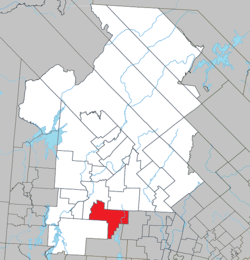 Location within Antoine-Labelle RCM. | |
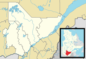 Lac-Ernest Location in central Quebec. | |
| Coordinates: 46°11′N 75°12′W[1] | |
| Country | |
| Province | |
| Region | Laurentides |
| RCM | Antoine-Labelle |
| Constituted | January 1, 1986 |
| Government | |
| • Federal riding | Laurentides—Labelle |
| • Prov. riding | Labelle |
| Area | |
| • Total | 381.50 km2 (147.30 sq mi) |
| • Land | 343.36 km2 (132.57 sq mi) |
| Population (2011)[3] | |
| • Total | 0 |
| • Density | 0.0/km2 (0/sq mi) |
| • Pop 2006-2011 | |
| • Dwellings | 0 |
| Time zone | UTC−5 (EST) |
| • Summer (DST) | UTC−4 (EDT) |
| Highways | No major routes |
History
In the early 1920s, the Singer Company, manufacturer best known for its sewing machines, began logging the area. This company built a railway from Thurso to southern Lake Montjoie in Lac-Ernest territory. Here a vast logging camp, known as "Camp 27", was established where logs were accumulated as far as the eye could see. In 1964, the MacLaren Company succeeded Singer and used the railroad until 1980 when it was dismantled and now functions as a rail trail.[4]
Demographics
Population trend:[5]
- Population in 2011: 0
- Population in 2006: 0
- Population in 2001: 0
- Population in 1996: 0
- Population in 1991: 0
gollark: Basically, <@184468521042968577>, by entirely redesigning CPUs and rewriting code which runs on them, they would be fixed.
gollark: https://queue.acm.org/detail.cfm?id=3212479
gollark: These CPU vulnerabilities really stem from the fact that they're trying to emulate decades-old systems well enough to run C-style programs (i.e. monotasking, for loops and not map etc everywhere, mutability *and* sharing memory...) properly while tacking on new features for speed etc.
gollark: I'm now selling synthetic dragon eggs at Wojbie's shop. 2KST/i.
gollark: Er...
References
- Reference number 149663 of the Commission de toponymie du Québec (in French)
- Geographic code 79924 in the official Répertoire des municipalités (in French)
- Statistics Canada 2011 Census - Lac-Ernest profile
- "Découvrir Duhamel - Histoire" (in French). Municipalité de Duhamel. Archived from the original on 2008-01-01. Retrieved 2009-08-17.
- Statistics Canada: 1996, 2001, 2006, 2011 census
Adjacent Municipal Subdivisions | ||||||||||
|---|---|---|---|---|---|---|---|---|---|---|
| ||||||||||
| Cities/towns | |
|---|---|
| Municipalities |
|
| Villages | |
| Unorganized territories | |
| |
This article is issued from Wikipedia. The text is licensed under Creative Commons - Attribution - Sharealike. Additional terms may apply for the media files.