La Tina Ranch, Texas
La Tina Ranch is a census-designated place (CDP) in Cameron County, in the U.S. state of Texas. The population was 618 at the 2010 census.[1] Prior to the 2010 census the community was part of the Arroyo Gardens-La Tina Ranch CDP. It is part of the Brownsville–Harlingen Metropolitan Statistical Area.
La Tina Ranch, Texas | |
|---|---|
 La Tina Ranch Location within the state of Texas | |
| Coordinates: 26°13′7″N 97°28′28″W | |
| Country | United States |
| State | Texas |
| County | Cameron |
| Area | |
| • Total | 7.1 sq mi (18.3 km2) |
| • Land | 7.0 sq mi (18.2 km2) |
| • Water | 0.04 sq mi (0.1 km2) |
| Elevation | 23 ft (7 m) |
| Population (2010) | |
| • Total | 618 |
| • Density | 88/sq mi (33.9/km2) |
| Time zone | UTC-6 (Central (CST)) |
| • Summer (DST) | UTC-5 (CDT) |
| FIPS code | 48-41660[1] |
Geography
La Tina Ranch is in north-central Cameron County, 16 miles (26 km) east of Harlingen and 25 miles (40 km) north of Brownsville. It is bordered on the west by Arroyo Gardens.
According to the United States Census Bureau, the CDP has a total area of 7.1 square miles (18.3 km2), of which 7.0 square miles (18.2 km2) is land and 0.04 square miles (0.1 km2), or 0.69%, is water.[1]
gollark: Check out this [REDACTED] on the [REDACTED]! It's [REDACTED] and [REDACTED]!
gollark: cease.
gollark: Do you want your soul feasted on?
gollark: I suppose I could help with the underground bunker.
gollark: I WILL FEAST ON YOUR SOUL
References
- "Geographic Identifiers: 2010 Census Summary File 1 (G001): La Tina Ranch CDP, Texas". U.S. Census Bureau, American Factfinder. Archived from the original on February 13, 2020. Retrieved July 9, 2015.
Municipalities and communities of Cameron County, Texas, United States | ||
|---|---|---|
| Cities | 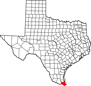 Cameron County map | |
| Towns | ||
| Village | ||
| CDPs |
| |
| Other unincorporated communities | ||
| Ghost town | ||
This article is issued from Wikipedia. The text is licensed under Creative Commons - Attribution - Sharealike. Additional terms may apply for the media files.