Kyōtamba, Kyoto
Kyōtamba (京丹波町, Kyōtanba-chō) is a town located in Funai District, Kyoto Prefecture, Japan. Its name comes from the first syllable of Kyōto and the former town of Tanba, a namesake of the historic Tanba Province.
Kyōtamba 京丹波町 | |
|---|---|
Town | |
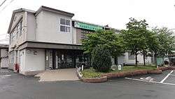 Kyōtamba Town hall | |
 Flag  Emblem | |
 Location of Kyōtamba in Kyoto Prefecture | |
 Kyōtamba Location in Japan | |
| Coordinates: 35°10′N 135°25′E | |
| Country | Japan |
| Region | Kansai |
| Prefecture | Kyoto Prefecture |
| District | Funai |
| Area | |
| • Total | 303.09 km2 (117.02 sq mi) |
| Population (October 1, 2017) | |
| • Total | 13,797 |
| • Density | 46/km2 (120/sq mi) |
| Time zone | UTC+9 (JST) |
| Website | www |
As of October 2017, the town has an estimated population of 13,797.[1] The total area is 303.09 km2.
The town was founded on October 11, 2005, by the merger of the former towns of Tanba, Mizuho and Wachi, all from Funai District.
Geography
Neighbouring municipalities
- Kyoto Prefecture
- Hyōgo Prefecture
- Sasayama
Transportation
gollark: If they didn't show up, it's probably due to the safe view limit filters, yes.
gollark: Also, tell me the codes, and I'll check if they're in the actual database or not.
gollark: How many views did each have?
gollark: Might annoy the people who pick them up, though.
gollark: You can add them while they're still in the AP, actually.
References
- "Official website of Kyoto Prefecture" (in Japanese). Japan: Kyoto Prefecture. Retrieved 11 February 2018.
External links

- Kyōtamba official website (in Japanese)
Kyoto (capital) | ||||
| Kyoto |
| |||
| Cities |
| |||
| Districts | ||||
This article is issued from Wikipedia. The text is licensed under Creative Commons - Attribution - Sharealike. Additional terms may apply for the media files.