Kranichfeld
Kranichfeld is a town in the Weimarer Land district, in Thuringia. It is situated on the river Ilm, 18 km southeast of Erfurt, and 16 km southwest of Weimar.
Kranichfeld | |
|---|---|
 Coat of arms | |
Location of Kranichfeld within Weimarer Land district 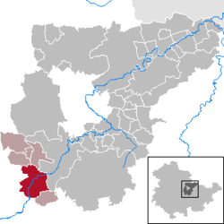 | |
 Kranichfeld  Kranichfeld | |
| Coordinates: 50°51′0″N 11°12′0″E | |
| Country | Germany |
| State | Thuringia |
| District | Weimarer Land |
| Municipal assoc. | Kranichfeld |
| Subdivisions | 3 |
| Government | |
| • Mayor | Wolf-Ludger Schlotzhauer (FDP) |
| Area | |
| • Total | 23.08 km2 (8.91 sq mi) |
| Elevation | 301 m (988 ft) |
| Population (2018-12-31)[1] | |
| • Total | 3,355 |
| • Density | 150/km2 (380/sq mi) |
| Time zone | CET/CEST (UTC+1/+2) |
| Postal codes | 99446–99448 |
| Dialling codes | 036450 |
| Vehicle registration | AP |
| Website | www.kranichfeld.de |
History
Within the German Empire (1871-1918), Kranichfeld was part of the Grand Duchy of Saxe-Weimar-Eisenach.
gollark: Yes, many older OSes anomalously mutate Python files containing * inside lists.
gollark: Your alleged validity is a mere lyriclyal construct.
gollark: Why did I even install Python 2?
gollark: Apiaristic bee memes.
gollark: Oh, that bit is entirely valid syntax, I just lied.
References
- "Bevölkerung der Gemeinden, erfüllenden Gemeinden und Verwaltungsgemeinschaften nach Geschlecht in Thüringen Gebietsstand: 31.12.2018". Thüringer Landesamt für Statistik (in German). September 2019.
| Authority control |
|
|---|
This article is issued from Wikipedia. The text is licensed under Creative Commons - Attribution - Sharealike. Additional terms may apply for the media files.