Hohenfelden
Hohenfelden is a municipality in the Weimarer Land district of Thuringia, Germany.
Hohenfelden | |
|---|---|
Location of Hohenfelden within Weimarer Land district 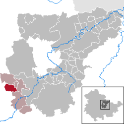 | |
 Hohenfelden  Hohenfelden | |
| Coordinates: 50°52′43″N 11°9′39″E | |
| Country | Germany |
| State | Thuringia |
| District | Weimarer Land |
| Municipal assoc. | Kranichfeld |
| Government | |
| • Mayor | Thomas Morche |
| Area | |
| • Total | 8.43 km2 (3.25 sq mi) |
| Elevation | 328 m (1,076 ft) |
| Population (2018-12-31)[1] | |
| • Total | 383 |
| • Density | 45/km2 (120/sq mi) |
| Time zone | CET/CEST (UTC+1/+2) |
| Postal codes | 99448 |
| Dialling codes | 036450 |
| Vehicle registration | AP |
| Website | hohenfelden.de |
History
Within the German Empire (1871–1918), the northern part of Hohenfelden belonged to the Grand Duchy of Saxe-Weimar-Eisenach, while the southern part belonged to the Duchy of Saxe-Meiningen.
gollark: Fun fact: skynet is now using 400MB of RAM.
gollark: Anyway, the NSA is actually the richest.
gollark: Reddit.
gollark: It doesn't seem to be.
gollark: Compact Flash.
References
- "Bevölkerung der Gemeinden, erfüllenden Gemeinden und Verwaltungsgemeinschaften nach Geschlecht in Thüringen Gebietsstand: 31.12.2018". Thüringer Landesamt für Statistik (in German). September 2019.
| Authority control |
|
|---|
This article is issued from Wikipedia. The text is licensed under Creative Commons - Attribution - Sharealike. Additional terms may apply for the media files.