Konradsreuth
Konradsreuth is a municipality in Upper Franconia in the district of Hof in Bavaria in Germany.
Konradsreuth | |
|---|---|
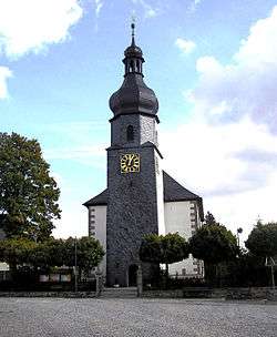 Lutheran church | |
 Coat of arms | |
Location of Konradsreuth within Hof district 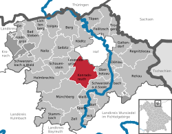 | |
 Konradsreuth  Konradsreuth | |
| Coordinates: 50°16′N 11°50′E | |
| Country | Germany |
| State | Bavaria |
| Admin. region | Oberfranken |
| District | Hof |
| Government | |
| • Mayor | Matthias Döhla (SPD) |
| Area | |
| • Total | 43.32 km2 (16.73 sq mi) |
| Elevation | 552 m (1,811 ft) |
| Population (2018-12-31)[1] | |
| • Total | 3,151 |
| • Density | 73/km2 (190/sq mi) |
| Time zone | CET/CEST (UTC+1/+2) |
| Postal codes | 95176 |
| Dialling codes | 09292 |
| Vehicle registration | HO |
| Website | www.konradsreuth.de |
Geography
The districts
With the local government reorganization in 1972, the following villages were merged into Konradsreuth municipality:
| Ahornberg | Berg | Birkenhof | Brand | Eckardsreuth | Engel |
| Frauenhof | Föhrenreuth | Glänzlamühle | Gläsel | Gottschalk | Hollareuth |
| Jägerhaus | Klausenhof | Konradsreuth | Lerchenberg | Martinsreuth | Maschinenhaus (Waldlust) |
| Modlitz | Neudörflein | Oberpferdt | Pretschenreuth | Reuthlas | Ringlasmühle |
| Schallershof | Schallersreuth | Schwarzenfurth | Schödelshöhe | Silberbach | Steinmühle |
| Stiftsgrün | Unterpferdt | Walburgisreuth | Weißlenreuth | Wendlershof | Wölbersbach |
gollark: Ah yes, that's a start.
gollark: If you pick a word to start with, then the next possibilities for your thing are a limited subset of all words - those without the letters in said first word. Though admittedly checking that would be slow too.
gollark: `/usr/share/dict/words` or `wc`?
gollark: `wc -l < /usr/share/dict/words` says there are only 123115 words.
gollark: It shouldn't even take that long with good optimizatiom.
References
- "Fortschreibung des Bevölkerungsstandes". Bayerisches Landesamt für Statistik und Datenverarbeitung (in German). July 2019.
Towns and municipalities in Hof (district) | ||
|---|---|---|
| Coat of Arms of Hof district | |
| Authority control |
|
|---|
This article is issued from Wikipedia. The text is licensed under Creative Commons - Attribution - Sharealike. Additional terms may apply for the media files.