De Wolden
De Wolden (![]()
De Wolden | |
|---|---|
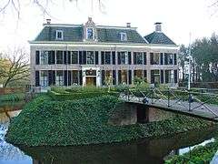
 Monumental farmhouse in De Wijk | |
 Flag Coat of arms | |
.svg.png) Location in Drenthe | |
| Coordinates: 52°40′N 6°26′E | |
| Country | Netherlands |
| Province | Drenthe |
| Established | 1 January 1998[1] |
| Government | |
| • Body | Municipal council |
| • Mayor | Roger de Groot (PVDD) |
| Area | |
| • Total | 226.35 km2 (87.39 sq mi) |
| • Land | 224.77 km2 (86.78 sq mi) |
| • Water | 1.58 km2 (0.61 sq mi) |
| Elevation | 12 m (39 ft) |
| Population (January 2019)[5] | |
| • Total | 24,110 |
| • Density | 107/km2 (280/sq mi) |
| Time zone | UTC+1 (CET) |
| • Summer (DST) | UTC+2 (CEST) |
| Postcode | Parts of 7900 range |
| Area code | 0522, 0523, 0528 |
| Website | www |
Population centres
- Alteveer
- Anholt
- Ansen
- Armweide
- Bazuin
- Benderse
- Berghuizen
- Blijdenstein
- Bloemberg
- Braamberg
- Buitenhuizen
- Bultinge
- De Oude Tol
- De Stapel
- De Stuw
- De Tippe
- De Wijk
- Dijkhuizen
- Dickninge
- Drogt
- Drogteropslagen
- Dunnigen
- Echten
- Eemten
- Engeland
- Eursinge
- Fort
- Gijsselte
- Haakswold
- Haalweide
- Hees
- Hoge Linthorst
- Kerkenveld
- Koekange
- Koekangerveld
- Kraloo
- Leeuwte
- Linde
- Lubbinge
- Lunssloten
- Middelveen
- Nolde
- Oldenhave
- Oosteinde
- Oosterwijk
- Oshaar
- Oud Veeningen
- Paardelanden
- Pieperij
- Rheebruggen
- Ruinen
- Ruinerweide
- Ruinerwold
- Schottershuizen
- Schrapveen
- Steenbergen
- Struikberg
- Ten Arlo
- Veeningen
- Vuile Riete
- Weerwille
- Wemmenhove
- Witteveen
- Zuidwolde
Topography

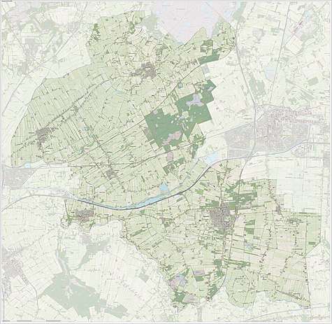
Dutch topographic map of the municipality of De Wolden, June 2015
Notable people

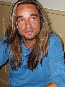
Jan Vayne, 2005
- Jan Evertsen Cloppenburgh (1571 in Ruinen – 1648) a Dutch publisher during the Dutch Golden Age
- Steven van Voorhees (1600 in Hees – 1684) an early Dutch settler in America
- Henrik Ruse, Baron of Rysensteen (1624 in Ruinen - 1679) a Dutch officer and fortification engineer
- Hendrikje Doelen (1784 in Oosterwijk – 1847) a Dutch serial killer
- Jan Arend Godert de Vos van Steenwijk II (1818 in De Wijk – 1905) a Dutch politician and president of the senate 1874/1880
- Jan Hendrik de Boer (1899 in Ruinen – 1971) a Dutch physicist and chemist
- Jan Vayne (1966 in Zuidwolde) a Dutch pianist
- Korie Homan (born 1986 in de Wijk) a Dutch former wheelchair tennis player and gold medallist at the 2008 Paralympics
Gallery
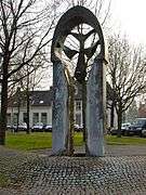
- Oude gemeentehuis van Ruinerwold
.jpg) De Wildenberg at sunset, Zuidwolde
De Wildenberg at sunset, Zuidwolde De Wieker Poort Onno de Ruijter
 Huis te Echten
gollark: My StorageSystem™
gollark: <@186486131565527040> wants a wyvern setup configured.
gollark: `BBWIFLIAARTTIATTLA` - be back when I feel like it and also remember that there is a thing to look at - would be more accurate.
gollark: Also, `brb` would be a lie.
gollark: Amazingly, people go AFK!
References
- "Gemeentelijke indeling op 1 januari 1998" [Municipal divisions on 1 January 1998]. cbs.nl (in Dutch). CBS. Retrieved 6 October 2013.
- "Ronnie Dunning" [Ronnie Dunning] (in Dutch). Gemeente De Wolden. Archived from the original on 14 July 2014. Retrieved 6 October 2013.
- "Kerncijfers wijken en buurten" [Key figures for neighbourhoods]. CBS Statline (in Dutch). CBS. 2 July 2013. Retrieved 12 March 2014.
- "Postcodetool for 7921GD". Actueel Hoogtebestand Nederland (in Dutch). Het Waterschapshuis. Retrieved 6 October 2013.
- "Bevolkingsontwikkeling; regio per maand" [Population growth; regions per month]. CBS Statline (in Dutch). CBS. 1 January 2019. Retrieved 1 January 2019.
External links
This article is issued from Wikipedia. The text is licensed under Creative Commons - Attribution - Sharealike. Additional terms may apply for the media files.
