Kitale Airport
Kitale Airport | |||||||||||
|---|---|---|---|---|---|---|---|---|---|---|---|
| Summary | |||||||||||
| Airport type | Public, Civilian | ||||||||||
| Owner | Kenya Airports Authority | ||||||||||
| Serves | Kitale, Kenya | ||||||||||
| Location | Kitale, | ||||||||||
| Elevation AMSL | 6,070 ft / 1,850 m | ||||||||||
| Coordinates | 00°58′30″N 34°57′36″E | ||||||||||
| Map | |||||||||||
 KTL Location of Kitale Airport in Kenya Placement on map is approximate | |||||||||||
| Runways | |||||||||||
| |||||||||||
Location
Kitale Airport (IATA: KTL, ICAO: HKKT) is located in the town of Kitale, Trans-Nzoia County, in northwestern Kenya, close to the International border with the Republic of Uganda.
Its location is approximately 336 kilometres (209 mi), by air, northwest of Nairobi International Airport, the country’s largest civilian airport.[1] The geographic coordinates of this airport are:0° 58' 30.00"N, 34° 57' 36.00"E (Latitude:0.975000; Longitude:34.960000).
Overview
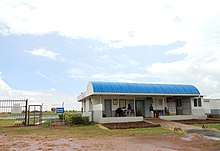
Kitale Airport is a small airstrip commonly referred to as kambi miwa airstrip by the local people, the airstrip serves the town of Kitale and surrounding communities. Situated at 6,070 feet (1,850 m) above sea level,[2] the airport has a single asphalt runway which measures 4,757 feet (1,450 m) in length and 57 feet (17 m) in width.[3]
Airlines and destinations
| Airlines | Destinations |
|---|---|
| Fly540 | Seasonal: Lodwar, Nairobi-Jomo Kenyatta [4] |
| Fly-SAX | Nairobi-Wilson |
| Safarilink | Nairobi-Wilson [5] |
References
- "Distance between Jomo Kenyatta Airport Nairobi (Nairobi Area) and Kitale () (Airport) (Kenya)". distancecalculator.globefeed.com. Retrieved 2018-08-21.
- Elevation of Kitale Airport
- Dimensions of Kitale Airport Runway
- Fly540 Schedules