Kipra Gap
Kipra Gap (Bulgarian: седловина Кипра, ‘Sedlovina Kipra’ \se-dlo-vi-'na 'ki-pra\) is the 2.3 km long, mostly ice-covered saddle of elevation 1650 m in northern Sentinel Range, Ellsworth Mountains in Antarctica connecting Mount Weems on the north to Gromshin Heights on the south.
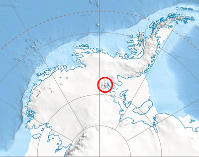
Location of Sentinel Range in Western Antarctica.
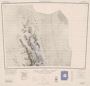
Map of northern Sentinel Range.
The saddle is named after the settlement of Kipra in Northeastern Bulgaria.
Location
Kipra Gap is located at 77°30′10″S 85°57′20″W, which is 12 km northeast of Skamni Saddle. US mapping in 1961.
Maps
- Newcomer Glacier. Scale 1:250 000 topographic map. Reston, Virginia: US Geological Survey, 1961.
- Antarctic Digital Database (ADD). Scale 1:250000 topographic map of Antarctica. Scientific Committee on Antarctic Research (SCAR). Since 1993, regularly updated.
gollark: PotatOS computers transmit CC version, Lua version, CraftOS version, build number, host, ID and if available location with incident reports.
gollark: Well, I was looking at automatic pings to SPUDNET's logging system so I could do better analysis.
gollark: Which involved a picture of a potato.
gollark: Well, they did, but they also ran the advertising campaign for potatOS on CNLite.
gollark: 6_4 aka Kan181.
References
- Kipra Gap. SCAR Composite Gazetteer of Antarctica.
- Bulgarian Antarctic Gazetteer. Antarctic Place-names Commission. (details in Bulgarian, basic data in English)
External links
- Kipra Gap. Copernix satellite image
This article includes information from the Antarctic Place-names Commission of Bulgaria which is used with permission.
| General |
| .svg.png) |
|---|---|---|
| Geographic regions | ||
| Waterways | ||
| Famous explorers | ||
This article is issued from Wikipedia. The text is licensed under Creative Commons - Attribution - Sharealike. Additional terms may apply for the media files.