Kings Weston Hill
Kings Weston Hill (grid reference ST556781) is a hill in the north of Bristol, England. It forms a ridge about 1 mile (1.6 km) long, extending from Henbury to Shirehampton and separating Lawrence Weston to the north from Coombe Dingle to the south. The hill is a public open space managed as part of the Blaise Castle Estate. It takes its name from the settlement of Kings Weston, now absorbed into Lawrence Weston.
 King's Weston hill fort | |
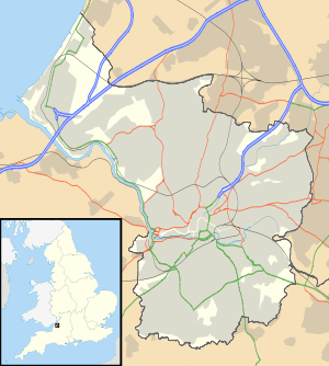
 Shown within Bristol | |
| Location | near Henbury |
|---|---|
| Region | Bristol, England |
| Coordinates | 51°30′1.93″N 2°38′25.14″W |
| Type | Hill fort |
| History | |
| Periods | Iron Age |
| Site notes | |
| Condition | some damage |
At the eastern end of Kings Weston Hill is the site of an Iron Age hill fort, which is a Scheduled Ancient Monument.[1]
The hill is located between Kings Weston House to the southwest, and Blaise Castle to the northeast, and the hill is also the site of a tower for television broadcasting.
References
- "Scheduled Ancient Monuments in Bristol". Bristol City Council. Archived from the original (PDF) on 2007-09-30. Retrieved 2007-05-07.
- "Kings Weston Hill". Megalithic Portal.
This article is issued from Wikipedia. The text is licensed under Creative Commons - Attribution - Sharealike. Additional terms may apply for the media files.