Kincaid, Kansas
Kincaid is a city in Anderson County, Kansas, United States. As of the 2010 census, the city population was 122.[7]
Kincaid, Kansas | |
|---|---|
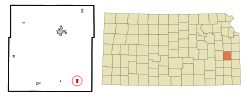 Location within Anderson County and Kansas | |
 KDOT map of Anderson County (legend) | |
| Coordinates: 38°5′1″N 95°9′13″W | |
| Country | United States |
| State | Kansas |
| County | Anderson |
| Founded | 1885 |
| Incorporated | 1886 |
| Named for | Robert Kincaid |
| Government | |
| • Mayor | Darlene Stewart [1] |
| Area | |
| • Total | 0.50 sq mi (1.30 km2) |
| • Land | 0.50 sq mi (1.30 km2) |
| • Water | 0.00 sq mi (0.00 km2) |
| Elevation | 1,053 ft (321 m) |
| Population | |
| • Total | 122 |
| • Estimate (2019)[4] | 116 |
| • Density | 232.00/sq mi (89.56/km2) |
| Time zone | UTC-6 (CST) |
| • Summer (DST) | UTC-5 (CDT) |
| ZIP code | 66039 |
| Area code | 620 |
| FIPS code | 20-36875 [5] |
| GNIS ID | 0478133 [6] |
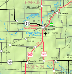
Geography
Kincaid is located at 38°5′1″N 95°9′13″W (38.083502, -95.153612).[10] According to the United States Census Bureau, the city has a total area of 0.50 square miles (1.29 km2), all of it land.[11]
Area events
The Kincaid Free Fair is an annual three-day event that began in 1908 and features a carnival, a Saturday parade, turtle races, kids races, live entertainment, and Fair Queen contest.
Demographics
| Historical population | |||
|---|---|---|---|
| Census | Pop. | %± | |
| 1890 | 284 | — | |
| 1900 | 364 | 28.2% | |
| 1910 | 426 | 17.0% | |
| 1920 | 443 | 4.0% | |
| 1930 | 380 | −14.2% | |
| 1940 | 401 | 5.5% | |
| 1950 | 309 | −22.9% | |
| 1960 | 220 | −28.8% | |
| 1970 | 189 | −14.1% | |
| 1980 | 192 | 1.6% | |
| 1990 | 170 | −11.5% | |
| 2000 | 178 | 4.7% | |
| 2010 | 122 | −31.5% | |
| Est. 2019 | 116 | [4] | −4.9% |
| U.S. Decennial Census | |||
2010 census
As of the census[3] of 2010, there were 122 people, 56 households, and 30 families residing in the city. The population density was 244.0 inhabitants per square mile (94.2/km2). There were 95 housing units at an average density of 190.0 per square mile (73.4/km2). The racial makeup of the city was 96.7% White, 0.8% Native American, 0.8% Asian, and 1.6% from two or more races. Hispanic or Latino of any race were 1.6% of the population.
There were 56 households, of which 28.6% had children under the age of 18 living with them, 41.1% were married couples living together, 8.9% had a female householder with no husband present, 3.6% had a male householder with no wife present, and 46.4% were non-families. 41.1% of all households were made up of individuals, and 16.1% had someone living alone who was 65 years of age or older. The average household size was 2.18 and the average family size was 3.00.
The median age in the city was 48.3 years. 19.7% of residents were under the age of 18; 9% were between the ages of 18 and 24; 14.8% were from 25 to 44; 35.2% were from 45 to 64; and 21.3% were 65 years of age or older. The gender makeup of the city was 52.5% male and 47.5% female.
2000 census
As of the census[5] of 2000, there were 178 people, 73 households, and 41 families residing in the city. The population density was 354.9 people per square mile (137.5/km2). There were 92 housing units at an average density of 183.4 per square mile (71.0/km2). The racial makeup of the city was 94.38% White, 4.49% Native American, 1.12% from other races. Hispanic or Latino of any race were 2.81% of the population.
There were 73 households, out of which 24.7% had children under the age of 18 living with them, 42.5% were married couples living together, 11.0% had a female householder with no husband present, and 43.8% were non-families. 39.7% of all households were made up of individuals, and 23.3% had someone living alone who was 65 years of age or older. The average household size was 2.44 and the average family size was 3.34.
In the city, the population was spread out, with 23.0% under the age of 18, 7.9% from 18 to 24, 23.0% from 25 to 44, 23.6% from 45 to 64, and 22.5% who were 65 years of age or older. The median age was 43 years. For every 100 females, there were 111.9 males. For every 100 females age 18 and over, there were 107.6 males.
The median income for a household in the city was $22,857, and the median income for a family was $29,375. Males had a median income of $20,694 versus $14,500 for females. The per capita income for the city was $9,472. About 7.0% of families and 11.1% of the population were below the poverty line, including none of those under the age of eighteen and 4.9% of those 65 or over.
Government
The Kincaid consists of a mayor and five council members. The council meets the 2nd Monday of each month at 7PM.[1]
- City Hall, 500 5th Ave.
Education
Kincaid is part of Unified School District 479.[12] The district high school is Crest High School.
Further reading
- The History Of Anderson County, Kansas, From Its First Settlement To The Fourth Of July, 1876; W.A. Johnson; Kauffman & Iler; 1877.[13]
- Plat Book Of Anderson County, Kansas, Compiled From County Records And Actual Survey; Northwest Publishing Co; 1901.[14]
- Kansas: A Cyclopedia Of State History, Embracing Events, Institutions, Industries, Counties, Cities, Towns, Prominent Persons, Etc; Frank W. Blackmar; Standard Publishing Co; 1912.[15][16][17]
- History Of The State of Kansas; William G. Cutler; A.T. Andreas Publisher; 1883.[18]
References
- Kincaid - Directory of Public Officials
- "2019 U.S. Gazetteer Files". United States Census Bureau. Retrieved July 24, 2020.
- "U.S. Census website". United States Census Bureau. Retrieved 2012-07-06.
- "Population and Housing Unit Estimates". United States Census Bureau. May 24, 2020. Retrieved May 27, 2020.
- "U.S. Census website". United States Census Bureau. Retrieved 2008-01-31.
- "US Board on Geographic Names". United States Geological Survey. 2007-10-25. Retrieved 2008-01-31.
- "2010 City Population and Housing Occupancy Status". U.S. Census Bureau. Retrieved March 6, 2011.
- "County Towns". Anderson County Historical Society. Retrieved 4 June 2014.
- Gannett, Henry (1905). The Origin of Certain Place Names in the United States. Govt. Print. Off. pp. 175.
- "US Gazetteer files: 2010, 2000, and 1990". United States Census Bureau. 2011-02-12. Retrieved 2011-04-23.
- "US Gazetteer files 2010". United States Census Bureau. Archived from the original on 2012-07-02. Retrieved 2012-07-06.
- USD 479
- The History Of Anderson County, Kansas, From Its First Settlement To The Fourth Of July, 1876; 1877.
- Plat Book Of Anderson County, Kansas, Compiled From County Records And Actual Survey; 1901.
- Kansas: A Cyclopedia Of State History, Embracing Events, Institutions, Industries, Counties, Cities, Towns, Prominent Persons, Etc - Vol 1; 1912.
- Kansas: A Cyclopedia Of State History, Embracing Events, Institutions, Industries, Counties, Cities, Towns, Prominent Persons, Etc - Vol 2; 1912.
- Kansas: A Cyclopedia Of State History, Embracing Events, Institutions, Industries, Counties, Cities, Towns, Prominent Persons, Etc - Vol 3; 1912.
- History Of The State of Kansas; 1883.
External links
| Wikimedia Commons has media related to Kincaid, Kansas. |
- City
- Schools
- Historical
- Maps
- Kincaid City Map, KDOT
Municipalities and communities of Anderson County, Kansas, United States | ||
|---|---|---|
| Cities |  Map of Kansas highlighting Anderson County | |
| CDPs | ||
| Unincorporated communities | ||
| Ghost town | ||
| Townships | ||
| Authority control |
|
|---|