Kimball, South Dakota
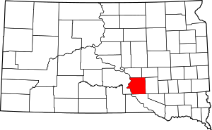
Kimball is a city in Brule County, South Dakota, United States. The population was 703 at the 2010 census.
Kimball, South Dakota | |
|---|---|
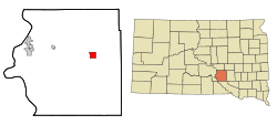
 Location in Brule County and the state of South Dakota | |
| Coordinates: 43°44′50″N 98°57′27″W | |
| Country | United States |
| State | South Dakota |
| County | Brule |
| Incorporated | 1889[1] |
| Area | |
| • Total | 3.09 sq mi (8.00 km2) |
| • Land | 3.09 sq mi (8.00 km2) |
| • Water | 0.00 sq mi (0.00 km2) |
| Elevation | 1,788 ft (545 m) |
| Population | |
| • Total | 703 |
| • Estimate (2019)[4] | 673 |
| • Density | 217.94/sq mi (84.15/km2) |
| Time zone | UTC-6 (Central (CST)) |
| • Summer (DST) | UTC-5 (CDT) |
| ZIP code | 57355 |
| Area code(s) | 605 |
| FIPS code | 46-33980[5] |
| GNIS feature ID | 1265268[6] |
History
Kimball was first known as Stake 48 on the Chicago, Milwaukee and St. Paul Railroad line going west out of Mitchell, South Dakota. In 1880, the first homestead claims were made in the vicinity of Stake 48. Kimball was organized as a village in the spring of 1883.[7] The town was named for J. W. Kimball, a railroad surveyor.[8]
The 1895 Holy Trinity Church is on the National Register of Historic Places.
Geography
Kimball is located at 43°44′50″N 98°57′27″W (43.747136, -98.957491).[9] Kimball lies just north of Interstate 90 at exit 284, the southern terminus of South Dakota Highway 45.
According to the United States Census Bureau, the city has a total area of 3.09 square miles (8.00 km2), all of it land.[10]
Kimball's ZIP code is 57355 and FIPS place code is 33980.
Demographics
| Historical population | |||
|---|---|---|---|
| Census | Pop. | %± | |
| 1890 | 593 | — | |
| 1900 | 453 | −23.6% | |
| 1910 | 713 | 57.4% | |
| 1920 | 993 | 39.3% | |
| 1930 | 1,111 | 11.9% | |
| 1940 | 997 | −10.3% | |
| 1950 | 952 | −4.5% | |
| 1960 | 912 | −4.2% | |
| 1970 | 825 | −9.5% | |
| 1980 | 752 | −8.8% | |
| 1990 | 743 | −1.2% | |
| 2000 | 745 | 0.3% | |
| 2010 | 703 | −5.6% | |
| Est. 2019 | 673 | [4] | −4.3% |
| U.S. Decennial Census[11] | |||
2010 census
At the 2010 census there were 703 people in 310 households, including 189 families, in the city. The population density was 227.5 inhabitants per square mile (87.8/km2). There were 369 housing units at an average density of 119.4 per square mile (46.1/km2). The racial makup of the city was 95.0% White, 0.3% African American, 3.3% Native American, 0.3% Asian, 0.4% from other races, and 0.7% from two or more races. Hispanic or Latino of any race were 1.1%.[3]
Of the 310 households 29.4% had children under the age of 18 living with them, 46.5% were married couples living together, 8.7% had a female householder with no husband present, 5.8% had a male householder with no wife present, and 39.0% were non-families. 35.2% of households were one person and 21.6% were one person aged 65 or older. The average household size was 2.26 and the average family size was 2.93.
The median age was 43 years. 26.6% of residents were under the age of 18; 5.4% were between the ages of 18 and 24; 21.7% were from 25 to 44; 27.2% were from 45 to 64; and 19.2% were 65 or older. The gender makeup of the city was 48.2% male and 51.8% female.
2000 census
At the 2000 census there were 745 people in 314 households, including 194 families, in the city. The population density was 240.7 people per square mile (92.8/km²). There were 351 housing units at an average density of 113.4 per square mile (43.7/km²). The racial makup of the city was 99.33% White, 0.54% Native American, and 0.13% from two or more races.[5]
Of the 314 households 29.9% had children under the age of 18 living with them, 52.2% were married couples living together, 6.4% had a female householder with no husband present, and 37.9% were non-families. 35.4% of households were one person and 19.7% were one person aged 65 or older. The average household size was 2.37 and the average family size was 3.11.
The age distribution was 27.9% under the age of 18, 6.4% from 18 to 24, 24.8% from 25 to 44, 17.9% from 45 to 64, and 23.0% 65 or older. The median age was 40 years. For every 100 females, there were 88.1 males. For every 100 females age 18 and over, there were 86.5 males.
As of 2000 the median income for a household in the city was $32,167, and the median family income was $37,813. Males had a median income of $27,727 versus $16,544 for females. The per capita income for the city was $15,398. About 5.9% of families and 10.9% of the population were below the poverty line, including 11.8% of those under age 18 and 16.7% of those age 65 or over.
Notable people
Alton Ochsner - Dr. Ocshner was born in Kimball and graduated from Kimball High School. He was "a world renowned surgeon and founder of the Oschner Clinic and Hospital in New Orleans. He is credited with convincing the medical world of the connection between cigarette smoking and lung cancer and heart disease. A cartoonist [12] used his crusade as a subject for one of his drawings."[13]
See also
References
- "SD Towns" (PDF). South Dakota State Historical Society. Archived from the original (PDF) on 2010-02-10. Retrieved 2010-02-13.
- "2019 U.S. Gazetteer Files". United States Census Bureau. Retrieved July 30, 2020.
- "U.S. Census website". United States Census Bureau. Retrieved 2012-06-21.
- "Population and Housing Unit Estimates". United States Census Bureau. May 24, 2020. Retrieved May 27, 2020.
- "U.S. Census website". United States Census Bureau. Retrieved 2008-01-31.
- "US Board on Geographic Names". United States Geological Survey. 2007-10-25. Retrieved 2008-01-31.
- Re-echoing the Past, Elsie Petula, 2000, pg 1
- Federal Writers' Project (1940). South Dakota place-names, v.1-3. University of South Dakota. p. 45.
- "US Gazetteer files: 2010, 2000, and 1990". United States Census Bureau. 2011-02-12. Retrieved 2011-04-23.
- "US Gazetteer files 2010". United States Census Bureau. Archived from the original on 2012-07-14. Retrieved 2012-06-21.
- United States Census Bureau. "Census of Population and Housing". Retrieved June 12, 2016.
- Doonesbury,G.B.Trudeau,Universal Press Syndicate,February 14, 1993
- Re-echoing the Past, Elsie Petula, 2000, pgs 12-13
External links
| Wikimedia Commons has media related to Kimball, South Dakota. |
