Khaniyadhana
Khaniyadhana is a tehsil and a Nagar Palika in Shivpuri district in the Indian state of Madhya Pradesh. It is known for its eight Jain temples.
Khaniyadhana | |
|---|---|
city | |
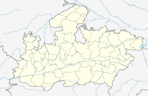
 Khaniyadhana Location in Madhya Pradesh, India  Khaniyadhana Khaniyadhana (India) | |
| Coordinates: 25.01°N 78.07°E | |
| Country | |
| State | Madhya Pradesh |
| District | Shivpuri |
| Area | |
| • Total | 5 km2 (2 sq mi) |
| Population (2011) | |
| • Total | 35,877 |
| • Density | 367/km2 (950/sq mi) |
| Languages | |
| • Official | Hindi |
| Time zone | UTC+5:30 (IST) |
| ISO 3166 code | IN-MP |
| Vehicle registration | MP |
History
Before Indian independence in 1947, Khaniyadhana was the capital of a judev maharaj kalgsingh of the same name - Khaniyadhana State.
Geography
It is located in Shivpuri District at 25º01' N, 78º07' E. Which is 110 KM away from Shivpuri and 85 Km away from Jhansi(UP). Basically this is situated on highland.
Demographics
As of 2001 India census,[1] Khaniyadhana had a population of 35,595. Males constitute 52% of the population and females 48%. Khaniyadhana has an average literacy rate of 78%, male literacy is 88%, and female literacy is 64%. In Khaniyadhana, 19% of the population is under 6 years of age.
gollark: I used actual mmap, which failed mysteriously.
gollark: I never managed to get my automated segfault fixer to work sadly.
gollark: !time <@509849474647064576>
gollark: I should probably run inference on the GPU.
gollark: Very slowly.
References
- "Census of India 2001: Data from the 2001 Census, including cities, villages and towns (Provisional)". Census Commission of India. Archived from the original on 16 June 2004. Retrieved 1 November 2008.
This article is issued from Wikipedia. The text is licensed under Creative Commons - Attribution - Sharealike. Additional terms may apply for the media files.