Kentucky Route 246
Kentucky Route 246 (KY 246) is a 3.8-mile-long (6.1 km) state highway in the U.S. state of Kentucky. The highway connects mostly rural areas of Muhlenberg County with Beechmont. It is known as Merle Travis Highway for its entire length.
| ||||
|---|---|---|---|---|
| Merle Travis Highway | ||||
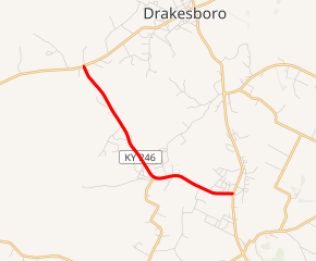
KY 246 highlighted in red | ||||
| Route information | ||||
| Maintained by KYTC | ||||
| Length | 3.8 mi[1] (6.1 km) | |||
| Major junctions | ||||
| West end | ||||
| East end | ||||
| Location | ||||
| Counties | Muhlenberg | |||
| Highway system | ||||
| ||||

Route description
KY 246 begins at an intersection with KY 176 in Ebenezer, within Muhlenberg County. It travels to the south-southeast and enters Beech Creek. There, it curves to the southeast and intersects the eastern terminus of KY 1163. It then heads in an east-southeastern direction and enters Beechmont. There, it meets its eastern terminus, an intersection with U.S. Route 431 (US 431).[1]
Major intersections
The entire route is in Muhlenberg County.
| Location | mi[1] | km | Destinations | Notes | |
|---|---|---|---|---|---|
| Ebenezer | 0.0 | 0.0 | Western terminus | ||
| Breech Creek | 2.3 | 3.7 | Eastern terminus of KY 1163 | ||
| Beechmont | 3.8 | 6.1 | Eastern terminus | ||
| 1.000 mi = 1.609 km; 1.000 km = 0.621 mi | |||||
gollark: Well, yes, but the technology isn't there yet.
gollark: A̪̥̓l̢̛̹ĺ̨̈́ ̗ͨ̑ĝ̲ͯļ͐͠o͊̽̚ṛ͖ͫy͎͌̇ ́̀͐҉̖̎t̤̙͖o̴͙̚҉̷ ̟͔ͤt̰͜͝h̡̿͗e̥ͯ͞ ̥́͐Ụ̓̂n̨̏͆ȉ͓ͩç͓̹o̩ͯͥd̖͓ͤḙ̥̕ ̲̀̒C҉̮ͮ͠҉o̧ͧ͑n̯̬͝ş̵̀o͍ͦ͑r̙͕̫t͚̰̎ï̿̃u҉̼̌̚m͕̋̈́.̟̳̟
gollark: i̪̝ͧn͚̓̒ìͫͦt̲͖̲i͔ͭͥȧ̫̐t̜̝͗i̔̓̀nͬ̉ͅg̵̳ͤ ̞͓̒p͍̚͞r͏ͣ̂ò̜̜ť̷͙ơ̳͊c̱̲ͧ҉̯̂͜ọ̏ͅl̳͔ͧ ͖͉̀o͇͆ͪm̧̹͞e̯ͤ̐g̟̪̒a҉̺͆͢
gollark: ¡fæðe!
gollark: wħæŧ‽
See also


References
- Google (May 29, 2016). "Kentucky Route 246" (Map). Google Maps. Google. Retrieved May 29, 2016.
This article is issued from Wikipedia. The text is licensed under Creative Commons - Attribution - Sharealike. Additional terms may apply for the media files.