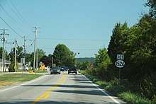
Kentucky Route 1526
Kentucky Route 1526 (KY 1526) is a 18.015-mile-long (28.992 km) state highway in the U.S. State of Kentucky. Its western terminus is at KY 44 in Cupio and its eastern terminus is at KY 44 in Mount Washington.
| ||||
|---|---|---|---|---|
| Route information | ||||
| Maintained by KYTC | ||||
| Length | 18.015 mi[1] (28.992 km) | |||
| Major junctions | ||||
| West end | ||||
| ||||
| East end | ||||
| Location | ||||
| Counties | Bullitt | |||
| Highway system | ||||
| ||||
Major junctions
The entire route is in Bullitt County.
| Location | mi[1] | km | Destinations | Notes | |
|---|---|---|---|---|---|
| Cupio | 0.000 | 0.000 | Western terminus | ||
| | 3.748 | 6.032 | Northern terminus of KY 1417 | ||
| | 4.944 | 7.957 | Southern terminus of KY 2672 | ||
| Hillview | 10.810 | 17.397 | |||
| 11.158 | 17.957 | East Blue Lick Road | Former KY 1603 | ||
| 11.352– 11.533 | 18.269– 18.561 | I-65 exit 121; diamond interchange | |||
| 11.720 | 18.862 | ||||
| Pioneer Village | 12.900 | 20.761 | Western end of KY 61 overlap | ||
| Hillview | 13.907 | 22.381 | Eastern end of KY 61 overlap | ||
| 14.043 | 22.600 | KY 6313 (Old Preston Highway) | |||
| Mount Washington | 18.015 | 28.992 | Eastern terminus | ||
1.000 mi = 1.609 km; 1.000 km = 0.621 mi
| |||||
Gallery

KY 1020 approaching KY 1526
gollark: I think the potatOS one returns a table, doesn't include the separator, and uses a string as a separator, not a pattern.
gollark: PotatOS lets you split strings with the division operator.
gollark: (I'm going to come up with more eventually)
gollark: ██████ Siri is a dangerous and advanced artificially intelligent system believed to have originated from a project to add an "AI" assistant to Opus OS to help with common tasks. Initial testing versions appeared helpful and were being considered for release, but the project was shut down after its computation began to take up a large amount of server tick time even when not used.
gollark: That's the automatic redaction routines built into the server at work.
References
- Commonwealth of Kentucky. "Official DMI Route Log". Retrieved 20 November 2019.
This article is issued from Wikipedia. The text is licensed under Creative Commons - Attribution - Sharealike. Additional terms may apply for the media files.
