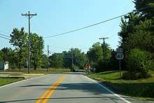
Kentucky Route 1417
Kentucky Route 1417 (KY 1417), also known as Martin Hill Road, is a 2.289-mile-long (3.684 km) state highway in the U.S. State of Kentucky. Its southern terminus is at KY 44 east of Cupio and its northern terminus is at KY 1526 northeast of Cupio.
| ||||
|---|---|---|---|---|
| Martin Hill Road | ||||
| Route information | ||||
| Maintained by KYTC | ||||
| Length | 2.289 mi[1] (3.684 km) | |||
| Major junctions | ||||
| South end | ||||
| North end | ||||
| Location | ||||
| Counties | Bullitt | |||
| Highway system | ||||
| ||||
Major junctions
The entire route is in Bullitt County.
| Location | mi[1] | km | Destinations | Notes | |
|---|---|---|---|---|---|
| | 0.000 | 0.000 | Southern terminus | ||
| | 2.289 | 3.684 | Northern terminus | ||
| 1.000 mi = 1.609 km; 1.000 km = 0.621 mi | |||||
Gallery

KY 44 approaching KY 1417
gollark: Maybe it could be done with some detachable component to do the launch in the air if I was better at docking.
gollark: On Minmus I just gave it some long landing legs.
gollark: It would probably recoil itself against the ground.
gollark: Given the low gravity it would be safe, if annoying, to just raise it a bit during the launch. Except possibly the mass driver recoil would cause problems.
gollark: I suppose, just adding more reaction wheels and RCS to it would have worked.
References
- Commonwealth of Kentucky. "Official DMI Route Log". Retrieved 20 November 2019.
This article is issued from Wikipedia. The text is licensed under Creative Commons - Attribution - Sharealike. Additional terms may apply for the media files.
