Kentucky Route 1020
Kentucky Route 1020 (KY 1020) is a 17.806-mile-long (28.656 km) north–south state highway in north central Kentucky, traversing portions of Bullitt and Jefferson counties, including the Louisville metropolitan area.[2]
| ||||
|---|---|---|---|---|
| Route information | ||||
| Maintained by KYTC | ||||
| Length | 17.806 mi[1] (28.656 km) | |||
| Major junctions | ||||
| South end | ||||
| ||||
| North end | ||||
| Location | ||||
| Counties | Bullitt, Jefferson | |||
| Highway system | ||||
| ||||

Route description
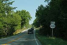
KY 1020 northbound
KY 1020 begins near Shepherdsville at a junction with KY 61. It travels northward into Louisville Metro/Jefferson County, where it has junctions with KY 841 and Interstate 264 (I-264). KY 1020 splits in downtown Louisville; the northbound lanes are on Second Street and the southbound lanes are on Third Street. Its northern terminus in downtown Louisville is at the intersection where US 31W and US 31E merge, with US 31 straight ahead.[3][4][5]
Major intersection
| County | Location | mi[1] | km | Destinations | Notes |
|---|---|---|---|---|---|
| Bullitt | Shepherdsville | 0.000 | 0.000 | Southern terminus | |
| | 1.211 | 1.949 | Northern terminus of KY 2673 | ||
| Brooks | 3.296 | 5.304 | |||
| Jefferson | Louisville | 6.481 | 10.430 | Southern terminus of KY 2055 | |
| 7.936 | 12.772 | KY 6295 (Neighborhood Place) | Eastern terminus of unsigned KY 6295 | ||
| 8.093– 8.251 | 13.024– 13.279 | KY 841 Exit 6 | |||
| 8.329 | 13.404 | KY 6294 (Cheri Way) | Western terminus of unsigned KY 6294 | ||
| 8.743 | 14.070 | ||||
| 10.765 | 17.325 | Northern terminus of KY 907 | |||
| 13.482 | 21.697 | I-264 Exit 10 | |||
| 14.949 | 24.058 | Southern end of US 60 Alternate concurrency | |||
| 15.201 | 24.464 | Northern end of US 60 Alternate concurrency | |||
| 17.179 | 27.647 | ||||
| 17.806 | 28.656 | Northern terminus; US 31W SB accessible via US 31 from Market St. to Main St. | |||
1.000 mi = 1.609 km; 1.000 km = 0.621 mi
| |||||
gollark: But then you can't send power.
gollark: If it's in geosynchronous orbit, we can make a space elevator *and* provide good internet access at the same time, actually!
gollark: But you can't run an ethernet cable to space.
gollark: Apparently the most efficient way to store power is something ridiculous like pumping water up hills then extracting energy from it going back down.
gollark: True, true, so not that much.
See also


- Roads in Louisville, Kentucky
References
- Commonwealth of Kentucky. "Official DMI Route Log". Retrieved October 2, 2018.
- DeLorme (2010). Kentucky Atlas & Gazetteer (Map). Yarmouth, ME: DeLorme. p. 35. §§ C5, D5, E5, E6,F6, and G6. ISBN 0-89933-340-0.
- Kentucky Transportation Cabinet (2018). Kentucky Official Highway Map (PDF) (Map) (2018–2019 ed.). Scale not given. Frankfort: Kentucky Transportation Cabinet. § C8.
- Kentucky Transportation Cabinet (2018). Kentucky Official Highway Map (PDF) (Map) (2018–2019 ed.). Scale not given. Frankfort: Kentucky Transportation Cabinet. Louisville inset.
- Kentucky Transportation Cabinet (2018). Kentucky Official Highway Map (PDF) (Map) (2018–2019 ed.). Scale not given. Frankfort: Kentucky Transportation Cabinet. Louisville Downtown inset.
This article is issued from Wikipedia. The text is licensed under Creative Commons - Attribution - Sharealike. Additional terms may apply for the media files.