Kentucky Route 129
Kentucky Route 129 (KY 129) is a 19.060-mile-long (30.674 km) state highway in Kentucky that runs from KY 116 in Fulton to KY 339 east of Wingo.
| ||||
|---|---|---|---|---|
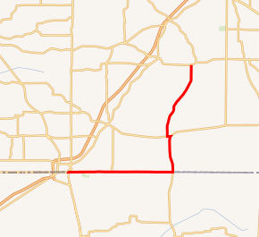
KY 129 highlighted in red | ||||
| Route information | ||||
| Maintained by KYTC | ||||
| Length | 19.060 mi[1] (30.674 km) | |||
| Major junctions | ||||
| South end | ||||
| North end | ||||
| Location | ||||
| Counties | Fulton, Hickman, Graves | |||
| Highway system | ||||
| ||||

Major intersections
| County | Location | mi[1] | km | Destinations | Notes |
|---|---|---|---|---|---|
| Fulton | Fulton | 0.000 | 0.000 | Western terminus | |
| Fulton–Obion county line | Fulton–South Fulton line | 0.101 | 0.163 | Kentucky–Tennessee line | |
| | 1.919 | 3.088 | |||
| Fulton–Hickman–Obion county tripoint | | 2.391 | 3.848 | ||
| Graves–Weakley county line | | 3.820 | 6.148 | ||
| Dukedom | 12.126 | 19.515 | |||
| Graves | | 12.126 | 19.515 | West end of KY 129 overlap | |
| | 12.392 | 19.943 | East end of KY 94 overlap | ||
| | 19.060 | 30.674 | Eastern terminus | ||
1.000 mi = 1.609 km; 1.000 km = 0.621 mi
| |||||
gollark: For moving/scanning them I think what's been done is having a separate subnet with the cell you want and pushing to/from that.
gollark: You can partition them, not sure about manually.
gollark: Wait, you mean *manually* move them through those, or what?
gollark: Makes sense. Trouble is, though, even if I know which items should go where, how do I move them without huge buffers?
gollark: I have a bunch of pre-set-up storage barrel thingies and just want the stuff stored in cells to be efficiently stored.
References
- "Official DMI Route Log". Kentucky Transportation Cabinet. Retrieved April 4, 2015.
This article is issued from Wikipedia. The text is licensed under Creative Commons - Attribution - Sharealike. Additional terms may apply for the media files.